
| Memorials | : | 0 |
| Location | : | Bad Gandersheim, Landkreis Northeim, Germany |
| Coordinate | : | 51.8703970, 10.0260970 |
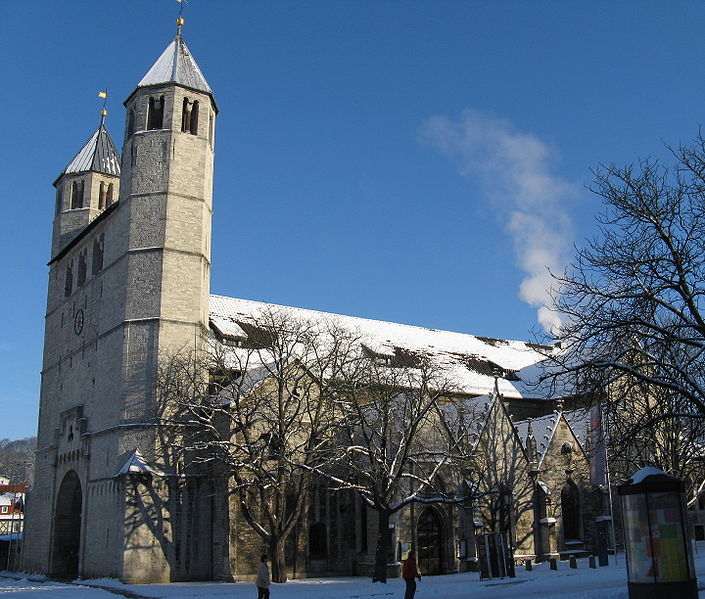
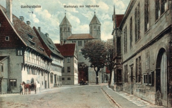
| Description | : | Gandersheim Abbey is a former house of secular canonesses (Frauenstift) in the present town of Bad Gandersheim in Lower Saxony, Germany. It was founded in 852 by Duke Liudolf of Saxony, progenitor of the Liudolfing or Ottonian dynasty, whose rich endowments ensured its stability and prosperity. His coffin is still in the abbey church, yet contents are unknown. The canonesses, commonly known as Stiftsdamen, were allowed private property and as they had taken no vows, were free at any time to leave the abbey. The Ottonian and Salian kings and their entourages often stayed in Gandersheim, and the canonesses were... Read More |
frequently asked questions (FAQ):
-
Where is Stiftskirche Gandersheim?
Stiftskirche Gandersheim is located at Bad Gandersheim, Landkreis Northeim ,Lower Saxony (Niedersachsen) ,Germany.
-
Stiftskirche Gandersheim cemetery's updated grave count on graveviews.com?
0 memorials
-
Where are the coordinates of the Stiftskirche Gandersheim?
Latitude: 51.8703970
Longitude: 10.0260970
Nearby Cemetories:
1. Jüdischer Friedhof Bad Gandersheim
Bad Gandersheim, Landkreis Northeim, Germany
Coordinate: 51.8707000, 10.0247700
2. Friedhof Bentierode
Bentierode, Landkreis Northeim, Germany
Coordinate: 51.8511471, 9.9995785
3. Cemetery of Mechtshausen
Mechtshausen, Landkreis Goslar, Germany
Coordinate: 51.9159000, 10.1119270
4. Marktkirche St. Jacobi
Einbeck, Landkreis Northeim, Germany
Coordinate: 51.8183588, 9.8664418
5. Neustädter Friedhof
Einbeck, Landkreis Northeim, Germany
Coordinate: 51.8114800, 9.8666000
6. Kloster Wiebrechtshausen
Landkreis Northeim, Germany
Coordinate: 51.7400000, 10.0177780
7. Adenstedt Friedhof
Adenstedt, Landkreis Hildesheim, Germany
Coordinate: 51.9964058, 9.9351195
8. Friedhof Ortshausen
Bockenem, Landkreis Hildesheim, Germany
Coordinate: 51.9867663, 10.1640728
9. Bad Grund Harz General Cemetery
Bad Grund, Landkreis Osterode am Harz, Germany
Coordinate: 51.8030210, 10.2371030
10. Friedhof Langenholtensen
Northeim, Landkreis Northeim, Germany
Coordinate: 51.7087877, 10.0149767
11. Hauptfriedhof
Northeim, Landkreis Northeim, Germany
Coordinate: 51.7083931, 10.0145429
12. Alter Stadtfriedhof
Northeim, Landkreis Northeim, Germany
Coordinate: 51.7062280, 9.9946316
13. Alter Kirchhof St Nicolai
Alfeld, Landkreis Hildesheim, Germany
Coordinate: 51.9863892, 9.8261458
14. Ruhewald Bürgerholz Northeim
Northeim, Landkreis Northeim, Germany
Coordinate: 51.6906093, 10.0255407
15. Friedhof Katlenburg
Katlenburg-Lindau, Landkreis Northeim, Germany
Coordinate: 51.6807954, 10.0979010
16. Marktkirche Sankt Aegidien
Osterode am Harz, Landkreis Osterode am Harz, Germany
Coordinate: 51.7278000, 10.2522400
17. Sankt Aegidien Marktkirche
Osterode am Harz, Landkreis Osterode am Harz, Germany
Coordinate: 51.7277400, 10.2521800
18. Osterode am Harz - Hauptfriedhof
Osterode am Harz, Landkreis Osterode am Harz, Germany
Coordinate: 51.7290162, 10.2566101
19. Alter Friedhof
Clausthal-Zellerfeld, Landkreis Goslar, Germany
Coordinate: 51.8052200, 10.3368600
20. Friedhof Lerbach
Lerbach, Landkreis Osterode am Harz, Germany
Coordinate: 51.7451808, 10.2895981
21. Friedhof Eberholzen
Eberholzen, Landkreis Hildesheim, Germany
Coordinate: 52.0563580, 9.8514530
22. Ruh-Wald Holle/Sottrum
Holle, Landkreis Hildesheim, Germany
Coordinate: 52.0790511, 10.1241843
23. Friedhof Dehnsen
Alfeld, Landkreis Hildesheim, Germany
Coordinate: 52.0220400, 9.7695900
24. Friedhof Sehlde
Sehlde, Landkreis Wolfenbüttel, Germany
Coordinate: 52.0379699, 10.2608226