
| Memorials | : | 2476 |
| Location | : | Stockton, San Joaquin County, USA |
| Coordinate | : | 37.9663110, -121.2846850 |
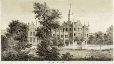
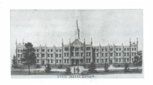
| Description | : | The original cemetery was located behind the Women's Facility, at what is now 510 E. Magnolia St. The lake and fountain are where the cemetery was located. The cemetery was used from about 1854 until January 1875, when the site on California Street was purchased. Nothing of this site remains. There were 4,467 known burials at this location. Only 1,619 were removed to the new site located on N. California Street before March 1875. Stockton General Hospital Cemetery 1851 Stockton Insane Asylum Cemetery - May 1852 - 1921 Stockton State Hospital Cemetery - 1921 - 1986... Read More |
frequently asked questions (FAQ):
-
Where is Stockton State Hospital Cemetery?
Stockton State Hospital Cemetery is located at California State University Stanislaus-Stockton Center Stockton, San Joaquin County ,California ,USA.
-
Stockton State Hospital Cemetery cemetery's updated grave count on graveviews.com?
2476 memorials
-
Where are the coordinates of the Stockton State Hospital Cemetery?
Latitude: 37.9663110
Longitude: -121.2846850
Nearby Cemetories:
1. San Joaquin Catholic Cemetery
Stockton, San Joaquin County, USA
Coordinate: 37.9707830, -121.2850190
2. Temple Israel Cemetery
Stockton, San Joaquin County, USA
Coordinate: 37.9640541, -121.2784348
3. Casa Bonita Mausoleum
Stockton, San Joaquin County, USA
Coordinate: 37.9752340, -121.2877800
4. Stockton Woodland Mausoleum
Stockton, San Joaquin County, USA
Coordinate: 37.9762400, -121.2878000
5. Thomas Lindsay Gravesite
San Joaquin County, USA
Coordinate: 37.9573110, -121.2918430
6. David Kelsey Gravesite
Stockton, San Joaquin County, USA
Coordinate: 37.9573110, -121.2918430
7. Citizens Cemetery
Stockton, San Joaquin County, USA
Coordinate: 37.9559410, -121.2769120
8. Stockton Rural Cemetery
Stockton, San Joaquin County, USA
Coordinate: 37.9794006, -121.2869034
9. Central United Methodist Church Columbarium
Stockton, San Joaquin County, USA
Coordinate: 37.9825710, -121.3078170
10. Chinese Cemetery
French Camp, San Joaquin County, USA
Coordinate: 37.8819962, -121.2805862
11. Congregation Adas Yeshuran of Stockton Cemetery
French Camp, San Joaquin County, USA
Coordinate: 37.8784065, -121.2740784
12. Congregation of Ahavas Achim Cemetery
French Camp, San Joaquin County, USA
Coordinate: 37.8778419, -121.2753067
13. Park View Cemetery
Manteca, San Joaquin County, USA
Coordinate: 37.8617249, -121.2238312
14. Live Oak Cemetery
Lodi, San Joaquin County, USA
Coordinate: 38.0868760, -121.2874780
15. Collegeville Cemetery
Collegeville, San Joaquin County, USA
Coordinate: 37.9044800, -121.1466141
16. Cherokee Memorial Park
Lodi, San Joaquin County, USA
Coordinate: 38.1017303, -121.2585983
17. Islamic Cemetery of California
Lodi, San Joaquin County, USA
Coordinate: 38.1091730, -121.2563590
18. Saint John The Baptist Episcopal Columbarium
Lodi, San Joaquin County, USA
Coordinate: 38.1213500, -121.3074400
19. East Union Cemetery
Manteca, San Joaquin County, USA
Coordinate: 37.8114014, -121.2350006
20. Linden Cemetery
Linden, San Joaquin County, USA
Coordinate: 38.0226707, -121.0889053
21. Lodi Memorial Park and Cemetery
Lodi, San Joaquin County, USA
Coordinate: 38.1319008, -121.2455978
22. Atlanta Cemetery
Five Corners, San Joaquin County, USA
Coordinate: 37.8270035, -121.1420135
23. Woodbridge Masonic Cemetery
Woodbridge, San Joaquin County, USA
Coordinate: 38.1496506, -121.3016663
24. Harmony Grove Cemetery
Lockeford, San Joaquin County, USA
Coordinate: 38.1478004, -121.1755981