
| Memorials | : | 0 |
| Location | : | Paarl, Cape Winelands District Municipality, South Africa |
| Phone | : | +27 21 872 4396 |
| Website | : | www.strooidak.co.za |
| Coordinate | : | -33.7456400, 18.9634080 |
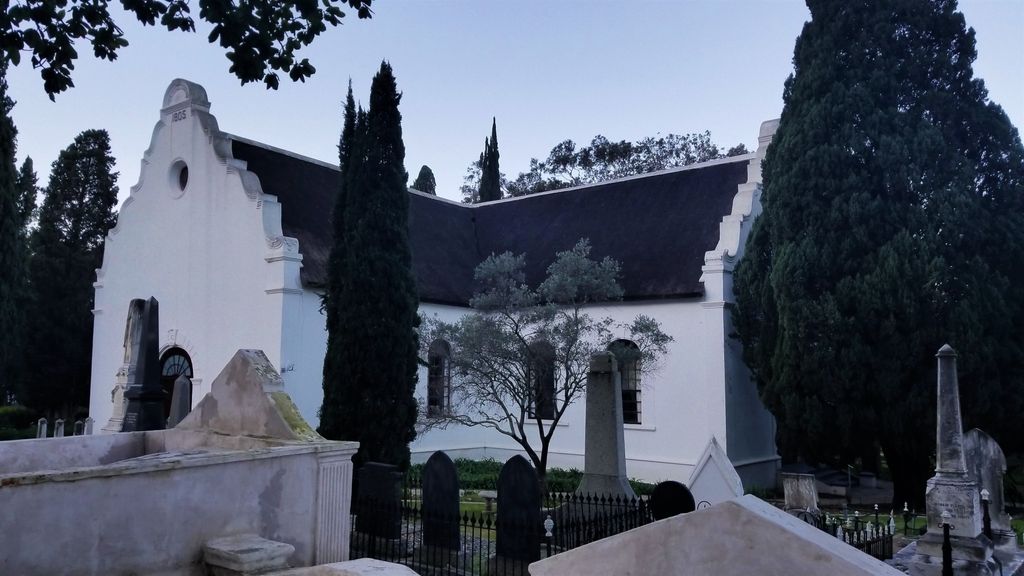
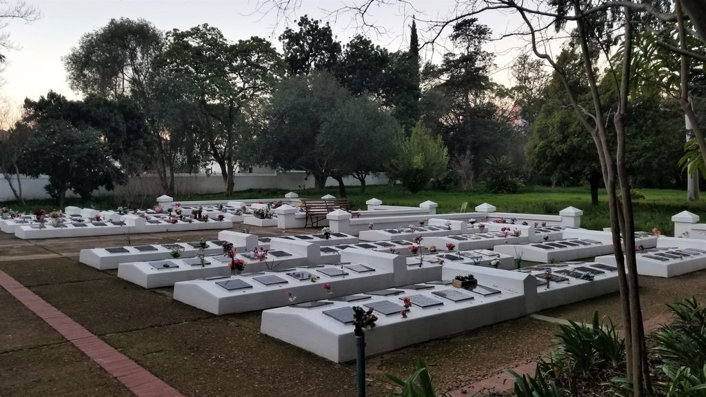
| Description | : | A Brief History of the Strooidakkerk Kerkhof in Paarl, South Africa by E. Smith Paarl is the third oldest European-founded city in South Africa following Cape Town and Stellenbosch. One of the European immigrant groups to come to South Africa in the late 17th century was the Huguenots who were escaping persecution by the Roman Catholic Church and the Crown in France. The Huguenots settled in the Cape Colony in 1688 and formed a congregation near the farming community of Diamant ende Peerlbegh—the name that was eventually shorted to Paarl. First holding French-language services in a barn on Babylonstoren... Read More |
frequently asked questions (FAQ):
-
Where is Strooidakkerk Kerkhof?
Strooidakkerk Kerkhof is located at 163 Main Street Paarl, Cape Winelands District Municipality ,Western Cape , 7646South Africa.
-
Strooidakkerk Kerkhof cemetery's updated grave count on graveviews.com?
0 memorials
-
Where are the coordinates of the Strooidakkerk Kerkhof?
Latitude: -33.7456400
Longitude: 18.9634080
Nearby Cemetories:
1. Old Hof Street Cemetery
Paarl, Cape Winelands District Municipality, South Africa
Coordinate: -33.7421670, 18.9677000
2. United Church Paarl Memorial Wall
Paarl, Cape Winelands District Municipality, South Africa
Coordinate: -33.7403940, 18.9618330
3. NG Kerk - Noorder-Paarl Cemetery
Paarl, Cape Winelands District Municipality, South Africa
Coordinate: -33.7414130, 18.9678810
4. St. Petri Lutheran Church Private Cemetery
Paarl, Cape Winelands District Municipality, South Africa
Coordinate: -33.7405320, 18.9683440
5. Upper Bosman Street Old Slave Cemetery
Paarl, Cape Winelands District Municipality, South Africa
Coordinate: -33.7493886, 18.9565776
6. Non Pareille Street Islamic Cemetery
Paarl, Cape Winelands District Municipality, South Africa
Coordinate: -33.7352871, 18.9579838
7. Parys Cemetery
Paarl, Cape Winelands District Municipality, South Africa
Coordinate: -33.7414330, 18.9788880
8. NG Kerk Suider-Paar Muur van Herdenking
Suider-Paarl, Cape Winelands District Municipality, South Africa
Coordinate: -33.7685670, 18.9572170
9. James Frederick Curlewis Burial Site
Noorder-Paarl, Cape Winelands District Municipality, South Africa
Coordinate: -33.7072480, 18.9616050
10. Klein Drakenstein Cemetery
Cape Winelands District Municipality, South Africa
Coordinate: -33.7244689, 19.0145543
11. Klein Drakestein Cemetery
Cape Winelands District Municipality, South Africa
Coordinate: -33.7244430, 19.0145890
12. Groenheuwel Cemetery
Paarl, Cape Winelands District Municipality, South Africa
Coordinate: -33.7033996, 18.9971974
13. Kleinbosch Cemetry
Cape Winelands District Municipality, South Africa
Coordinate: -33.6892371, 19.0258791
14. Slot van die Paarl Kerkhof
Windmeul, Cape Winelands District Municipality, South Africa
Coordinate: -33.6742970, 18.9108114
15. Windmeul Cemetery
Windmeul, Cape Winelands District Municipality, South Africa
Coordinate: -33.6710694, 18.9073423
16. Wellington Cemetery
Wellington, Cape Winelands District Municipality, South Africa
Coordinate: -33.6566522, 18.9943304
17. Courtrai Cemetery
Cape Winelands District Municipality, South Africa
Coordinate: -33.8382805, 18.9596530
18. NG Kerk - Simondium Kerkhof
Cape Winelands District Municipality, South Africa
Coordinate: -33.8391931, 18.9571992
19. NG Kerk - Simondium Begraafplaas
Cape Winelands District Municipality, South Africa
Coordinate: -33.8393489, 18.9618987
20. Champagne Graveyard
Wellington, Cape Winelands District Municipality, South Africa
Coordinate: -33.6521700, 19.0000930
21. Wellington Muslim Community Maqbarah
Wellington, Cape Winelands District Municipality, South Africa
Coordinate: -33.6467724, 18.9945307
22. St. George's Churchyard
Simondium, Cape Winelands District Municipality, South Africa
Coordinate: -33.8694533, 18.9871936
23. Franschhoek St Georges Churchyard
Franschhoek, Cape Winelands District Municipality, South Africa
Coordinate: -33.8695160, 18.9872990
24. Pniel United Congregational Church Cemetery
Pniel, Cape Winelands District Municipality, South Africa
Coordinate: -33.8915330, 18.9585000