
| Memorials | : | 0 |
| Location | : | Dalton, Randolph County, USA |
| Coordinate | : | 36.4597015, -91.1718979 |
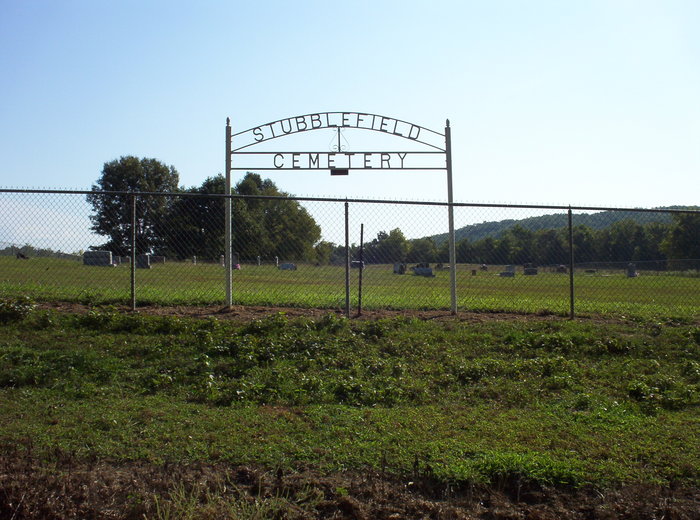
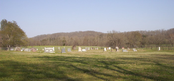
| Description | : | The historic Stubblefield Cemetery is located along the old Thomasville Road which (before modern roads) led from Pocahontas to Thomasville, Missouri. The cemetery is near the Stubblefield Ford on the Eleven Point River. Many founding families of Davidson Township are represented in this burial ground. |
frequently asked questions (FAQ):
-
Where is Stubblefield Cemetery?
Stubblefield Cemetery is located at Dalton, Randolph County ,Arkansas ,USA.
-
Stubblefield Cemetery cemetery's updated grave count on graveviews.com?
0 memorials
-
Where are the coordinates of the Stubblefield Cemetery?
Latitude: 36.4597015
Longitude: -91.1718979
Nearby Cemetories:
1. Reynolds Cemetery
Elm Store, Randolph County, USA
Coordinate: 36.4491997, -91.1860962
2. Bryan Cemetery
Randolph County, USA
Coordinate: 36.4458008, -91.1552963
3. Mosely Cemetery
Randolph County, USA
Coordinate: 36.4460983, -91.1975021
4. King Cemetery
Randolph County, USA
Coordinate: 36.4357986, -91.1836014
5. Dalton Cemetery
Randolph County, USA
Coordinate: 36.4338989, -91.1496964
6. Walnut Grove Cemetery
Elm Store, Randolph County, USA
Coordinate: 36.4914017, -91.1967010
7. Eaton Cemetery
Randolph County, USA
Coordinate: 36.4185982, -91.1999969
8. Mount Carmel Cemetery
Calm, Oregon County, USA
Coordinate: 36.5106010, -91.1643982
9. Coe Cemetery
Warm Springs, Randolph County, USA
Coordinate: 36.4732400, -91.1102200
10. Bailey Cemetery
Dalton, Randolph County, USA
Coordinate: 36.4049225, -91.1895065
11. Upshaw Cemetery
Randolph County, USA
Coordinate: 36.4185982, -91.1207962
12. White Cemetery
Randolph County, USA
Coordinate: 36.3939018, -91.1821976
13. Hamilton
Warm Springs, Randolph County, USA
Coordinate: 36.4469170, -91.0900830
14. Old Elmore Thomas field
Billmore, Oregon County, USA
Coordinate: 36.5237770, -91.1980250
15. Crawford Cemetery
Randolph County, USA
Coordinate: 36.3881520, -91.1693990
16. New Home Cemetery
Tucker (Gatewood), Ripley County, USA
Coordinate: 36.5112100, -91.1089800
17. Looney Cemetery
Randolph County, USA
Coordinate: 36.3946991, -91.1231003
18. Spring Valley Cemetery
Billmore, Oregon County, USA
Coordinate: 36.5324670, -91.2003420
19. Macedonia Cemetery
Warm Springs, Randolph County, USA
Coordinate: 36.4707985, -91.0742035
20. Church of God Cemetery
Oregon County, USA
Coordinate: 36.5023500, -91.2580200
21. Confederate Cemetery
Randolph County, USA
Coordinate: 36.4441400, -91.0688100
22. Myrtle Cemetery
Myrtle, Oregon County, USA
Coordinate: 36.5133900, -91.2664300
23. Wells Cemetery
Randolph County, USA
Coordinate: 36.3847008, -91.1018982
24. Bellah Cemetery
Ravenden Springs, Randolph County, USA
Coordinate: 36.4207993, -91.2825012