
| Memorials | : | 0 |
| Location | : | Logan County, USA |
| Coordinate | : | 40.4336000, -103.1401000 |
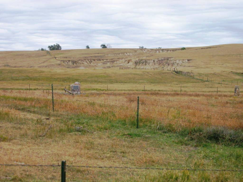
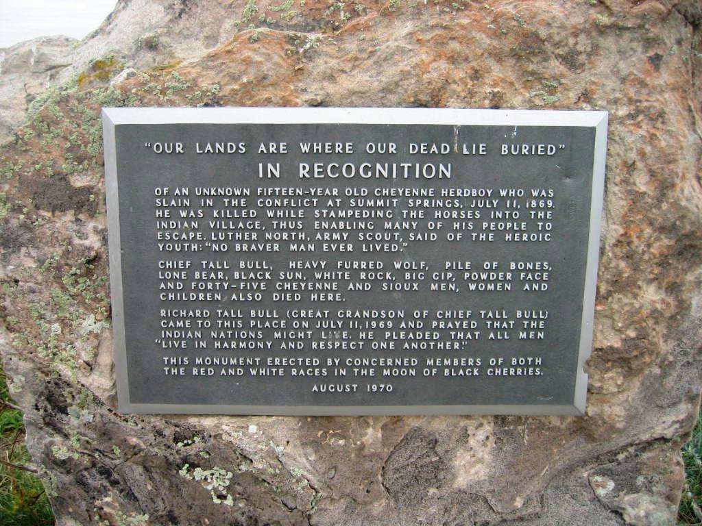
| Description | : | On July 11, 1869, the US Army's Fifth Cavalry led by MajGen Eugene A. Carr out of Fort McPherson, Nebraska, attacked a village of Cheyenne Dog Soldiers. The Cheyenne had camped at this location following a series of raids on white settlements along the Kansas frontier. The Cheyenne had two white captives, Susanna Alderdice and Maria Wiechel. During the fight, Susanna Alderdice was killed by one of the Cheyennes. She was buried at the site the following day. Her grave location is unknown. There are several markers at the battle site, one of which tells Susanna's... Read More |
frequently asked questions (FAQ):
-
Where is Summit Springs Battle Site?
Summit Springs Battle Site is located at Logan County ,Colorado ,USA.
-
Summit Springs Battle Site cemetery's updated grave count on graveviews.com?
0 memorials
-
Where are the coordinates of the Summit Springs Battle Site?
Latitude: 40.4336000
Longitude: -103.1401000
Nearby Cemetories:
1. Kelly Community Cemetery
Sterling, Logan County, USA
Coordinate: 40.4716670, -103.0461110
2. Burdett Cemetery
Burdett, Washington County, USA
Coordinate: 40.3659706, -102.9611664
3. Riverside Cemetery
Sterling, Logan County, USA
Coordinate: 40.5928001, -103.2296982
4. Curtis Cemetery
Washington County, USA
Coordinate: 40.2655983, -103.0614014
5. Merino Cemetery
Logan County, USA
Coordinate: 40.4639015, -103.3930969
6. Leroy Cemetery
Logan County, USA
Coordinate: 40.5541992, -102.9131012
7. Hope Cemetery
Washington County, USA
Coordinate: 40.2668991, -102.9661026
8. New Haven Cemetery
New Haven, Logan County, USA
Coordinate: 40.4824000, -102.8416000
9. Sunset Memorial Gardens
Sterling, Logan County, USA
Coordinate: 40.6737000, -103.2050000
10. Saint Peters Cemetery
Logan County, USA
Coordinate: 40.5531006, -102.8182983
11. Saint Joseph Cemetery
Akron, Washington County, USA
Coordinate: 40.1610000, -103.1910000
12. Akron Cemetery
Akron, Washington County, USA
Coordinate: 40.1602898, -103.2274780
13. Prairie Lawn Cemetery
Willard, Logan County, USA
Coordinate: 40.5517006, -103.4950027
14. Schlake Cemetery
Yuma, Yuma County, USA
Coordinate: 40.3216600, -102.7738792
15. Otis Cemetery
Otis, Washington County, USA
Coordinate: 40.1360000, -102.9640000
16. Fleming Cemetery
Fleming, Logan County, USA
Coordinate: 40.6875000, -102.8482971
17. Rockland Cemetery
Rockland, Logan County, USA
Coordinate: 40.4522031, -102.6924118
18. Hyde Cemetery
Washington County, USA
Coordinate: 40.1481018, -102.8227997
19. Bryant Cemetery
Phillips County, USA
Coordinate: 40.4728012, -102.6382980
20. Franz Gebauer Cemetery
Akron, Washington County, USA
Coordinate: 40.0703500, -103.3381000
21. Brush Memorial Cemetery
Brush, Morgan County, USA
Coordinate: 40.2617780, -103.6329600
22. Eben Ezer Cemetery
Brush, Morgan County, USA
Coordinate: 40.2546310, -103.6419373
23. Haxtun Cemetery
Haxtun, Phillips County, USA
Coordinate: 40.6436000, -102.6372000
24. Prairie View Cemetery
Weld County, USA
Coordinate: 40.6096992, -103.6707993