| Memorials | : | 0 |
| Location | : | Winslow, Navajo County, USA |
| Coordinate | : | 35.0468050, -110.6599880 |
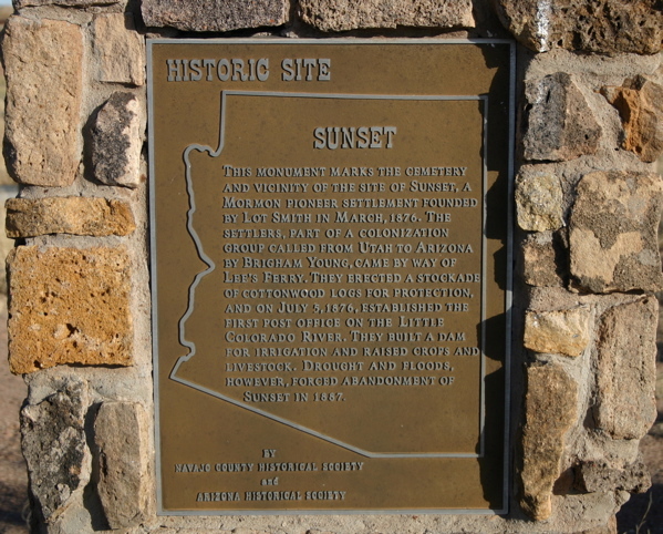
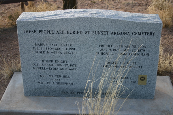
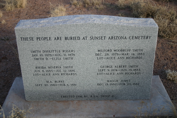
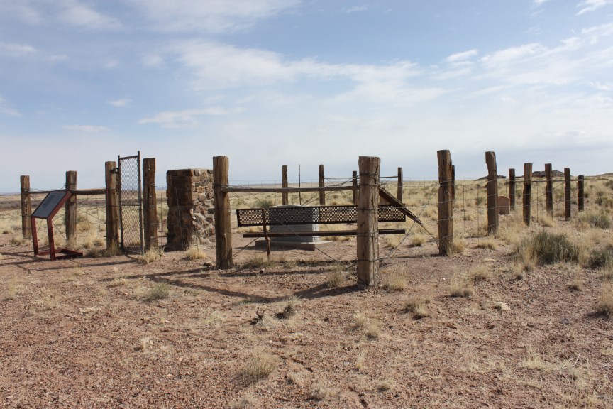
| Description | : | Cemetery closed to new interments in 1888. History of Sunset Cemetery & Fort: Although Homolovi State Park protects Hopi lands and cultural artifacts, the park also contains a small cemetery from a group of 19th century settlers who founded the Fort of Sunset. Sunset Cemetery stands as a mute testimony to the undaunted spirit of the brave pioneers who forged a living from this once desolate and forbidding land. On January 24, 1876, over 200 men, women and children were called as missionaries to settle the Little Colorado River Valley. James Brown and Lot Smith were appointed to lead the... Read More |
frequently asked questions (FAQ):
-
Where is Sunset Cemetery?
Sunset Cemetery is located at Homolovi State Park Entrance Rd. Winslow, Navajo County ,Arizona , 86047USA.
-
Sunset Cemetery cemetery's updated grave count on graveviews.com?
0 memorials
-
Where are the coordinates of the Sunset Cemetery?
Latitude: 35.0468050
Longitude: -110.6599880
Nearby Cemetories:
1. Whipple Memorial Park
Navajo County, USA
Coordinate: 35.0247002, -110.6742020
2. Brigham City Cemetery
Winslow, Navajo County, USA
Coordinate: 35.0530100, -110.7055800
3. Winslow Indian Sanatorium Cemetery
Winslow, Navajo County, USA
Coordinate: 35.0385000, -110.7070180
4. Desert View Cemetery
Winslow, Navajo County, USA
Coordinate: 35.0316700, -110.7072200
5. McCamant-McCauley Family Cemetery
Navajo County, USA
Coordinate: 34.9239400, -110.5297500
6. Joseph City Cemetery
Joseph City, Navajo County, USA
Coordinate: 34.9397040, -110.3125190
7. Hunt Family Cemetery
Joseph City, Navajo County, USA
Coordinate: 34.9239500, -110.2665600
8. Leupp Villiage Cemetery
Coconino County, USA
Coordinate: 35.2862250, -110.9689810
9. Kempton Gravesite
Joseph City, Navajo County, USA
Coordinate: 34.9195500, -110.2546700
10. Canyon Diablo Cemetery
Canyon Diablo, Coconino County, USA
Coordinate: 35.1563020, -111.1146500
11. Boot Hill Cemetery
Canyon Diablo, Coconino County, USA
Coordinate: 35.1639330, -111.1166200
12. H-Y Ranch Family Cemetery
Holbrook, Navajo County, USA
Coordinate: 34.9014659, -110.2159816
13. Seventh Day Adventist Mission Cemetery
Holbrook, Navajo County, USA
Coordinate: 34.8842400, -110.1906100
14. Dilkon Community Cemetery
Dilkon, Navajo County, USA
Coordinate: 35.3769444, -110.3372222
15. Holbrook Cemetery
Holbrook, Navajo County, USA
Coordinate: 34.9097600, -110.1572500
16. Woodruff Cemetery
Woodruff, Navajo County, USA
Coordinate: 34.7775000, -110.0325000
17. Indian Wells Community Cemetery
Indian Wells, Navajo County, USA
Coordinate: 35.4064600, -110.0857800
18. Heber Cemetery
Heber, Navajo County, USA
Coordinate: 34.4274635, -110.6049194
19. Overgaard Baby Cemetery
Overgaard, Navajo County, USA
Coordinate: 34.4011000, -110.5582900
20. Grant Roadside Gravesite
Aripine, Navajo County, USA
Coordinate: 34.4258995, -110.4132767
21. Big Dry Wash Battlefield
Coconino County, USA
Coordinate: 34.5461230, -111.2206610
22. R V Mike Ramsay Memorial Cemetery
Snowflake, Navajo County, USA
Coordinate: 34.5044000, -110.0869000
23. Baca Family Cemetery
Heber, Navajo County, USA
Coordinate: 34.3229000, -110.6864700
24. Clay Springs Cemetery
Clay Springs, Navajo County, USA
Coordinate: 34.3686500, -110.2988300


