| Memorials | : | 0 |
| Location | : | Sunshine, Thunder Bay District, Canada |
| Coordinate | : | 48.5574700, -89.6966700 |
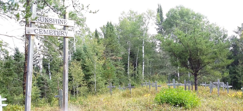
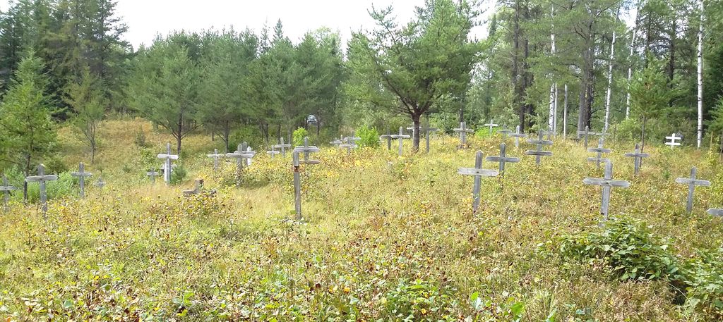
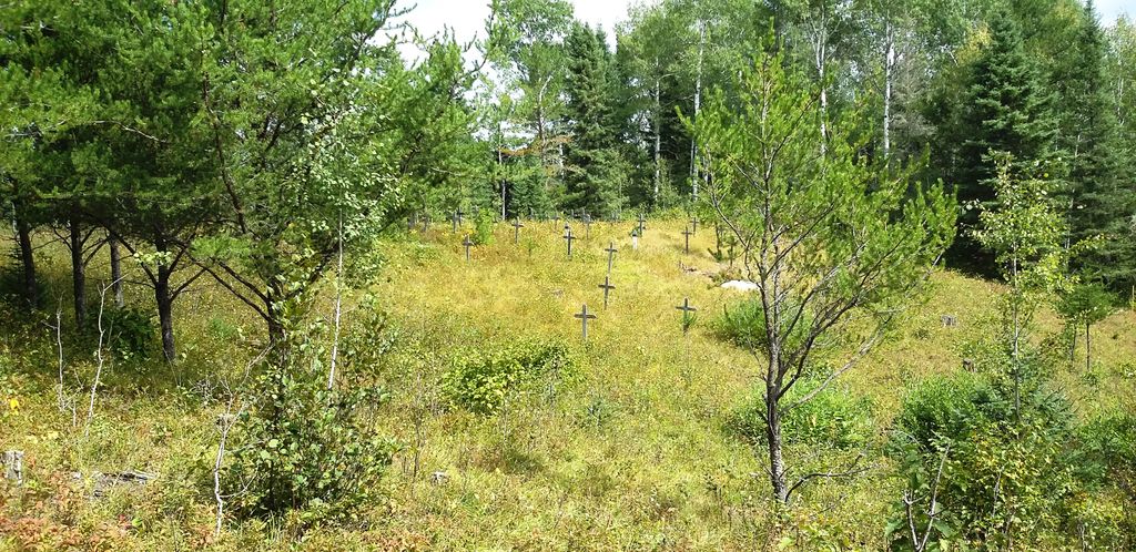
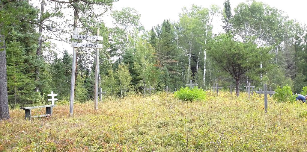
| Description | : | Located on Dawson Road Lots & was originally accessed by railroad. This cemetery was the final resting spot for residents of Sunshine , Ellis & Finmark which were all whistle stops on the railroad line. The land was donated by Lars Adolph & Ann Lofquist. The property was surveyed by Mr. A Phillips& registered on Dec 15 1919. First burial listed is May 1917,the latest being May 1945. During the summers of 1993 to 1997 the 15th Current River, Port Arthur Boy Scouts Troop led by William J Taylor took on the project to clear the cemetery of trees, brush,... Read More |
frequently asked questions (FAQ):
-
Where is Sunshine-Finmark Cemetery?
Sunshine-Finmark Cemetery is located at 6918 Hwy 11/17 one mile north Sunshine, Thunder Bay District ,Ontario ,Canada.
-
Sunshine-Finmark Cemetery cemetery's updated grave count on graveviews.com?
0 memorials
-
Where are the coordinates of the Sunshine-Finmark Cemetery?
Latitude: 48.5574700
Longitude: -89.6966700
Nearby Cemetories:
1. Collins Cemetery
Kenora District, Canada
Coordinate: 48.6550392, -89.5794662
2. Dog River Community Cemetery
Thunder Bay, Thunder Bay District, Canada
Coordinate: 48.5668000, -89.4834300
3. Conmee Cemetery
Conmee, Thunder Bay District, Canada
Coordinate: 48.4164600, -89.6414100
4. O'Connor Cemetery
Kakabeka Falls, Thunder Bay District, Canada
Coordinate: 48.3983870, -89.6454010
5. St. James Cemetery
Murillo, Thunder Bay District, Canada
Coordinate: 48.4423083, -89.4955555
6. Stanley Hill Cemetery
Thunder Bay, Thunder Bay District, Canada
Coordinate: 48.3807259, -89.5637894
7. Ware-Gorham Cemetery
Thunder Bay, Thunder Bay District, Canada
Coordinate: 48.5409000, -89.3847000
8. Saint Pius V Roman Catholic Cemetery
Harstone, Thunder Bay District, Canada
Coordinate: 48.3488833, -89.6485000
9. Lappe Cemetery
Thunder Bay, Thunder Bay District, Canada
Coordinate: 48.5888000, -89.3548500
10. O'Connor Free Methodist Cemetery
O'Connor, Thunder Bay District, Canada
Coordinate: 48.3254400, -89.7243100
11. Sunset Memorial Gardens
Thunder Bay, Thunder Bay District, Canada
Coordinate: 48.4140778, -89.4115219
12. Kivikoski Cemetery
Thunder Bay, Thunder Bay District, Canada
Coordinate: 48.4967500, -89.3297900
13. Hymers Cemetery
Hymers, Thunder Bay District, Canada
Coordinate: 48.3044600, -89.7171000
14. Pinegrove Cemetery
Hymers, Thunder Bay District, Canada
Coordinate: 48.2944800, -89.6957700
15. Lappe Old Lutheran Church Cemetery Gorham
Thunder Bay, Thunder Bay District, Canada
Coordinate: 48.5668000, -89.2834200
16. Nolalu Cemetery
Nolalu, Thunder Bay District, Canada
Coordinate: 48.2908500, -89.8228900
17. Shaarey Shomayim Congregation Cemetery
Thunder Bay, Thunder Bay District, Canada
Coordinate: 48.3809800, -89.3424100
18. Ukrainian Catholic Cemetery
Thunder Bay District, Canada
Coordinate: 48.3813490, -89.3394520
19. Ukrainian Catholic Cemetery
Thunder Bay, Thunder Bay District, Canada
Coordinate: 48.3809070, -89.3392300
20. Leeper Cemetery
Thunder Bay District, Canada
Coordinate: 48.2645100, -89.7660300
21. Trinity Lutheran Cemetery
Scoble West, Thunder Bay District, Canada
Coordinate: 48.2749123, -89.5063777
22. Saint Benedicts Cemetery
Neebing, Thunder Bay District, Canada
Coordinate: 48.2738700, -89.4834700
23. Riverside Cemetery
Thunder Bay, Thunder Bay District, Canada
Coordinate: 48.4250600, -89.2576300
24. Saint Andrew's Catholic Cemetery
Thunder Bay, Thunder Bay District, Canada
Coordinate: 48.4262314, -89.2535095


