
| Memorials | : | 2 |
| Location | : | Spraytown, Jackson County, USA |
| Coordinate | : | 39.0358000, -86.0736000 |
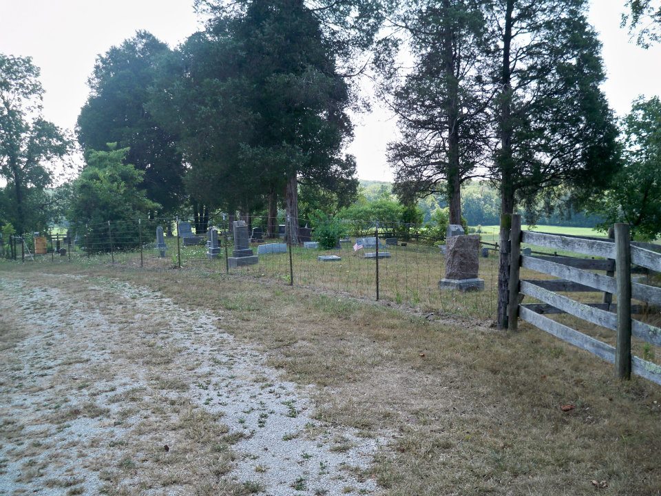
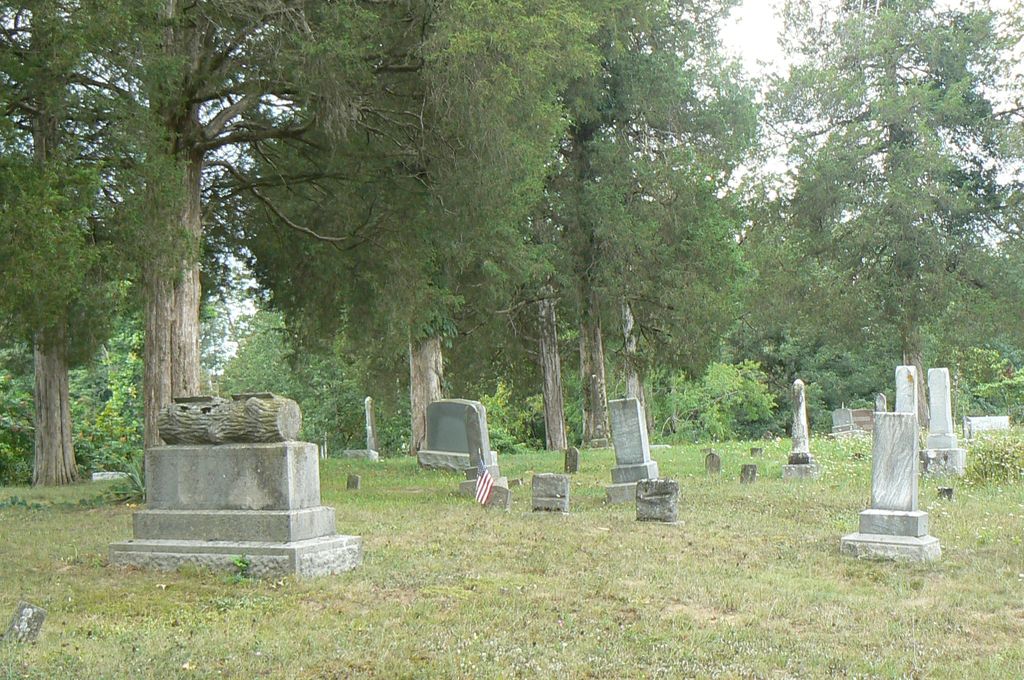
| Description | : | The cemetery is located in Bartholomew County and in Jackson County (Pershing Township) on the south side of W County Road 1100 S about 0.1 miles west of its intersection with Indiana State Highway 58. Most of the cemetery lies in Jackson County. Indiana Cemetery Locations, Volume 4, published by the Indiana Genealogical Society (April 2009), gives the primary cemetery name as Sutherland Cemetery with an alternate name of Calhoun Cemetery and lists the cemetery in Jackson County. The cemetery is listed in the Cemetery and Burial Grounds Registry of the Indiana Department of Natural Resources (DNR) and... Read More |
frequently asked questions (FAQ):
-
Where is Sutherland Cemetery?
Sutherland Cemetery is located at W County Road 1100 S Spraytown, Jackson County ,Indiana , 47274USA.
-
Sutherland Cemetery cemetery's updated grave count on graveviews.com?
2 memorials
-
Where are the coordinates of the Sutherland Cemetery?
Latitude: 39.0358000
Longitude: -86.0736000
Nearby Cemetories:
1. Spraytown Cemetery
Spraytown, Jackson County, USA
Coordinate: 39.0107950, -86.0798120
2. Boknect Cemetery
Cortland, Jackson County, USA
Coordinate: 39.0284000, -86.0398000
3. Whites Chapel Cemetery
Spraytown, Jackson County, USA
Coordinate: 39.0119820, -86.0524826
4. Rotert Farm Cemetery
Waymansville, Bartholomew County, USA
Coordinate: 39.0550640, -86.0418550
5. Saint Peter Lutheran Cemetery
Waymansville, Bartholomew County, USA
Coordinate: 39.0612068, -86.0454559
6. McLaughlin Cemetery
Waymansville, Bartholomew County, USA
Coordinate: 39.0667000, -86.0469000
7. Weddell Cemetery
Jackson County, USA
Coordinate: 39.0139008, -86.0291977
8. Barkheimer Cemetery
Freetown, Jackson County, USA
Coordinate: 39.0452840, -86.1301960
9. Spurgeons Corner Cemetery #2
Spraytown, Jackson County, USA
Coordinate: 39.0451000, -86.1304000
10. Waggoner Cemetery
Spraytown, Jackson County, USA
Coordinate: 39.0293999, -86.1324997
11. Taylors Chapel Cemetery
Jackson County, USA
Coordinate: 39.0066170, -86.1226100
12. Ogilvie Cemetery
Ogilville, Bartholomew County, USA
Coordinate: 39.0841530, -86.0619830
13. Claycamp Cemetery
Acme, Jackson County, USA
Coordinate: 38.9858670, -86.0683140
14. Becks Grove Cemetery
Becks Grove, Brown County, USA
Coordinate: 39.0788994, -86.1113968
15. Saint Paul Lutheran Cemetery
Jackson County, USA
Coordinate: 39.0333100, -86.0017470
16. Phillips Cemetery
Becks Grove, Brown County, USA
Coordinate: 39.0838928, -86.1115265
17. Mount Healthy Cemetery
Mount Healthy, Bartholomew County, USA
Coordinate: 39.0869026, -86.0360184
18. Acme Cemetery
Acme, Jackson County, USA
Coordinate: 38.9778709, -86.0587692
19. McKinney Cemetery
Freetown, Jackson County, USA
Coordinate: 39.0568000, -86.1448900
20. Buffalo Cemetery
Van Buren Township, Brown County, USA
Coordinate: 39.0583992, -86.1450119
21. Cain Cemetery
Becks Grove, Brown County, USA
Coordinate: 39.0938988, -86.0975037
22. McKinney Cemetery
Christiansburg, Brown County, USA
Coordinate: 39.0564003, -86.1539001
23. Kinsey Cemetery
Becks Grove, Brown County, USA
Coordinate: 39.1032104, -86.0794907
24. White Creek Methodist Church Cemetery
Columbus, Bartholomew County, USA
Coordinate: 39.0639305, -85.9941330