
| Memorials | : | 0 |
| Location | : | Brinson, Decatur County, USA |
| Coordinate | : | 30.9697300, -84.7122100 |
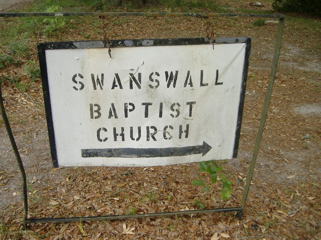
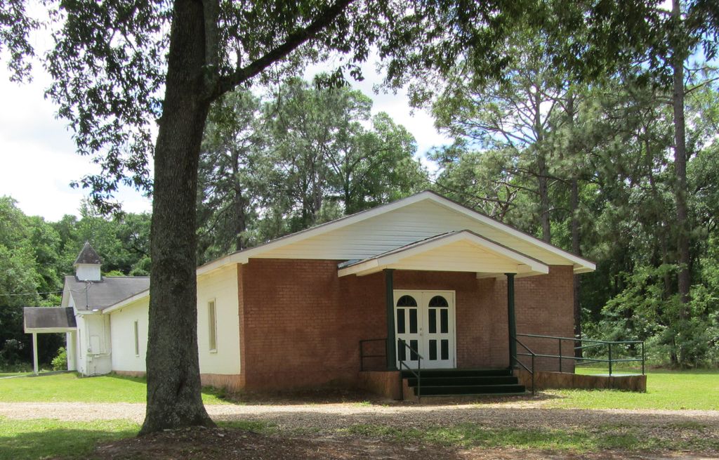
| Description | : | Church and Cemetery are located in Brinson off Swanswall Road. Turn off U S 84/Dothan Rd. Go a short distance to Brinson-Airbase Road, turn right. Swanswall Road is a dirt road to the right a short distance after turning onto Brinson-Airbase road. You will follow the dirt road/railroad tracks. It is about 2 miles from 84 to the cemetery. The church and cemetery are on the right. If you are going from Bainbridge, take Hwy 84/Dothan Rd. to Cyrene road on the right. Go to Swanswall Road on the left and go for a few miles... Read More |
frequently asked questions (FAQ):
-
Where is Swanswall Baptist Church Cemetery?
Swanswall Baptist Church Cemetery is located at Next door to 347 Swanswall Rd Brinson, Decatur County ,Georgia , 39825USA.
-
Swanswall Baptist Church Cemetery cemetery's updated grave count on graveviews.com?
0 memorials
-
Where are the coordinates of the Swanswall Baptist Church Cemetery?
Latitude: 30.9697300
Longitude: -84.7122100
Nearby Cemetories:
1. Brinson Cemetery
Brinson, Decatur County, USA
Coordinate: 30.9699500, -84.7323330
2. Jackson Cemetery
Brinson, Decatur County, USA
Coordinate: 30.9703007, -84.7406006
3. Bethel Baptist Church Cemetery
Bainbridge, Decatur County, USA
Coordinate: 30.9785860, -84.6604970
4. Thompson Cemetery
Decatur County, USA
Coordinate: 30.9575005, -84.6489029
5. Pine Grove Baptist Church Cemetery
Brinson, Decatur County, USA
Coordinate: 31.0269430, -84.7118400
6. Lane Cemetery
Decatur County, USA
Coordinate: 31.0408001, -84.7142029
7. Nazarene Church Cemetery
Eldorendo, Decatur County, USA
Coordinate: 31.0266200, -84.6433100
8. Mount Olive Baptist Church Cemetery
Bainbridge, Decatur County, USA
Coordinate: 30.8962100, -84.6602800
9. Mount Zion Baptist Church Cemetery
Bainbridge, Decatur County, USA
Coordinate: 30.9843370, -84.6116680
10. Eldorendo Baptist Church Cemetery
Decatur County, USA
Coordinate: 31.0451670, -84.6487890
11. Mount Gilead Freewill Baptist Church Cemetery
Decatur County, USA
Coordinate: 30.8667240, -84.7130120
12. Fellowship Baptist Church Cemetery
Bainbridge, Decatur County, USA
Coordinate: 30.8663070, -84.7072160
13. Breedlove Cemetery
Decatur County, USA
Coordinate: 30.8708000, -84.6703033
14. Hornsby Cemetery
Miller County, USA
Coordinate: 31.0727997, -84.7391968
15. Pilgrims Rest Church Cemetery
Colquitt, Miller County, USA
Coordinate: 31.0788994, -84.7136002
16. Mount Olive Missionary Baptist Church Cemetery
Decatur County, USA
Coordinate: 30.9008780, -84.6128330
17. Whites Bridge Cemetery
Miller County, USA
Coordinate: 31.0794400, -84.7133000
18. King Cloud Cemetery
Decatur County, USA
Coordinate: 30.8656500, -84.7559600
19. West Bainbridge Cemetery
Bainbridge, Decatur County, USA
Coordinate: 30.9274680, -84.5913160
20. Bethany Baptist Church Cemetery
Brinson, Decatur County, USA
Coordinate: 30.8581470, -84.7248230
21. Calvary Assembly of God Church Cemetery
Brinson, Decatur County, USA
Coordinate: 30.8662230, -84.7674660
22. Mothers Home Baptist Church Cemetery
Miller County, USA
Coordinate: 31.0916996, -84.7011032
23. Mock Cemetery
Decatur County, USA
Coordinate: 30.8458004, -84.7146988
24. Scarborough Cemetery
Colquitt, Miller County, USA
Coordinate: 31.0938200, -84.7327400