
| Memorials | : | 0 |
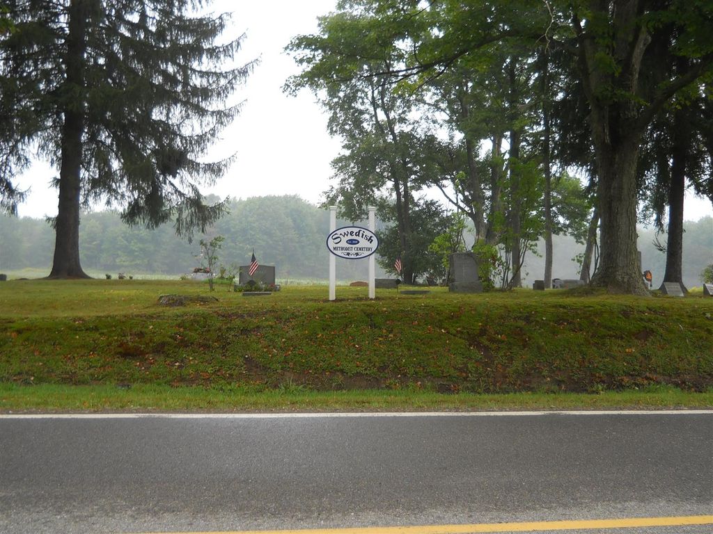
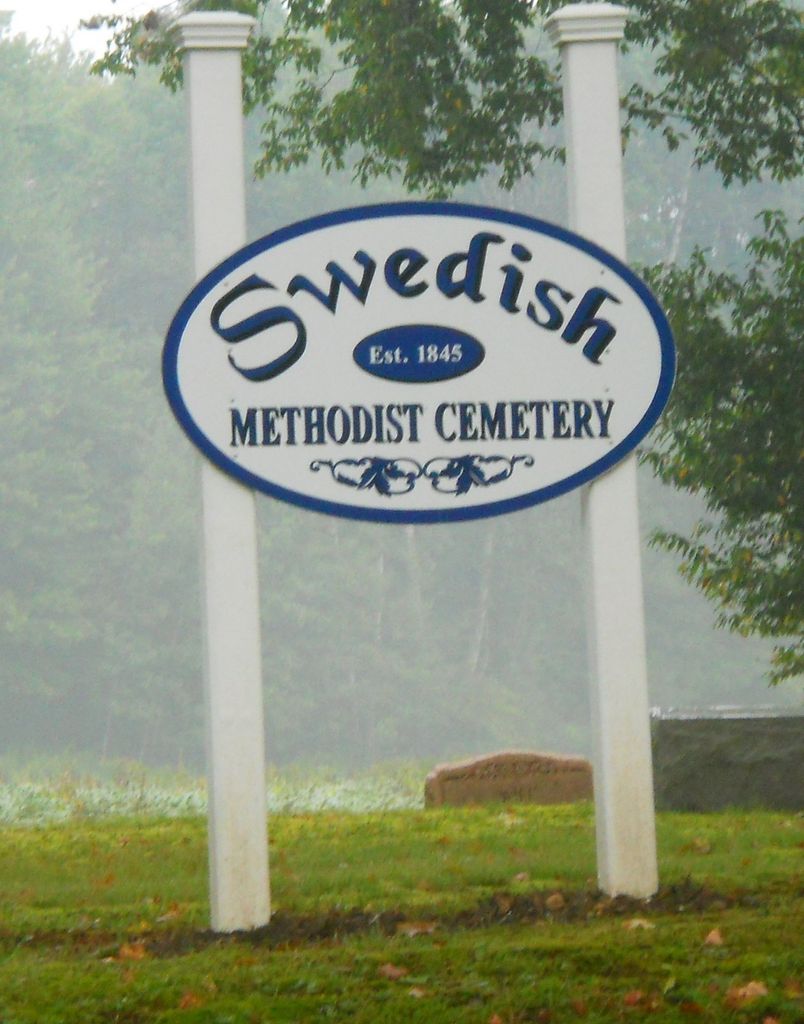
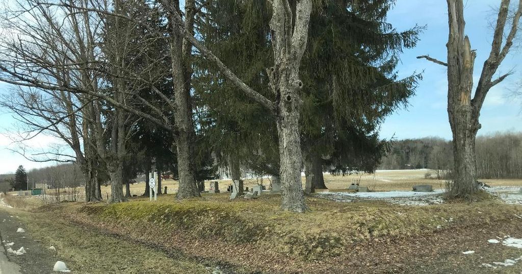
| Location | : | Chandlers Valley, Warren County, USA |
| Coordinate | : | 41.9346000, -79.3234000 |
| Description | : | It is located on Rt. 27/Matthews Run, about 1 mile from Rt. 69/Jackson Run Rd. |
frequently asked questions (FAQ):
-
Where is Swedish Methodist Episcopalian Church Cemetery?
Swedish Methodist Episcopalian Church Cemetery is located at on Rt. 27/Matthews Run Chandlers Valley, Warren County ,Pennsylvania ,USA.
-
Swedish Methodist Episcopalian Church Cemetery cemetery's updated grave count on graveviews.com?
0 memorials
-
Where are the coordinates of the Swedish Methodist Episcopalian Church Cemetery?
Latitude: 41.9346000
Longitude: -79.3234000
Nearby Cemetories:
1. Hessel Valley Lutheran Cemetery
Chandlers Valley, Warren County, USA
Coordinate: 41.9436646, -79.3173294
2. Mission Covenant Church Cemetery
Sugar Grove, Warren County, USA
Coordinate: 41.9444000, -79.3176000
3. Patchen Hill Cemetery
Sugar Grove Township, Warren County, USA
Coordinate: 41.9294021, -79.3426175
4. Chandlers Valley Cemetery
Chandlers Valley, Warren County, USA
Coordinate: 41.9261017, -79.3058014
5. Fullison Cemetery
Sugar Grove, Warren County, USA
Coordinate: 41.9606390, -79.3509860
6. Tuttle Hill Cemetery
Sugar Grove, Warren County, USA
Coordinate: 41.9362000, -79.3824000
7. Stilson Hill Cemetery
Sugar Grove, Warren County, USA
Coordinate: 41.9242000, -79.3846000
8. Wesleyan Cemetery
Sugar Grove, Warren County, USA
Coordinate: 41.9818993, -79.2960968
9. Robert Miles Gravesite
Sugar Grove, Warren County, USA
Coordinate: 41.9880480, -79.3111040
10. Kitchen Cemetery
Warren, Warren County, USA
Coordinate: 41.9023400, -79.2633600
11. Cherry Hill Cemetery
Sugar Grove, Warren County, USA
Coordinate: 41.9886017, -79.3405991
12. Jackson Run Cemetery
Warren County, USA
Coordinate: 41.9128000, -79.2541000
13. Hull Family Burial Plot
Brokenstraw Township, Warren County, USA
Coordinate: 41.8815630, -79.2948290
14. Turnpike Cemetery
Sugar Grove, Warren County, USA
Coordinate: 41.9668999, -79.3981018
15. Foster Cemetery
Lander, Warren County, USA
Coordinate: 41.9547005, -79.2403030
16. Union Grove Cemetery
Lander, Warren County, USA
Coordinate: 41.9865460, -79.2614080
17. Swedish Lutheran Church Cemetery
Youngsville, Warren County, USA
Coordinate: 41.8621460, -79.3141080
18. South Ridge Cemetery
Russell, Warren County, USA
Coordinate: 41.9949670, -79.2666150
19. Youngsville Cemetery
Youngsville, Warren County, USA
Coordinate: 41.8573500, -79.3176500
20. Wintergreen Cemetery
Busti, Chautauqua County, USA
Coordinate: 42.0071983, -79.3656006
21. Wrightsville Cemetery
Wrightsville, Warren County, USA
Coordinate: 41.9202995, -79.4282990
22. Lottsville Cemetery
Lottsville, Warren County, USA
Coordinate: 41.9517100, -79.4318700
23. Berea Lutheran Cemetery
Pittsfield, Warren County, USA
Coordinate: 41.9024200, -79.4255905
24. Mead Cemetery
Warren County, USA
Coordinate: 41.8764000, -79.2394028