
| Memorials | : | 0 |
| Location | : | Szekszárd, Szekszárdi járás, Hungary |
| Coordinate | : | 46.3497640, 18.6999870 |
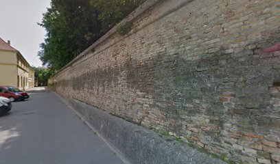
| Description | : | The Benedictine abbey of Szekszárd was founded in 1061 by the famous Bela I. The cross-shaped church was intended for the burying-place of the royal family. The tradition holds that Bela I was buried here in 1063. The first writing is from 1212, which certifies the authenticity function of the abbey. After the Mongol invasion a castle was built around the abbey's building. In the 14th century a monastery school worked in it. Abbot Michael Merey took over the building of the abbey after the Turks , who managed a Christian church there. This condition lasted until 1794, but a... Read More |
frequently asked questions (FAQ):
-
Where is Szekszárd Abbey?
Szekszárd Abbey is located at Szekszárd, Szekszárdi járás ,Tolna ,Hungary.
-
Szekszárd Abbey cemetery's updated grave count on graveviews.com?
0 memorials
-
Where are the coordinates of the Szekszárd Abbey?
Latitude: 46.3497640
Longitude: 18.6999870
Nearby Cemetories:
1. Jewish cemetery
Szekszárd, Szekszárdi járás, Hungary
Coordinate: 46.3514810, 18.7164230
2. Jewish cemetery, Szekszárd
Szekszárd, Szekszárdi járás, Hungary
Coordinate: 46.3515520, 18.7165300
3. Szekszárd Alsóvárosi temetö
Szekszárd, Szekszárdi járás, Hungary
Coordinate: 46.3370430, 18.7012260
4. Szekszárd Újvárosi temetö
Szekszárd, Szekszárdi járás, Hungary
Coordinate: 46.3650780, 18.7056800
5. Szekszárd Hollós László u temetö , (Szölöhegyi)
Szekszárd, Szekszárdi járás, Hungary
Coordinate: 46.3079850, 18.6851930
6. Őcsény katolikus temetö
Őcsény, Szekszárdi járás, Hungary
Coordinate: 46.3110140, 18.7459990
7. Jewish Cemetery
Őcsény, Szekszárdi járás, Hungary
Coordinate: 46.3110360, 18.7471470
8. Őcsény református temetö
Őcsény, Szekszárdi járás, Hungary
Coordinate: 46.3111480, 18.7525930
9. Őcsény református temetö
Őcsény, Szekszárdi járás, Hungary
Coordinate: 46.3110010, 18.7527870
10. Bonyhádi Jewish Cemetery
Bonyhád, Bonyhádi járás, Hungary
Coordinate: 46.3013000, 18.5264890
11. Vadászmajori temetö, Tengelic
Tengelic, Paksi járás, Hungary
Coordinate: 46.4786460, 18.7298070
12. Ortodox zsidó temető
Bonyhád, Bonyhádi járás, Hungary
Coordinate: 46.2999720, 18.5233890
13. Bátaszék Jewish Cemetery
Bátaszék, Szekszárdi járás, Hungary
Coordinate: 46.2012860, 18.7203350
14. Tengelic temetö
Tengelic, Paksi járás, Hungary
Coordinate: 46.5288400, 18.7064800
15. Szölöhegyi temetö, Tengelic
Tengelic, Paksi járás, Hungary
Coordinate: 46.5293360, 18.7655820
16. Dunaszentgyörgy temetö
Dunaszentgyörgy, Paksi járás, Hungary
Coordinate: 46.5273750, 18.8160630
17. Csapó család sírkertje
Tengelic, Paksi járás, Hungary
Coordinate: 46.5500070, 18.7008950
18. Bajaszentistváni temetö, Baja
Baja, Bajai járás, Hungary
Coordinate: 46.2095170, 18.9602440
19. Jewish cemetery , Gyönk
Gyönk, Tamási járás, Hungary
Coordinate: 46.5487920, 18.4874750
20. Szent Rokus Roman Catholic Cemetery
Baja, Bajai járás, Hungary
Coordinate: 46.1769910, 18.9587540
21. Zengõvárkony
Zengővárkony, Pécsváradi járás, Hungary
Coordinate: 46.1738853, 18.4329987
22. Calvaria Cemetery
Baja, Bajai járás, Hungary
Coordinate: 46.1704600, 18.9636700
23. Geresd Cemetery
Geresdlak, Pécsváradi járás, Hungary
Coordinate: 46.1109274, 18.5294791
24. Geresdlak
Geresdlak, Pécsváradi járás, Hungary
Coordinate: 46.1083500, 18.5236400