
| Memorials | : | 0 |
| Location | : | College Hill, Lafayette County, USA |
| Coordinate | : | 34.4546967, -89.6487350 |
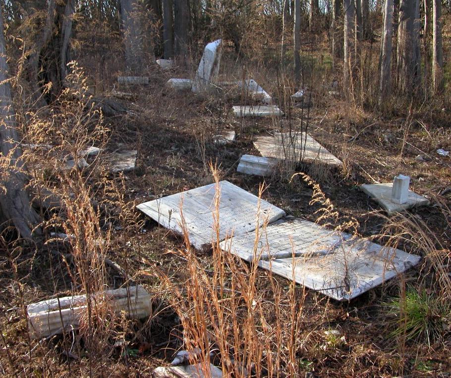
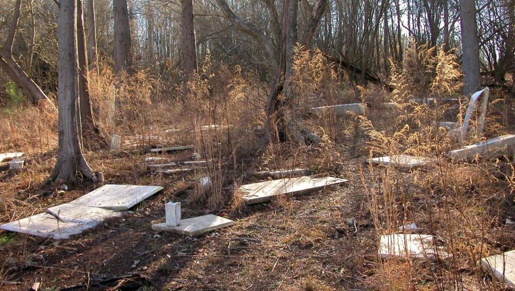
| Description | : | In 1936 Congress approved a comprehensive plan to control flooding in the Yazoo Basin. As part of the plan a dam was constructed on the Little Tallahatchie River near the town of Sardis, Mississippi. Becoming operational in October 1940, Sardis Dam embodied some of the most advanced design and construction methods of its day. At 15,300 feet long and with an average height of 97 feet it was at one time reputed to be the largest earth-filled type dam in the world. Many small communities and cemeteries along the river and its tributaries fell victum to the high water of... Read More |
frequently asked questions (FAQ):
-
Where is Tallahatchie Cemetery?
Tallahatchie Cemetery is located at College Hill, Lafayette County ,Mississippi ,USA.
-
Tallahatchie Cemetery cemetery's updated grave count on graveviews.com?
0 memorials
-
Where are the coordinates of the Tallahatchie Cemetery?
Latitude: 34.4546967
Longitude: -89.6487350
Nearby Cemetories:
1. Buford Chapel Cemetery
Lafayette County, USA
Coordinate: 34.4599991, -89.6164017
2. Elijah Cemetery
Oxford, Lafayette County, USA
Coordinate: 34.4239006, -89.6619034
3. Galilee Church Cemetery
Oxford, Lafayette County, USA
Coordinate: 34.4119377, -89.6420822
4. Pine Grove Cemetery
Lafayette County, USA
Coordinate: 34.4235992, -89.6038971
5. Hurricane Creek Primitive Cemetery
Lafayette County, USA
Coordinate: 34.4446430, -89.5842470
6. New Hope Cemetery
Lafayette County, USA
Coordinate: 34.5031013, -89.6943970
7. Jordan Chapel Cemetery
Oxford, Lafayette County, USA
Coordinate: 34.4170550, -89.5891130
8. Free Springs CME Church Cemetery
Harmontown, Lafayette County, USA
Coordinate: 34.5185930, -89.6519580
9. Fulmer Cemetery
Lafayette County, USA
Coordinate: 34.5106010, -89.6900024
10. Free Springs Cemetery
Harmontown, Lafayette County, USA
Coordinate: 34.5250015, -89.6517029
11. Saint John Cemetery
College Hill, Lafayette County, USA
Coordinate: 34.4596010, -89.5633260
12. College Hill Cemetery
Oxford, Lafayette County, USA
Coordinate: 34.4227982, -89.5702972
13. Oak Grove Church of Christ Cemetery
Harmontown, Lafayette County, USA
Coordinate: 34.5248690, -89.6865150
14. Cooper Cemetery
Teckville, Lafayette County, USA
Coordinate: 34.5169990, -89.7089200
15. Jackson Cemetery
Harmontown, Lafayette County, USA
Coordinate: 34.5327200, -89.6704200
16. Providence United Methodist Cemetery
Abbeville, Lafayette County, USA
Coordinate: 34.4957220, -89.5605000
17. Saint Peter Cemetery
Abbeville, Lafayette County, USA
Coordinate: 34.4959200, -89.5604400
18. Emory Cemetery
Panola County, USA
Coordinate: 34.4810982, -89.7455978
19. Harmontown Baptist Church Cemetery
Harmontown, Lafayette County, USA
Coordinate: 34.5393982, -89.6466980
20. Adams Cemetery
Glenville, Panola County, USA
Coordinate: 34.5136700, -89.7225800
21. Lammey Cemetery
Lafayette County, USA
Coordinate: 34.5388985, -89.6656036
22. Tobby Tubby Cemetery
Lafayette County, USA
Coordinate: 34.4599991, -89.5385971
23. Waldrip Cemetery
Lafayette County, USA
Coordinate: 34.5477982, -89.6691971
24. Simon Chapel Cemetery #02
Sardis, Panola County, USA
Coordinate: 34.4757996, -89.7643967