
| Memorials | : | 0 |
| Location | : | Lawndale, Cleveland County, USA |
| Coordinate | : | 35.4576645, -81.5860214 |
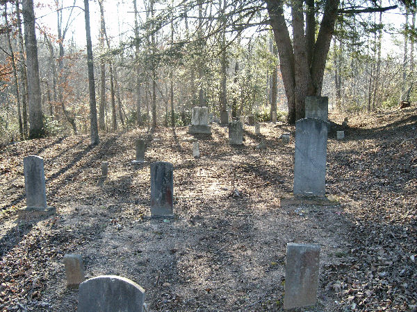
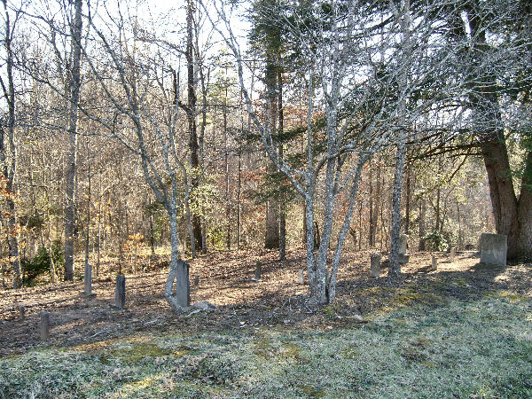
| Description | : | Many thanks to my friend, Robert Williams who took me to this cemetery. A church once sat near the Tan Yard, which occupied a lot of this area. Eventually, the tan yard relocated, as did the church which is now Kistler UMC. All that remains of this bit of history is this small cemetery, known as the "Tan Yard" cemetery. Info sent to me by Mr. Bill Floyd. |
frequently asked questions (FAQ):
-
Where is Tan Yard Cemetery?
Tan Yard Cemetery is located at Lawndale, Cleveland County ,North Carolina ,USA.
-
Tan Yard Cemetery cemetery's updated grave count on graveviews.com?
0 memorials
-
Where are the coordinates of the Tan Yard Cemetery?
Latitude: 35.4576645
Longitude: -81.5860214

Nearby Cemetories:
1. Wilson Cemetery
Lawndale, Cleveland County, USA
Coordinate: 35.4425610, -81.5864900
2. Mooney Cemetery
Lawndale, Cleveland County, USA
Coordinate: 35.4435997, -81.5738983
3. Mauney Family Cemetery
Lawndale, Cleveland County, USA
Coordinate: 35.4434090, -81.5730362
4. Pine Grove Primitive Baptist Church Cemetery
Lawndale, Cleveland County, USA
Coordinate: 35.4731483, -81.5638275
5. Eaker Cemetery
Cleveland County, USA
Coordinate: 35.4516983, -81.6144028
6. Warlick Cemetery
Belwood, Cleveland County, USA
Coordinate: 35.4782982, -81.5639038
7. Procter Cemetery
Belwood, Cleveland County, USA
Coordinate: 35.4783330, -81.5600000
8. Lucas Family Cemetery
Polkville, Cleveland County, USA
Coordinate: 35.4415210, -81.6235040
9. Willis Cemetery
Belwood, Cleveland County, USA
Coordinate: 35.4850000, -81.5566667
10. Oak Grove United Methodist
Lawndale, Cleveland County, USA
Coordinate: 35.4322600, -81.6208300
11. Oak Grove United Methodist Church Cemetery
Polkville, Cleveland County, USA
Coordinate: 35.4337440, -81.6225710
12. Clover Hill United Methodist Church Cemetery
Lawndale, Cleveland County, USA
Coordinate: 35.4817500, -81.6246000
13. Old Cloverhill Cemetery
Casar, Cleveland County, USA
Coordinate: 35.4826190, -81.6239550
14. Pleasant Hill United Methodist Cemetery
Belwood, Cleveland County, USA
Coordinate: 35.4946830, -81.5641520
15. Palm Tree Methodist Church Cemetery
Lawndale, Cleveland County, USA
Coordinate: 35.4151430, -81.5857920
16. Saint Paul Fire Baptized Holiness Church Cemetery
Lawndale, Cleveland County, USA
Coordinate: 35.4098516, -81.5789814
17. Elliott Memorial Baptist Cemetery
Cleveland County, USA
Coordinate: 35.4131851, -81.6116791
18. First Baptist Cemetery
Lawndale, Cleveland County, USA
Coordinate: 35.4082909, -81.5746002
19. Saint Paul Baptist Church Cemetery
Casar, Cleveland County, USA
Coordinate: 35.5082100, -81.5743600
20. Casar Baptist Cemetery
Casar, Cleveland County, USA
Coordinate: 35.5067450, -81.6099510
21. Brizendine Ford Cemetery
Lawndale, Cleveland County, USA
Coordinate: 35.4048970, -81.5721990
22. Normans Grove Baptist Church Cemetery
Belwood, Cleveland County, USA
Coordinate: 35.4793777, -81.5233688
23. Blessed Way Baptist Church Cemetery
Lawndale, Cleveland County, USA
Coordinate: 35.4177900, -81.5335700
24. Grigg-Lattimore Cemetery
Lawndale, Cleveland County, USA
Coordinate: 35.4188100, -81.5310100