
| Memorials | : | 0 |
| Location | : | Monroe County, USA |
| Coordinate | : | 41.0382000, -75.3039000 |
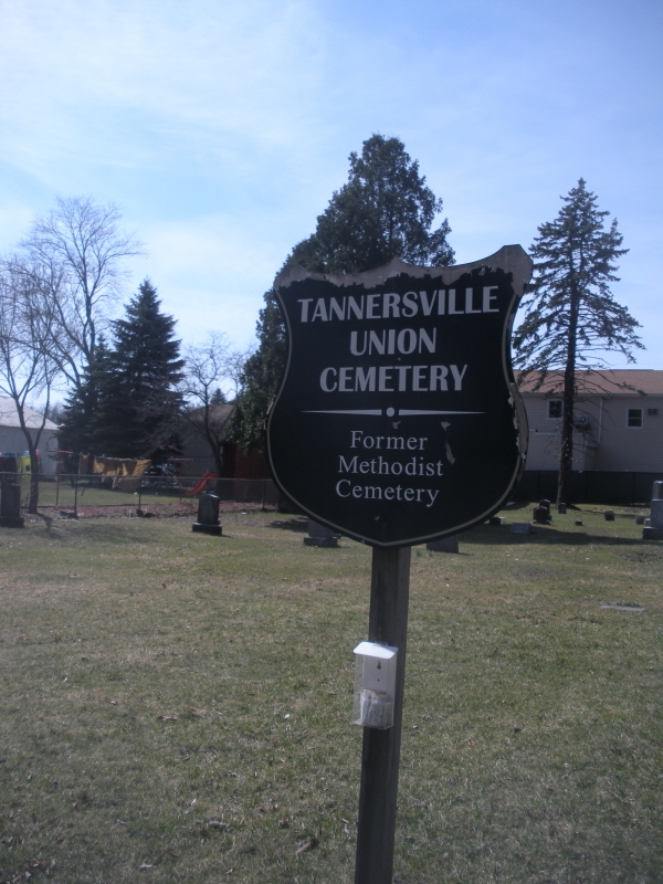
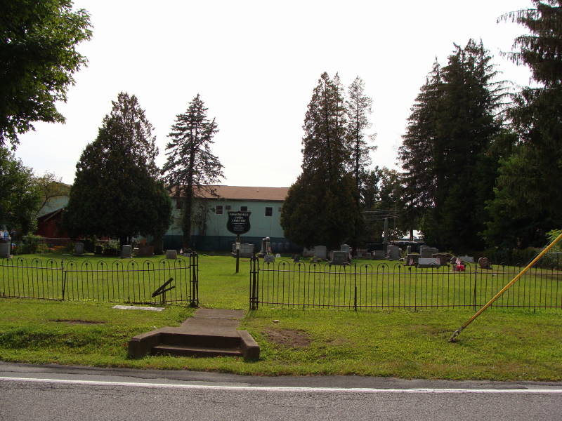
| Description | : | The cemetery is located between RT 611 and Learn Road. The Methodist church (once the Union Church) stood by the cemetery from about 1859 to about 1960. The congregation that built this church held their early meetings at a school house on the corner of Sullivan Trail and RT 715. The old Union Cemetery is at that location. |
frequently asked questions (FAQ):
-
Where is Tannersville Methodist Church Cemetery?
Tannersville Methodist Church Cemetery is located at Monroe County ,Pennsylvania ,USA.
-
Tannersville Methodist Church Cemetery cemetery's updated grave count on graveviews.com?
0 memorials
-
Where are the coordinates of the Tannersville Methodist Church Cemetery?
Latitude: 41.0382000
Longitude: -75.3039000
Nearby Cemetories:
1. Grace United Church of Christ Cemetery
Tannersville, Monroe County, USA
Coordinate: 41.0450000, -75.3113000
2. Tannersville Union Cemetery
Tannersville, Monroe County, USA
Coordinate: 41.0449600, -75.3116545
3. Saint Johns Cemetery
Scotrun, Monroe County, USA
Coordinate: 41.0640000, -75.3184000
4. Reeders Methodist Cemetery
Jackson Township, Monroe County, USA
Coordinate: 41.0185000, -75.3370000
5. Doll Family Burial Grounds
Reeders, Monroe County, USA
Coordinate: 41.0165010, -75.3363070
6. Cherry Lane United Methodist Church Cemetery
Monroe County, USA
Coordinate: 41.0612000, -75.2666000
7. Custards Cemetery
Bartonsville, Monroe County, USA
Coordinate: 40.9925480, -75.2854500
8. Saint Johns Cemetery
Bartonsville, Monroe County, USA
Coordinate: 40.9924190, -75.2848860
9. Pocono Union Church Cemetery
Tannersville, Monroe County, USA
Coordinate: 41.0804000, -75.2680000
10. Appenzell Cemetery
Appenzell, Monroe County, USA
Coordinate: 40.9927000, -75.3602000
11. Mount Calvary Cemetery
Monroe County, USA
Coordinate: 40.9933014, -75.3621979
12. Analomink United Methodist Churchyard
Analomink, Monroe County, USA
Coordinate: 41.0517000, -75.2206000
13. Saint Paul's Cemetery
Swiftwater, Monroe County, USA
Coordinate: 41.1040000, -75.3088000
14. Ransberry Family Cemetery
Monroe County, USA
Coordinate: 41.0717590, -75.2244830
15. Storm Family Burial Ground
Snydersville, Monroe County, USA
Coordinate: 40.9665985, -75.2689209
16. Trinity Episcopal Church Memorial Garden
Mount Pocono, Monroe County, USA
Coordinate: 41.1094590, -75.3423420
17. Shafer Schoolhouse Cemetery
Monroe County, USA
Coordinate: 40.9751000, -75.2451000
18. Keokee Chapel Cemetery
Paradise Valley, Monroe County, USA
Coordinate: 41.1232450, -75.2897570
19. Saint John's Cemetery
Neola, Monroe County, USA
Coordinate: 40.9511000, -75.3334000
20. Neola Methodist Church Cemetery
Monroe County, USA
Coordinate: 40.9509720, -75.3333350
21. Miller Family Burial Ground
Stroudsburg, Monroe County, USA
Coordinate: 40.9499891, -75.2797181
22. Beakleyville Baptist Church Cemetery
Monroe County, USA
Coordinate: 41.0207000, -75.1850000
23. Hollinshead Cemetery
Stroudsburg, Monroe County, USA
Coordinate: 40.9799054, -75.2077550
24. Kellersville Methodist Church Cemetery
Kellersville, Monroe County, USA
Coordinate: 40.9446000, -75.2997000