
| Memorials | : | 0 |
| Location | : | Burning Fork, Magoffin County, USA |
| Coordinate | : | 37.7136580, -83.0071810 |
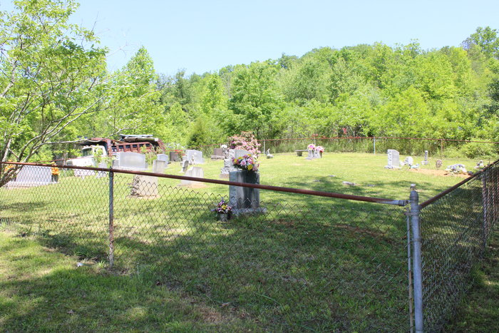
| Description | : | This graveyard is known as, the "Tater Bill Howard Cemetery" and is located in the Bradley area of Magoffin County. To find this graveyard, take Burning Fork road (1888) from Salyersville to Bill Howard Drive. Bill Howard Drive will be on your left-hand side and easy to miss. Follow the road uphill, around a few curves and it will lead you directly to the cemetery. Easily visible and accessible from the roadway, it will be located on your left-hand side. This is an active cemetery, enclosed by a chain link fence and well maintained. |
frequently asked questions (FAQ):
-
Where is Tater Bill Howard Cemetery?
Tater Bill Howard Cemetery is located at Burning Fork, Magoffin County ,Kentucky ,USA.
-
Tater Bill Howard Cemetery cemetery's updated grave count on graveviews.com?
0 memorials
-
Where are the coordinates of the Tater Bill Howard Cemetery?
Latitude: 37.7136580
Longitude: -83.0071810
Nearby Cemetories:
1. Captain Reuben Patrick Cemetery
Magoffin County, USA
Coordinate: 37.7125920, -83.0081270
2. Meredith Patrick Cemetery
Bradley, Magoffin County, USA
Coordinate: 37.7119100, -83.0066400
3. Birch Branch Collinsworth Cemetery
Burning Fork, Magoffin County, USA
Coordinate: 37.7175531, -83.0143540
4. Jack Rice Cemetery
Burning Fork, Magoffin County, USA
Coordinate: 37.7088500, -82.9951800
5. Huston Patrick Cemetery
Burning Fork, Magoffin County, USA
Coordinate: 37.7228012, -83.0160980
6. Marshall Family Cemetery
Burning Fork, Magoffin County, USA
Coordinate: 37.7227400, -83.0165700
7. Henry Hackworth Family Cemetery
Burning Fork, Magoffin County, USA
Coordinate: 37.7084620, -82.9892960
8. Elijah Whitaker Cemetery
Magoffin County, USA
Coordinate: 37.7162220, -82.9849770
9. Burke Cemetery
Magoffin County, USA
Coordinate: 37.7057991, -82.9803009
10. Cain Cemetery
Magoffin County, USA
Coordinate: 37.7340200, -83.0210200
11. Adams Cemetery
Magoffin County, USA
Coordinate: 37.7431810, -83.0022290
12. Charley May Cemetery
Magoffin County, USA
Coordinate: 37.7168680, -83.0453220
13. Fletcher Cemetery
Magoffin County, USA
Coordinate: 37.6892014, -82.9828033
14. Arnett Cemetery
Magoffin County, USA
Coordinate: 37.6906000, -83.0460000
15. Jackson Family Cemetery
Conley, Magoffin County, USA
Coordinate: 37.7483330, -82.9750000
16. Byrd Owens Cemetery
Magoffin County, USA
Coordinate: 37.6780550, -83.0503210
17. William Cole Cemetery
Carver, Magoffin County, USA
Coordinate: 37.6747600, -83.0471500
18. Charles Minix Cemetery
Magoffin County, USA
Coordinate: 37.6729900, -83.0443100
19. Captain Powers Cemetery
Magoffin County, USA
Coordinate: 37.7135200, -83.0743500
20. Boone Howard Cemetery
Magoffin County, USA
Coordinate: 37.6624985, -82.9721985
21. John D. Blanton Cemetery
Conley, Magoffin County, USA
Coordinate: 37.7505620, -82.9490090
22. Blanton Cemetery
Magoffin County, USA
Coordinate: 37.7708015, -83.0261002
23. Mathie Pace Cemetery
Conley, Magoffin County, USA
Coordinate: 37.7514000, -82.9479833
24. Mont Conley Cemetery
Falcon, Magoffin County, USA
Coordinate: 37.7710300, -83.0318400