
| Memorials | : | 0 |
| Location | : | Aramiro, Waikato District, New Zealand |
| Coordinate | : | -37.8856213, 175.0276607 |
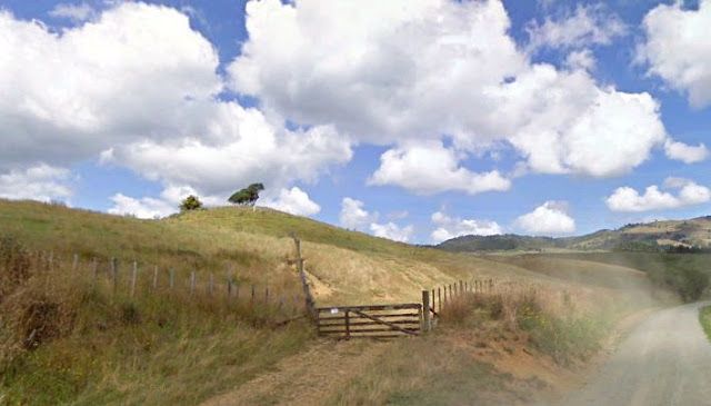
| Description | : | TE RUA O PUERU is a private, Maori owned Urupa/Burial Ground gazetted as such by the New Zealand Government for the purposes of a burial ground for members of the Ngati Tonganui subtribe of the Ngati Mahanga tribe. This burial ground is also referred to simply as PUERU. Land for the burial ground was donated by the late Tiatia Te Heruika in 1909, although it is said that there were interments prior to this date. Tiatia's gifting of shares (individual interests)formalised the reservation in terms of land ownership. It is difficult to articulate the number... Read More |
frequently asked questions (FAQ):
-
Where is Te Rua o Pueru?
Te Rua o Pueru is located at Waitetuna Valley Road Aramiro, Waikato District ,Waikato , 3293New Zealand.
-
Te Rua o Pueru cemetery's updated grave count on graveviews.com?
0 memorials
-
Where are the coordinates of the Te Rua o Pueru?
Latitude: -37.8856213
Longitude: 175.0276607
Nearby Cemetories:
1. St. Paul's Cemetery
Te Uku, Waikato District, New Zealand
Coordinate: -37.8290334, 174.9810162
2. Te Uku Church Cemetery
Te Uku, Waikato District, New Zealand
Coordinate: -37.8280630, 174.9601860
3. Te Uku Catholic Cemetery
Te Uku, Waikato District, New Zealand
Coordinate: -37.8370770, 174.9350620
4. Okete Cemetery
Okete, Waikato District, New Zealand
Coordinate: -37.8328300, 174.9172400
5. Te Mata Cemetery
Te Mata, Waikato District, New Zealand
Coordinate: -37.8966860, 174.8692030
6. Te Mata Catholic Church Cemetery
Te Mata, Waikato District, New Zealand
Coordinate: -37.8803870, 174.8650430
7. Ruamakamaka Urupā
Whatawhata, Waikato District, New Zealand
Coordinate: -37.7931298, 175.1463011
8. Raglan Cemetery
Raglan, Waikato District, New Zealand
Coordinate: -37.8049530, 174.8753310
9. Whatawhata Cemetery
Whatawhata, Waikato District, New Zealand
Coordinate: -37.7938680, 175.1745930
10. Pirongia Cemetery
Te Awamutu, Waipa District, New Zealand
Coordinate: -37.9870310, 175.2115260
11. Ruapuke Cemetery
Raglan, Waikato District, New Zealand
Coordinate: -37.9236350, 174.7925600
12. Papakainga Urupā
Raglan, Waikato District, New Zealand
Coordinate: -37.9538140, 174.7982410
13. Paterangi Cemetery
Te Awamutu, Waipa District, New Zealand
Coordinate: -37.9608970, 175.2707680
14. Saint Albans Anglican Church Cemetery
Waingaro, Waikato District, New Zealand
Coordinate: -37.6813280, 174.9721870
15. Hamilton West Cemetery
Hamilton, Hamilton City, New Zealand
Coordinate: -37.7791480, 175.2661750
16. Kawhia Cemetery
Kawhia, Otorohanga District, New Zealand
Coordinate: -38.0441760, 174.8274300
17. Ohaupo Cemetery
Ōhaupō, Waipa District, New Zealand
Coordinate: -37.9077640, 175.3159600
18. Jackson Street Cemetery
Ngāruawāhia, Waikato District, New Zealand
Coordinate: -37.6814940, 175.1641650
19. Ohaupo Catholic Cemetery
Ōhaupō, Waipa District, New Zealand
Coordinate: -37.9383320, 175.3141890
20. Ngaruawahia Cemetery
Ngāruawāhia, Waikato District, New Zealand
Coordinate: -37.6803921, 175.1656371
21. Hamilton East Cemetery
Hamilton, Hamilton City, New Zealand
Coordinate: -37.8032400, 175.3085160
22. St. Stephen's Cemetery
Tamahere, Waikato District, New Zealand
Coordinate: -37.8302500, 175.3575900
23. St Johns Anglican Church Cemetery
Te Awamutu, Waipa District, New Zealand
Coordinate: -38.0091760, 175.3278440
24. Te Awamutu Cemetery
Te Awamutu, Waipa District, New Zealand
Coordinate: -37.9991220, 175.3426520