
| Memorials | : | 79 |
| Location | : | Darke County, USA |
| Coordinate | : | 40.3250470, -84.5377310 |
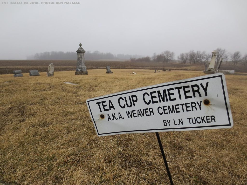
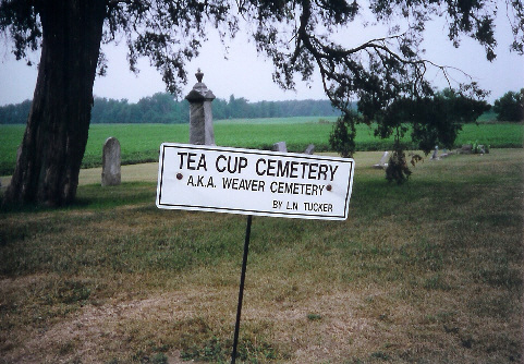
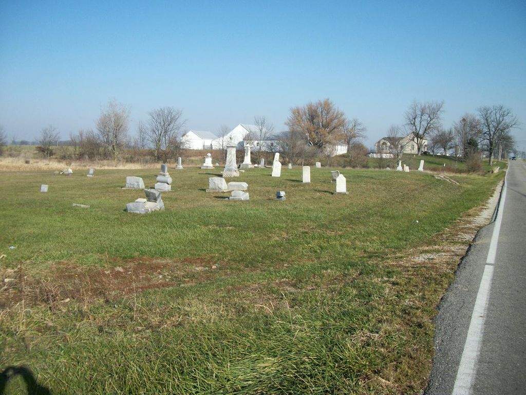
| Description | : | The cemetery is located on the north side of North Star Fort Loramie Road (County Road 18) about 0.2 miles west of its intersection with Mangen Road (County Road 54). The cemetery is located in Wabash Township, Darke County, Ohio and is #2777 (Teacup Cemetery / Weaver Cemetery) in “Ohio Cemeteries 1803-2003”, compiled by the Ohio Genealogical Society. The cemetery is registered with the Ohio Division of Real Estate and Professional Licensing (ODRE) as Teacup Cemetery with registration license number CGR.0000980767. The U.S. Geological Survey (USGS) Geographic Names Information System (GNIS) feature ID for the cemetery is 1806199... Read More |
frequently asked questions (FAQ):
-
Where is Tea Cup Cemetery?
Tea Cup Cemetery is located at North Star Fort Loramie Road (County Road 18) Wabash Township, Darke County ,Ohio , 45380USA.
-
Tea Cup Cemetery cemetery's updated grave count on graveviews.com?
79 memorials
-
Where are the coordinates of the Tea Cup Cemetery?
Latitude: 40.3250470
Longitude: -84.5377310
Nearby Cemetories:
1. Saint Louis Cemetery
North Star, Darke County, USA
Coordinate: 40.3244019, -84.5344009
2. Saint Paul Cemetery
North Star, Darke County, USA
Coordinate: 40.3106000, -84.5447000
3. Mendenhall Cemetery
Yorkshire, Darke County, USA
Coordinate: 40.3206560, -84.4977340
4. Saint Martins Catholic Cemetery
Osgood, Darke County, USA
Coordinate: 40.3356018, -84.4903030
5. Speelman Cemetery
Darke County, USA
Coordinate: 40.2891998, -84.5030975
6. Shooks Cemetery
Darke County, USA
Coordinate: 40.3122711, -84.6082916
7. Holsapple Cemetery
New Weston, Darke County, USA
Coordinate: 40.3344002, -84.6093979
8. Old Brock Boyd Cemetery
Frenchtown, Darke County, USA
Coordinate: 40.2686615, -84.5702896
9. Brock Cemetery
Greenville, Darke County, USA
Coordinate: 40.2604408, -84.5610580
10. Scheidler Cemetery
Brock, Darke County, USA
Coordinate: 40.2528253, -84.5666210
11. Saint Francis Catholic Church Cemetery
Cranberry Prairie, Mercer County, USA
Coordinate: 40.3932991, -84.5816803
12. Willowdell Cemetery
Clark, Darke County, USA
Coordinate: 40.3067017, -84.4393997
13. Saint Marys Cemetery
Burkettsville, Mercer County, USA
Coordinate: 40.3608017, -84.6307983
14. Holy Family Cemetery
Wayne Township, Darke County, USA
Coordinate: 40.2461128, -84.5238876
15. Simison Cemetery
Mercer County, USA
Coordinate: 40.3952940, -84.5893190
16. Cassella Cemetery
Cassella, Mercer County, USA
Coordinate: 40.4061584, -84.5521774
17. Saint Rosa Catholic Cemetery
Maria Stein, Mercer County, USA
Coordinate: 40.4072227, -84.5153351
18. Saint Bernard Cemetery
Burkettsville, Darke County, USA
Coordinate: 40.3494911, -84.6449585
19. Yoder Cemetery
Darke County, USA
Coordinate: 40.2593994, -84.4606018
20. Walkup Cemetery
Fort Loramie, Shelby County, USA
Coordinate: 40.3444200, -84.4153560
21. Hoschover Cemetery
Rossburg, Darke County, USA
Coordinate: 40.2630997, -84.6333008
22. English Cemetery
Versailles, Darke County, USA
Coordinate: 40.2501570, -84.4594030
23. Saint John's Catholic Church Cemetery
Maria Stein, Mercer County, USA
Coordinate: 40.4085960, -84.4727631
24. Saint Joseph Cemetery
Egypt, Auglaize County, USA
Coordinate: 40.3852997, -84.4344025