
| Memorials | : | 0 |
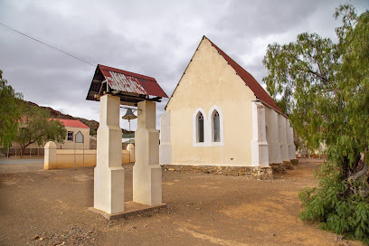
| Location | : | Klaarstroom, Central Karoo District Municipality, South Africa |
| Coordinate | : | -33.3312360, 22.5358250 |
frequently asked questions (FAQ):
-
Where is The Good Shepherd Churchyard?
The Good Shepherd Churchyard is located at Hogg Street, Klaarstroom, Central Karoo District Municipality, Western Cape, South Africa Klaarstroom, Central Karoo District Municipality ,Western Cape ,South Africa.
-
The Good Shepherd Churchyard cemetery's updated grave count on graveviews.com?
0 memorials
-
Where are the coordinates of the The Good Shepherd Churchyard?
Latitude: -33.3312360
Longitude: 22.5358250
Nearby Cemetories:
1. Klaarstroom Cemetery
Klaarstroom, Central Karoo District Municipality, South Africa
Coordinate: -33.3282930, 22.5310960
2. NG Kerk - De Rust Kerkhof en Gedenkmuur
De Rust, Garden Route District Municipality, South Africa
Coordinate: -33.4907000, 22.5362500
3. De Rust Cemetery
De Rust, Garden Route District Municipality, South Africa
Coordinate: -33.4927970, 22.5368060
4. De Rust Old Cemetery
De Rust, Garden Route District Municipality, South Africa
Coordinate: -33.4981290, 22.5317520
5. NG Kerk - Kangovalleie Muur van Herinnering
Schoemanshoek, Garden Route District Municipality, South Africa
Coordinate: -33.4791830, 22.2418170
6. Oudtshoorn Cemetery
Oudtshoorn, Garden Route District Municipality, South Africa
Coordinate: -33.5911900, 22.2319820
7. Condor Street Cemetery and Extension
Oudtshoorn, Garden Route District Municipality, South Africa
Coordinate: -33.5853920, 22.2145800
8. Oudtshoorn Jewish Cemetery
Oudtshoorn, Garden Route District Municipality, South Africa
Coordinate: -33.5859980, 22.2133790
9. NG Kerk - Oudtshoorn-Noord Muur van Herinnering
Oudtshoorn, Garden Route District Municipality, South Africa
Coordinate: -33.5831670, 22.2092170
10. Kerk Street Cemetery
Oudtshoorn, Garden Route District Municipality, South Africa
Coordinate: -33.5888318, 22.2089255
11. Bad Street Cemetery
Oudtshoorn, Garden Route District Municipality, South Africa
Coordinate: -33.5905170, 22.2101500
12. NG Kerk - Oudtshoorn Muur van Herinnering
Oudtshoorn, Garden Route District Municipality, South Africa
Coordinate: -33.5884330, 22.2063830
13. St. Judes Churchyard
Oudtshoorn, Garden Route District Municipality, South Africa
Coordinate: -33.5878140, 22.2032160
14. NG Kerk Oudtshoorn-Park Muur van Herinnering
Oudtshoorn, Garden Route District Municipality, South Africa
Coordinate: -33.5814700, 22.1945060
15. Langenhoven Cemetery
Oudtshoorn, Garden Route District Municipality, South Africa
Coordinate: -33.5864830, 22.1950500
16. NG Kerk - Oudtshoorn-Wes Muur van Herinnering
Oudtshoorn, Garden Route District Municipality, South Africa
Coordinate: -33.5982500, 22.1953970
17. NG Kerk Begraafplaas
Prince Albert, Central Karoo District Municipality, South Africa
Coordinate: -33.2382170, 22.0294670
18. NG Kerk - Prins Albert Gedenkmuur
Prince Albert, Central Karoo District Municipality, South Africa
Coordinate: -33.2271670, 22.0297780
19. De Beer Street Cemetery
Prince Albert, Central Karoo District Municipality, South Africa
Coordinate: -33.2207000, 22.0317500
20. Fransie Pienaar Museum
Prince Albert, Central Karoo District Municipality, South Africa
Coordinate: -33.2245585, 22.0305046
21. Prince Albert Cemetery
Prince Albert, Central Karoo District Municipality, South Africa
Coordinate: -33.2259979, 22.0289741
22. Stockenstrom Street Cemetery
Prince Albert, Central Karoo District Municipality, South Africa
Coordinate: -33.2140569, 22.0316395
23. Prince Albert North Cemetery
Prince Albert, Central Karoo District Municipality, South Africa
Coordinate: -33.2092205, 22.0183504
24. NG Kerk - De Hoop Kerkhof
Hoopvol, Garden Route District Municipality, South Africa
Coordinate: -33.6067314, 22.0449938