
| Memorials | : | 0 |
| Location | : | Robbins, Moore County, USA |
| Coordinate | : | 35.4233030, -79.5486440 |
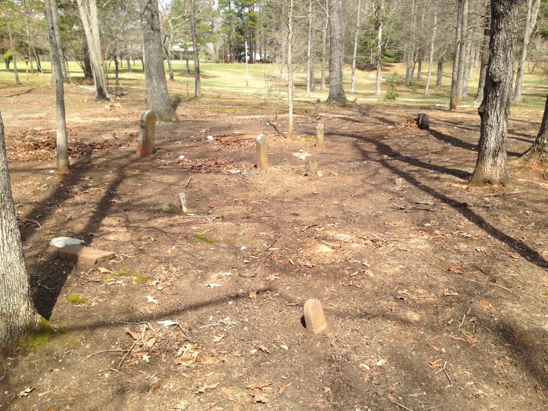
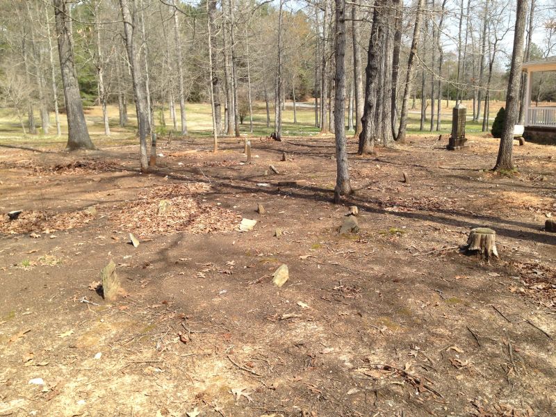
| Description | : | From A.E. Parker's A Guide to Moore County Cemeteries: South of the Plank Road and approximately .2 miles east of where the Plank Road intersects with Hemp Street Extension. The cemetery is 100 yards south of the highway in a thick wooded grove. (note the wooded grove is gone and this cemetery is very near the house of Velma Brady's daughter.) Another description of how to get there (dated 30 May 2011): The cemetery is located just off Hemp Street Extension at Velna Nichols Brady's daughter's house. It is in the stretch of trees between Velna's house and her daughters. ... Read More |
frequently asked questions (FAQ):
-
Where is Thomas J. Williams Cemetery?
Thomas J. Williams Cemetery is located at Off Hemp St Ext near Plank Rd Robbins, Moore County ,North Carolina ,USA.
-
Thomas J. Williams Cemetery cemetery's updated grave count on graveviews.com?
0 memorials
-
Where are the coordinates of the Thomas J. Williams Cemetery?
Latitude: 35.4233030
Longitude: -79.5486440
Nearby Cemetories:
1. Cockman Cemetery
Robbins, Moore County, USA
Coordinate: 35.4133060, -79.5326550
2. Bellview AME Zion Church Cemetery
Robbins, Moore County, USA
Coordinate: 35.4397130, -79.5546770
3. Flint Hill Baptist Church Cemetery
Robbins, Moore County, USA
Coordinate: 35.4053500, -79.5564300
4. Emsley Wallace Home Cemetery
Robbins, Moore County, USA
Coordinate: 35.4109047, -79.5710886
5. Wallace Family Cemetery
Robbins, Moore County, USA
Coordinate: 35.4038400, -79.5637800
6. Pine Rest Cemetery
Robbins, Moore County, USA
Coordinate: 35.4356003, -79.5738983
7. Crossroads Baptist Church Cemetery
Robbins, Moore County, USA
Coordinate: 35.4094700, -79.5763900
8. Matthew Williams Cemetery
Robbins, Moore County, USA
Coordinate: 35.4098309, -79.5773649
9. Ike Wallace Gravesite
Robbins, Moore County, USA
Coordinate: 35.4062281, -79.5196652
10. Tabernacle United Methodist Church Cemetery
Robbins, Moore County, USA
Coordinate: 35.4306200, -79.5850470
11. Melton-Muse Family Cemetery
Robbins, Moore County, USA
Coordinate: 35.3974497, -79.5280123
12. Sampson Delaney Wallace Gravesite
Robbins, Moore County, USA
Coordinate: 35.3908535, -79.5469594
13. George Davis Cemetery
Robbins, Moore County, USA
Coordinate: 35.4159672, -79.5941860
14. New Testament Baptist Church Cemetery
Robbins, Moore County, USA
Coordinate: 35.4564730, -79.5728570
15. Unity Grove Baptist Church Cemetery
Carthage, Moore County, USA
Coordinate: 35.3850610, -79.5550270
16. Sowell Family Cemetery
Robbins, Moore County, USA
Coordinate: 35.4062360, -79.5947134
17. Pleasant Hill Methodist Church
Robbins, Moore County, USA
Coordinate: 35.4655685, -79.5528336
18. Calvary Baptist Church Cemetery
Carthage, Moore County, USA
Coordinate: 35.3935980, -79.5044520
19. Samuel Barrett Cemetery
Robbins, Moore County, USA
Coordinate: 35.3756002, -79.5546403
20. Chestley Horner Grave Marker
Robbins, Moore County, USA
Coordinate: 35.3925143, -79.5013028
21. Pleasant View Friends Church Cemetery
Eagle Springs, Moore County, USA
Coordinate: 35.4003400, -79.6049900
22. Rock Hill Friends Meeting Cemetery
Eagle Springs, Moore County, USA
Coordinate: 35.3815650, -79.5936600
23. Williams-Morgan Cemetery
Eagle Springs, Moore County, USA
Coordinate: 35.3872530, -79.6047342
24. Davis Family Cemetery
Robbins, Moore County, USA
Coordinate: 35.3798600, -79.4992600