
| Memorials | : | 1 |
| Location | : | Pella, Marion County, USA |
| Coordinate | : | 41.3781400, -92.9672340 |
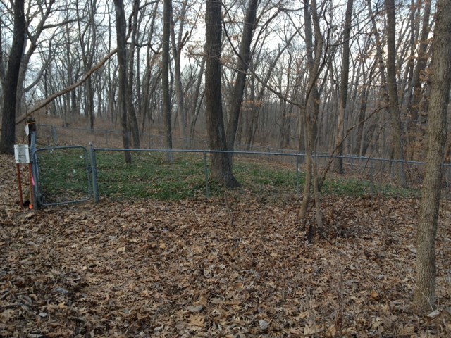
| Description | : | From 1862 until 1915 the cemetery was called the Vander Linden Cemetery. It is near the north overlook by the dam at Lake Red Rock, south-west of Pella about four miles. If one parks in the parking lot by the north overlook and then walks down to the bike trail, take a right. Shortly after turning, there is a hiking trail on the left. Take it and within a 1/4 mile one can find the cemetery off to the left. It is enclosed by a fence and is in the middle of the woods. |
frequently asked questions (FAQ):
-
Where is Timber Ridge Cemetery?
Timber Ridge Cemetery is located at Pella, Marion County ,Iowa ,USA.
-
Timber Ridge Cemetery cemetery's updated grave count on graveviews.com?
1 memorials
-
Where are the coordinates of the Timber Ridge Cemetery?
Latitude: 41.3781400
Longitude: -92.9672340

Nearby Cemetories:
1. t'Lam Cemetery
Pella, Marion County, USA
Coordinate: 41.3849983, -92.9816971
2. Monster Cemetery
Knoxville, Marion County, USA
Coordinate: 41.3689995, -93.0169983
3. Coal Ridge Church Cemetery
Knoxville, Marion County, USA
Coordinate: 41.3781013, -93.0231018
4. Asbury Cemetery
Marion County, USA
Coordinate: 41.3457985, -93.0049973
5. Oak Wood Cemetery
Pella, Marion County, USA
Coordinate: 41.4096870, -92.9282000
6. Klein Cemetery
Pella, Marion County, USA
Coordinate: 41.4199000, -92.9907000
7. Welle Farm Cemetery
Pella, Marion County, USA
Coordinate: 41.4258000, -92.9644500
8. Coffman Cemetery
Knoxville, Marion County, USA
Coordinate: 41.3549000, -93.0238000
9. Vierson Cemetery
Pella, Marion County, USA
Coordinate: 41.4235090, -92.9387260
10. Eureka Cemetery
Durham, Marion County, USA
Coordinate: 41.3274994, -92.9480972
11. Graceland Cemetery
Pella, Marion County, USA
Coordinate: 41.4300003, -92.9103012
12. Saint Marys Cemetery
Pella, Marion County, USA
Coordinate: 41.4336014, -92.9158020
13. Buwalda Cemetery
Pella, Marion County, USA
Coordinate: 41.4450000, -92.9485500
14. Porter Grove Cemetery
Harvey, Marion County, USA
Coordinate: 41.3502998, -92.8764038
15. Breckenridge Cemetery
Harvey, Marion County, USA
Coordinate: 41.3024000, -92.9944000
16. Price Cemetery
Marion County, USA
Coordinate: 41.4389000, -93.0369034
17. Funk Cemetery
Marion County, USA
Coordinate: 41.3139992, -93.0329971
18. Fisher Cemetery
Summit Township, Marion County, USA
Coordinate: 41.4487745, -93.0225801
19. Loynachan Farm Cemetery
Tracy, Marion County, USA
Coordinate: 41.2970000, -92.9920000
20. Black Oak Cemetery
Mahaska County, USA
Coordinate: 41.3922005, -92.8542023
21. Howard Cemetery
Leighton, Mahaska County, USA
Coordinate: 41.3400000, -92.8612000
22. Karr Family Cemetery
Marion County, USA
Coordinate: 41.4252000, -93.0737000
23. Parsons Cemetery
Marion County, USA
Coordinate: 41.3136300, -92.8707470
24. Greenwood Cemetery
Knoxville, Marion County, USA
Coordinate: 41.3466988, -93.0952988