
| Memorials | : | 612 |
| Location | : | Tahoe City, Placer County, USA |
| Phone | : | 530-581-2879. |
| Coordinate | : | 39.1720700, -120.1464000 |
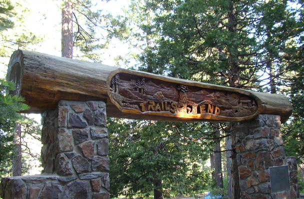
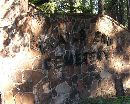
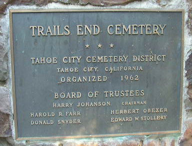
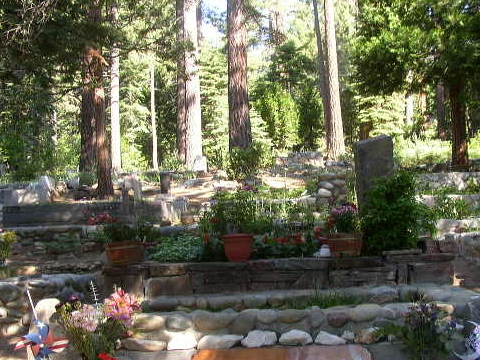
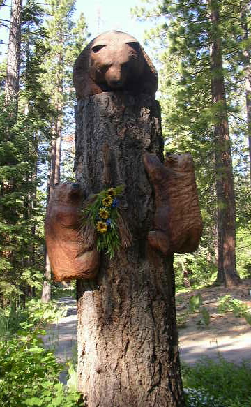
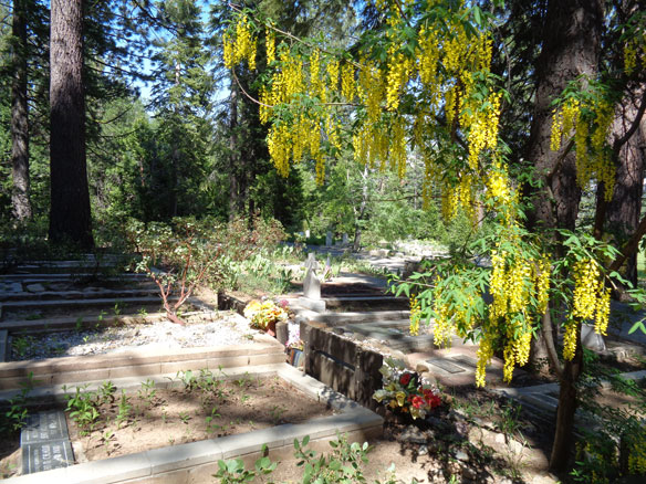
| Description | : | Early graves that were located around the hilly area of the current Lighthouse Center were relocated to the northeast part of town, buried in tight rows, and given the name of Trails End Cemetery. Four decades passed with the cemetery receiving little care. Any burials after 1909 were sometimes randomly placed and often buried in the area of the present-day golf course near the cemetery. When the Tahoe City Cemetery District was formed, those graves were moved within the cemetery. In 1953 Constable Harry Johansson -- on his own -- cleaned, plotted gravesites, created maps, and carved grave markers for... Read More |
frequently asked questions (FAQ):
-
Where is Trails End Cemetery?
Trails End Cemetery is located at 597 Fairway Drive Tahoe City, Placer County ,California ,USA.
-
Trails End Cemetery cemetery's updated grave count on graveviews.com?
612 memorials
-
Where are the coordinates of the Trails End Cemetery?
Latitude: 39.1720700
Longitude: -120.1464000
Nearby Cemetories:
1. Schaffer Family Cemetery
Truckee, Nevada County, USA
Coordinate: 39.3240900, -120.1780200
2. Brickelltown Cemetery
Truckee, Nevada County, USA
Coordinate: 39.3248030, -120.1854090
3. Saint Francis of Assisi Urn Garden
Incline Village, Washoe County, USA
Coordinate: 39.2544760, -119.9678710
4. Catholic Cemetery
Truckee, Nevada County, USA
Coordinate: 39.3319931, -120.1805801
5. Donner Party Camp at Alder Creek Valley
Truckee, Nevada County, USA
Coordinate: 39.3216670, -120.2327500
6. Sierra Mountains Cemetery
Truckee, Nevada County, USA
Coordinate: 39.3342018, -120.1772003
7. Donner Memorial State Park
Truckee, Nevada County, USA
Coordinate: 39.3246040, -120.2330160
8. Saint Patricks Episcopal Church Columbarium
Incline Village, Washoe County, USA
Coordinate: 39.2514000, -119.9543991
9. Glenbrook Cemetery
Glenbrook, Douglas County, USA
Coordinate: 39.0891100, -119.9352500
10. Saint Johns in the Wilderness Episcopal Columbariu
Glenbrook, Douglas County, USA
Coordinate: 39.0722520, -119.9422930
11. Boca Cemetery
Boca, Nevada County, USA
Coordinate: 39.3870510, -120.0922310
12. Jacks Valley Cemetery
Douglas County, USA
Coordinate: 39.0840751, -119.8468480
13. Franktown Creek Cemetery
Franktown, Washoe County, USA
Coordinate: 39.2752991, -119.8463974
14. Bowers Mansion Cemetery
Washoe County, USA
Coordinate: 39.2852800, -119.8422000
15. Al Tahoe Cemetery
South Lake Tahoe, El Dorado County, USA
Coordinate: 38.9411011, -119.9875565
16. Johnson-Springmeyer Cemetery
South Lake Tahoe, El Dorado County, USA
Coordinate: 38.9376580, -119.9681600
17. Happy Homestead Cemetery
South Lake Tahoe, El Dorado County, USA
Coordinate: 38.9371986, -119.9681015
18. Carson Pioneer Cemetery
Carson City, Carson City, USA
Coordinate: 39.1612396, -119.7792969
19. Genoa Cemetery
Genoa, Douglas County, USA
Coordinate: 39.0116997, -119.8431015
20. Knott Family Graveyard
Genoa, Douglas County, USA
Coordinate: 39.0069900, -119.8452400
21. Washoe City Cemetery
Reno, Washoe County, USA
Coordinate: 39.3171997, -119.8198547
22. William W Tyler’s Grave
El Dorado County, USA
Coordinate: 38.8822220, -120.2055560
23. Stewart Cemetery
Carson City, Carson City, USA
Coordinate: 39.1175800, -119.7701000
24. Ormsby Poor Farm Cemetery
Carson City, Carson City, USA
Coordinate: 39.1172066, -119.7700043