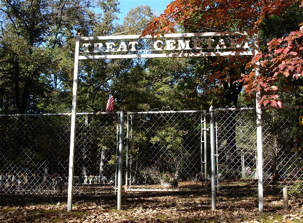
| Memorials | : | 3 |
| Location | : | Hagarville, Johnson County, USA |
| Coordinate | : | 35.6128006, -93.1782990 |
| Description | : | From the junction of Highway 7 and 27 in Dover, AR, go north on highway 7 for 12.4 miles. Turn left on Forest Service Road # 1801 (Long Pool Road) for 1.4 miles. Turn right on Forrest Service Road #1805 for 7.5 miles. Take Forest Service Road # 1821 (Dead End) for 1.4 miles. Cemetery on right. These forest service roads have been recently changed to county roads. |
frequently asked questions (FAQ):
-
Where is Treat Cemetery?
Treat Cemetery is located at Hagarville, Johnson County ,Arkansas ,USA.
-
Treat Cemetery cemetery's updated grave count on graveviews.com?
2 memorials
-
Where are the coordinates of the Treat Cemetery?
Latitude: 35.6128006
Longitude: -93.1782990
Nearby Cemetories:
1. Shannon Cemetery
Treat, Pope County, USA
Coordinate: 35.6077995, -93.1613998
2. Fort Douglas Cemetery
Fort Douglas, Johnson County, USA
Coordinate: 35.6789000, -93.2390000
3. Oak Grove Cemetery
Simpson, Pope County, USA
Coordinate: 35.6094017, -93.0643997
4. Self Cemetery
Johnson County, USA
Coordinate: 35.7061005, -93.1680984
5. Bradley Cemetery
Pope County, USA
Coordinate: 35.5191994, -93.1583023
6. Wheeler Cemetery
Johnson County, USA
Coordinate: 35.7047005, -93.2118988
7. Lane Cemetery
Dover, Pope County, USA
Coordinate: 35.5428009, -93.0969009
8. New Freeman Cemetery
Freeman Springs, Pope County, USA
Coordinate: 35.6557999, -93.0661011
9. Freeman Springs Cemetery
Freeman Springs, Pope County, USA
Coordinate: 35.6563988, -93.0661011
10. Coleman Cemetery
Pope County, USA
Coordinate: 35.7127991, -93.1361008
11. Owens Cemetery
Dover, Pope County, USA
Coordinate: 35.5010986, -93.1682968
12. Annies Chapel Cemetery
Hagarville, Johnson County, USA
Coordinate: 35.5222015, -93.2758026
13. Woods Mountain Cemetery
Johnson County, USA
Coordinate: 35.5999985, -93.3313980
14. Union Cemetery
Johnson County, USA
Coordinate: 35.6343994, -93.3319016
15. Adams Cemetery
Johnson County, USA
Coordinate: 35.4977989, -93.2481003
16. Sherman Cemetery
Tag, Pope County, USA
Coordinate: 35.5489006, -93.0413971
17. Brown-Rye Cemetery
Pope County, USA
Coordinate: 35.4735985, -93.1958008
18. Booger Hollow Cemetery
Pope County, USA
Coordinate: 35.4749985, -93.1472015
19. Lindsey Cemetery
Pope County, USA
Coordinate: 35.4721985, -93.1810989
20. Newton Cemetery
Johnson County, USA
Coordinate: 35.5155983, -93.3047028
21. Adkins Cemetery
Johnson County, USA
Coordinate: 35.5233002, -93.3169022
22. Brock Cemetery
Victor, Pope County, USA
Coordinate: 35.6389008, -93.0028000
23. Saint Pauls Cemetery
Lutherville, Johnson County, USA
Coordinate: 35.4771996, -93.2771988
24. Boyd Cemetery
Sand Gap, Pope County, USA
Coordinate: 35.6921997, -93.0066986


