
| Memorials | : | 0 |
| Location | : | Sand Springs, Tulsa County, USA |
| Coordinate | : | 36.1364410, -96.1000970 |
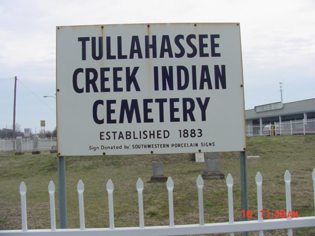
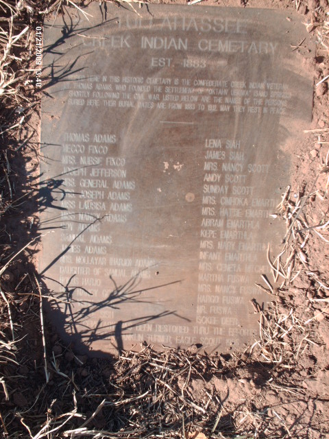
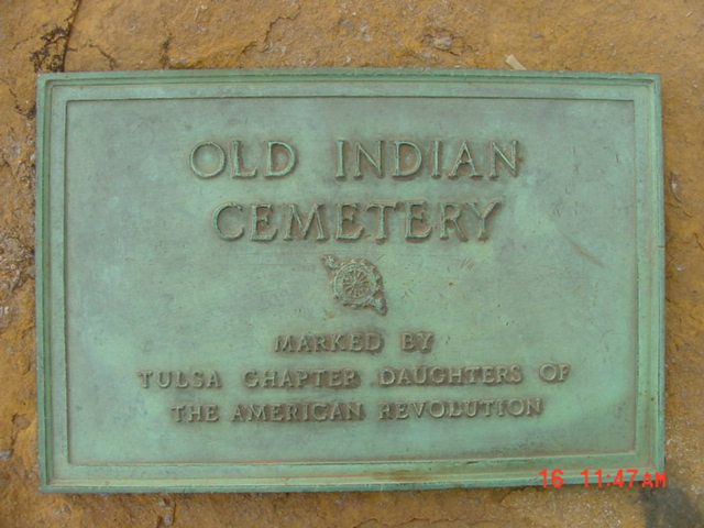
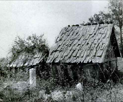
| Description | : | burial dates are from 1883 to 1912. May they rest in Peace The earliest known settlement in the Sand Springs area dates back to 1826, when it was occupied by the Cherokee Indians who came through the Trail of Tears. In 1828, the Cherokees were forced to move elsewhere in Indian Territory due to a new treaty. The land was allotted to the Creek Indian tribe by the U.S. Government. Lt. Thomas Adams, a Confederate Indian veteran, brought his family to the area and settled by the springs, from which the name Sand Springs derived. The settlement which arose was originally... Read More |
frequently asked questions (FAQ):
-
Where is Tullahassee Creek Indian Cemetery?
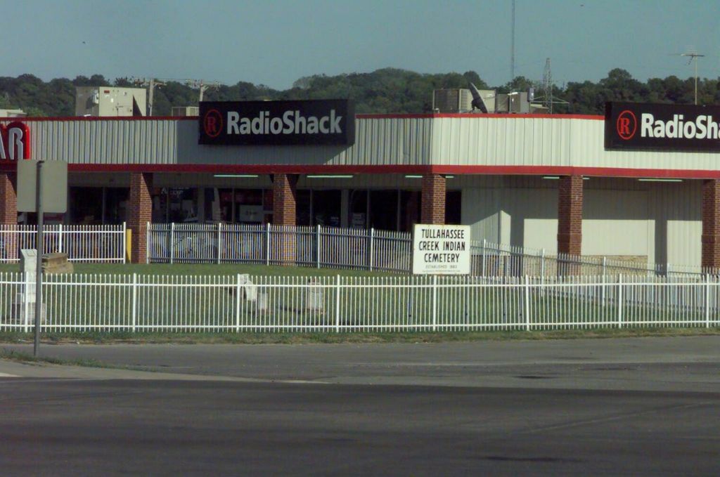
Tullahassee Creek Indian Cemetery is located at 700 E Charles Page Blvd Sand Springs, Tulsa County ,Oklahoma , 74063USA.
-
Tullahassee Creek Indian Cemetery cemetery's updated grave count on graveviews.com?
0 memorials
-
Where are the coordinates of the Tullahassee Creek Indian Cemetery?
Latitude: 36.1364410
Longitude: -96.1000970
Nearby Cemetories:
1. Saint Matthews Memorial Garden
Sand Springs, Tulsa County, USA
Coordinate: 36.1448360, -96.0899450
2. Woodland Memorial Park Cemetery
Sand Springs, Tulsa County, USA
Coordinate: 36.1528015, -96.1141968
3. Postoak Cemetery
Sand Springs, Tulsa County, USA
Coordinate: 36.1114006, -96.1489029
4. Hellard Cemetery
Osage County, USA
Coordinate: 36.1906013, -96.0817032
5. Meadowbrook Cemetery
Tulsa, Tulsa County, USA
Coordinate: 36.0818810, -96.0647720
6. Clinton Oaks Cemetery
Tulsa, Tulsa County, USA
Coordinate: 36.1016960, -96.0185220
7. Gilcrease Museum Grounds
Tulsa, Tulsa County, USA
Coordinate: 36.1748000, -96.0210000
8. Parish Church of Saint Jerome Columbarium
Tulsa, Tulsa County, USA
Coordinate: 36.1680700, -95.9983900
9. Tiger Bone Cemetery
Sand Springs, Tulsa County, USA
Coordinate: 36.0756650, -96.1833940
10. Hinson Cemetery
Sand Springs, Osage County, USA
Coordinate: 36.1838186, -96.1961881
11. Gooden Indian Cemetery
Sand Springs, Tulsa County, USA
Coordinate: 36.1517900, -96.2122500
12. First Presbyterian Church Columbarium
Tulsa, Tulsa County, USA
Coordinate: 36.1490000, -95.9870000
13. Trinity Episcopal Church Columbarium
Tulsa, Tulsa County, USA
Coordinate: 36.1522090, -95.9869180
14. Boston Avenue Methodist Church Columbarium
Tulsa, Tulsa County, USA
Coordinate: 36.1437225, -95.9843597
15. Oaklawn Cemetery
Tulsa, Tulsa County, USA
Coordinate: 36.1486015, -95.9775009
16. All Souls Memorial Garden
Tulsa, Tulsa County, USA
Coordinate: 36.1212900, -95.9763100
17. Southminster Presbyterian Church Columbarium
Tulsa, Tulsa County, USA
Coordinate: 36.1132900, -95.9774000
18. Perryman Cemetery
Tulsa, Tulsa County, USA
Coordinate: 36.1156600, -95.9728000
19. Rock Creek Cemetery
Sand Springs, Tulsa County, USA
Coordinate: 36.0965500, -96.2263300
20. Little Cussetah Cemetery
Sapulpa, Creek County, USA
Coordinate: 36.0233400, -96.0825310
21. Grace Lutheran Church Cemetery
Tulsa, Tulsa County, USA
Coordinate: 36.1528730, -95.9583930
22. Saint John's Episcopal Church Columbarium
Tulsa, Tulsa County, USA
Coordinate: 36.1032070, -95.9553880
23. Saint Johns Episcopal Church Garden of the Resurre
Tulsa, Tulsa County, USA
Coordinate: 36.1035300, -95.9547600
24. Rosencutter Cemetery
Jenks, Tulsa County, USA
Coordinate: 36.0413833, -96.0005972