
| Memorials | : | 3 |
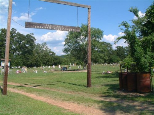
| Location | : | Tuskahoma, Pushmataha County, USA |
| Coordinate | : | 34.6425018, -95.2731018 |
| Description | : | From Clayton, Oklahoma, go north, then it turns east, on Highway 271 for 6 miles. You will come to a stop sign with “Tuskahoma Road” going south (right) and “Council House Road” going north. Turn north (left) on Council House Road (also called #4355) and go 1.3 miles where you will see the Choctaw Nation Capitol Museum on your left. Turn right on Road #4350 and go ¼ mile which will bring you to the Tuskahoma Cemetery. |
frequently asked questions (FAQ):
-
Where is Tuskahoma Cemetery?
Tuskahoma Cemetery is located at Tuskahoma, Pushmataha County ,Oklahoma ,USA.
-
Tuskahoma Cemetery cemetery's updated grave count on graveviews.com?
2 memorials
-
Where are the coordinates of the Tuskahoma Cemetery?
Latitude: 34.6425018
Longitude: -95.2731018

Nearby Cemetories:
1. William Bryant Grave Site
Tuskahoma, Pushmataha County, USA
Coordinate: 34.6232300, -95.2501300
2. A. L. Stephens Cemetery
Clayton, Pushmataha County, USA
Coordinate: 34.6221810, -95.3236700
3. Cole Spur Cemetery
Pushmataha County, USA
Coordinate: 34.6314011, -95.2177963
4. Brown Cemetery
Latimer County, USA
Coordinate: 34.6950920, -95.3078230
5. Cupco Cemetery
Yanush, Latimer County, USA
Coordinate: 34.6951840, -95.3087500
6. Trowbridge Cemetery
Latimer County, USA
Coordinate: 34.7099991, -95.2917023
7. Hokit Cemetery
Latimer County, USA
Coordinate: 34.7064018, -95.3230972
8. Kiamichi Pioneer Cemetery
Albion, Pushmataha County, USA
Coordinate: 34.6299600, -95.1808800
9. Anderson Cemetery
Pushmataha County, USA
Coordinate: 34.6472015, -95.3775024
10. King Cemetery
Latimer County, USA
Coordinate: 34.7289009, -95.2703018
11. Clayton Cemetery
Clayton, Pushmataha County, USA
Coordinate: 34.5831500, -95.3501600
12. Potts Cemetery
Latimer County, USA
Coordinate: 34.7160988, -95.2097015
13. Laura Cemetery
Latimer County, USA
Coordinate: 34.7388992, -95.2133026
14. Young Cemetery
Latimer County, USA
Coordinate: 34.7529140, -95.2233450
15. Noah Cemetery
Albion, Pushmataha County, USA
Coordinate: 34.6530991, -95.1069031
16. Heath Cemetery
Albion, Pushmataha County, USA
Coordinate: 34.6542015, -95.0963974
17. Armstrong Cemetery
Albion, Pushmataha County, USA
Coordinate: 34.6711006, -95.0971985
18. Nashoba Indian Cemetery
Pushmataha County, USA
Coordinate: 34.4849900, -95.2352700
19. Black Fork Cemetery
Nashoba, Pushmataha County, USA
Coordinate: 34.4831009, -95.2482986
20. Veterans Colony Cemetery
Latimer County, USA
Coordinate: 34.8061960, -95.2939810
21. Albion Cemetery
Albion, Pushmataha County, USA
Coordinate: 34.6671982, -95.0710983
22. Wall Family Cemetery
Albion, Pushmataha County, USA
Coordinate: 34.6723940, -95.0670150
23. Borden Cemetery
Pushmataha County, USA
Coordinate: 34.6450005, -95.4882965
24. George Allison Myers Family Cemetery
Talihina, Le Flore County, USA
Coordinate: 34.7151820, -95.0586330