
| Memorials | : | 3 |
| Location | : | Latham, Logan County, USA |
| Coordinate | : | 39.9377785, -89.1738892 |
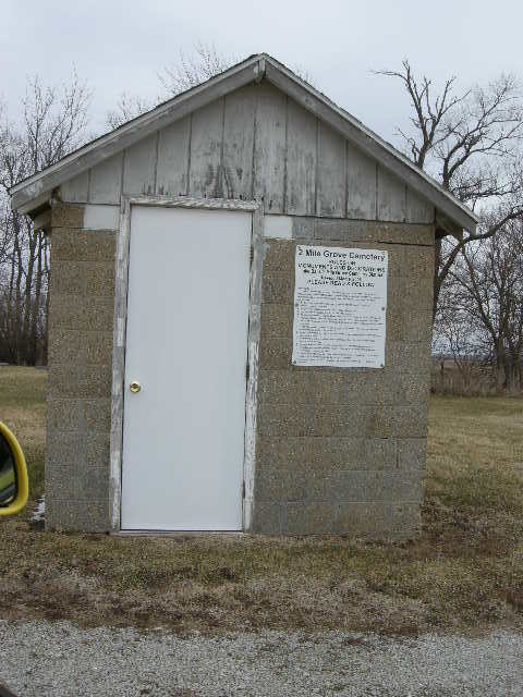
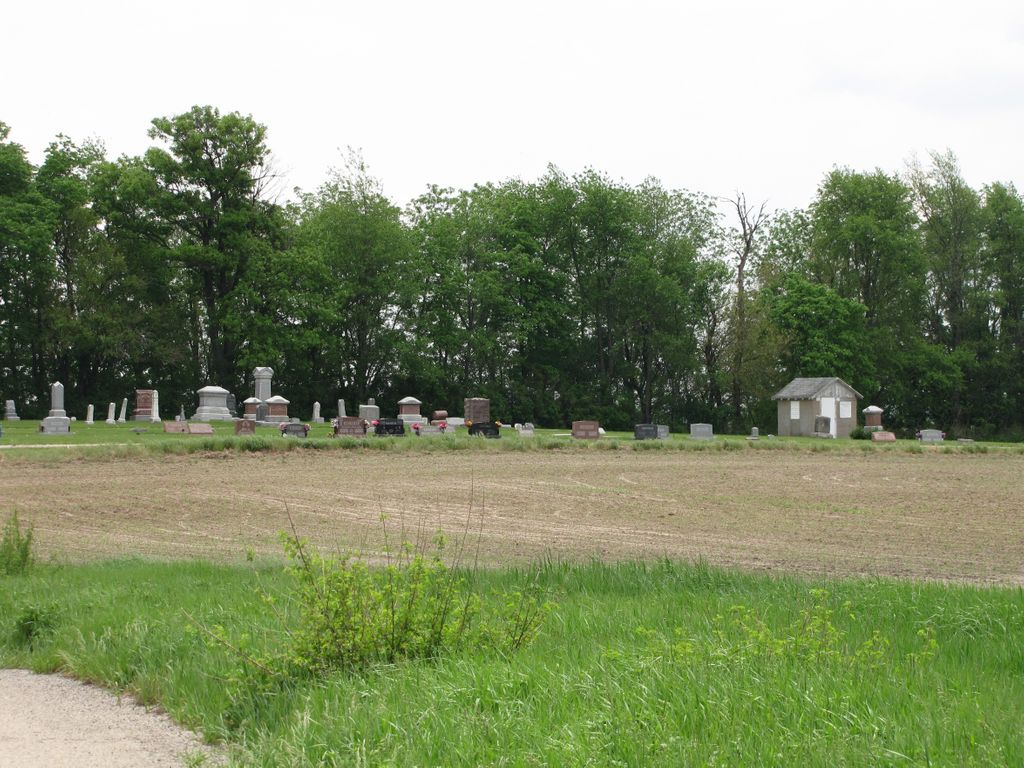
| Description | : | History of Two Mile Grove Cemetery Two Mile Grove Cemetery started out as a burial plot for the members of the Baptist Church. The members purchased an acre of ground at the Two Mile Grove Cemetery for $20.00 and intended to use the land to build a place of worship and a burial plt for church members. A log church was built and it was called Myrtle Tree Church. It was commonly called the Two Mile Grove Baptist Church. In 1872, the members decided they must move into the newly laid out town of Lathan. The... Read More |
frequently asked questions (FAQ):
-
Where is Two Mile Grove Cemetery?
Two Mile Grove Cemetery is located at Latham, Logan County ,Illinois ,USA.
-
Two Mile Grove Cemetery cemetery's updated grave count on graveviews.com?
2 memorials
-
Where are the coordinates of the Two Mile Grove Cemetery?
Latitude: 39.9377785
Longitude: -89.1738892
Nearby Cemetories:
1. Lake Bank Cemetery
Mount Pulaski, Logan County, USA
Coordinate: 39.9514008, -89.2225037
2. Bell Cemetery
Mount Pulaski, Logan County, USA
Coordinate: 39.9566994, -89.2643967
3. Illini Cemetery
Warrensburg, Macon County, USA
Coordinate: 39.9091682, -89.0872192
4. Emery Cemetery
Austin Township, Macon County, USA
Coordinate: 40.0299988, -89.1224976
5. Long Point Cemetery
Niantic, Macon County, USA
Coordinate: 39.8293500, -89.1722700
6. Steenbergen Cemetery
Mount Pulaski, Logan County, USA
Coordinate: 39.9611015, -89.3131027
7. Wilcox Cemetery
Illiopolis, Sangamon County, USA
Coordinate: 39.8440240, -89.2472540
8. Harristown Cemetery
Harristown, Macon County, USA
Coordinate: 39.8454018, -89.0851974
9. Calvary Cemetery
Illiopolis, Sangamon County, USA
Coordinate: 39.8344002, -89.2410965
10. Mount Pulaski Cemetery
Mount Pulaski, Logan County, USA
Coordinate: 40.0175018, -89.2866669
11. Laenna Cemetery
Chestnut, Logan County, USA
Coordinate: 40.0546989, -89.2099991
12. Riverside Cemetery
Illiopolis, Sangamon County, USA
Coordinate: 39.8222008, -89.2536011
13. Macon County Memorial Park
Harristown, Macon County, USA
Coordinate: 39.8442001, -89.0532990
14. Crum Cemetery
Harristown, Macon County, USA
Coordinate: 39.8266983, -89.0667038
15. Berea Cemetery
Osbernville, Christian County, USA
Coordinate: 39.8000570, -89.1553730
16. Donnan Cemetery
Logan County, USA
Coordinate: 40.0764008, -89.2108002
17. Whitley Cemetery
Harristown, Macon County, USA
Coordinate: 39.8044434, -89.1011124
18. Carlyle Cemetery
Mount Pulaski, Logan County, USA
Coordinate: 39.9935989, -89.3482971
19. Boiling Springs Cemetery
Decatur, Macon County, USA
Coordinate: 39.8838997, -88.9978027
20. Mostetter Cemetery
Illiopolis, Sangamon County, USA
Coordinate: 39.8139590, -89.2763610
21. Sharon Cemetery
Decatur, Macon County, USA
Coordinate: 39.8431015, -89.0222015
22. Wrights Grove Cemetery
Maroa, Macon County, USA
Coordinate: 40.0363998, -89.0218964
23. Muirheid Cemetery
Macon County, USA
Coordinate: 39.7963982, -89.0858002
24. Hunter Cemetery
Mount Auburn, Christian County, USA
Coordinate: 39.7827988, -89.2208023