
| Memorials | : | 5 |
| Location | : | Udall, Ozark County, USA |
| Coordinate | : | 36.5457500, -92.2581800 |
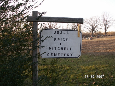
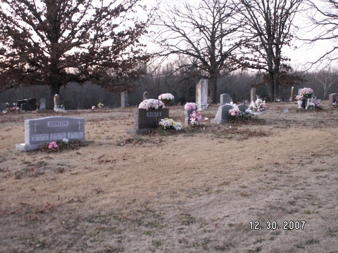
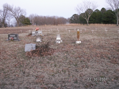
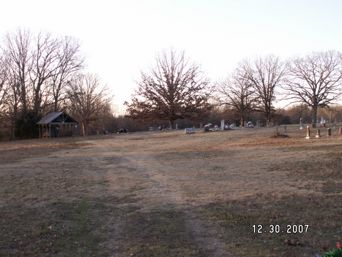
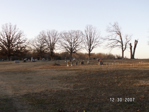
| Description | : | Udall cemetery takes its name from Ozark County's second oldest post office and first called St. Ledger. The U.S. Corps of Engineers moved the relocated Price and Mitchell family cemeteries to this place in 1943. The cemeteries were moved to prevent inundation by the coming impoundment of Lake Norfork. |
frequently asked questions (FAQ):
-
Where is Udall Price and Mitchell Cemetery?
Udall Price and Mitchell Cemetery is located at Udall, Ozark County ,Missouri ,USA.
-
Udall Price and Mitchell Cemetery cemetery's updated grave count on graveviews.com?
5 memorials
-
Where are the coordinates of the Udall Price and Mitchell Cemetery?
Latitude: 36.5457500
Longitude: -92.2581800
Nearby Cemetories:
1. Mount Pleasant Cemetery
Udall, Ozark County, USA
Coordinate: 36.5517400, -92.2316800
2. Price Cemetery
Ozark County, USA
Coordinate: 36.5299988, -92.2797012
3. Hawkins Ridge Cemetery
Udall, Ozark County, USA
Coordinate: 36.5180700, -92.2203200
4. East Wind Community Cemetery
Ozark County, USA
Coordinate: 36.5558100, -92.3078600
5. Old Tecumseh Cemetery
Tecumseh, Ozark County, USA
Coordinate: 36.5830120, -92.2853600
6. Howards Ridge Cemetery
Howards Ridge, Ozark County, USA
Coordinate: 36.5317307, -92.3273815
7. Martin and King Graves
Dawt, Ozark County, USA
Coordinate: 36.6017500, -92.2738300
8. Clear Springs Cemetery
Dawt, Ozark County, USA
Coordinate: 36.6056600, -92.2675400
9. Parker Cemetery
Ozark County, USA
Coordinate: 36.5999985, -92.2930984
10. Bentley Ridge Cemetery
Clarkridge, Baxter County, USA
Coordinate: 36.4872017, -92.2825012
11. White Oak Cemetery
Ozark County, USA
Coordinate: 36.6021996, -92.2253036
12. Ellison Family Cemetery
Baxter County, USA
Coordinate: 36.4935200, -92.3061800
13. James Isom Burial
Dawt Mill, Ozark County, USA
Coordinate: 36.6093270, -92.2772170
14. Fay Cemetery
Fay, Ozark County, USA
Coordinate: 36.5553017, -92.3450012
15. Baptist Hill Cemetery
Elijah, Ozark County, USA
Coordinate: 36.5782200, -92.1701100
16. James Cemetery
Tecumseh, Ozark County, USA
Coordinate: 36.6255300, -92.2603800
17. Hambelton Cemetery
Gainesville, Ozark County, USA
Coordinate: 36.6187300, -92.3027600
18. Bean Cemetery
Gamaliel, Baxter County, USA
Coordinate: 36.4578819, -92.2359848
19. Sallee Cemetery
Ozark County, USA
Coordinate: 36.6018982, -92.3480988
20. Fluty Cemetery
Baxter County, USA
Coordinate: 36.4667015, -92.1949997
21. Bakersfield Cemetery
Bakersfield, Ozark County, USA
Coordinate: 36.5292015, -92.1388016
22. Williams Cemetery
Gamaliel, Baxter County, USA
Coordinate: 36.4674050, -92.1854150
23. Fore Cemetery
Bakersfield, Ozark County, USA
Coordinate: 36.5127983, -92.1418991
24. County Line Cemetery
Baxter County, USA
Coordinate: 36.4869003, -92.1521988