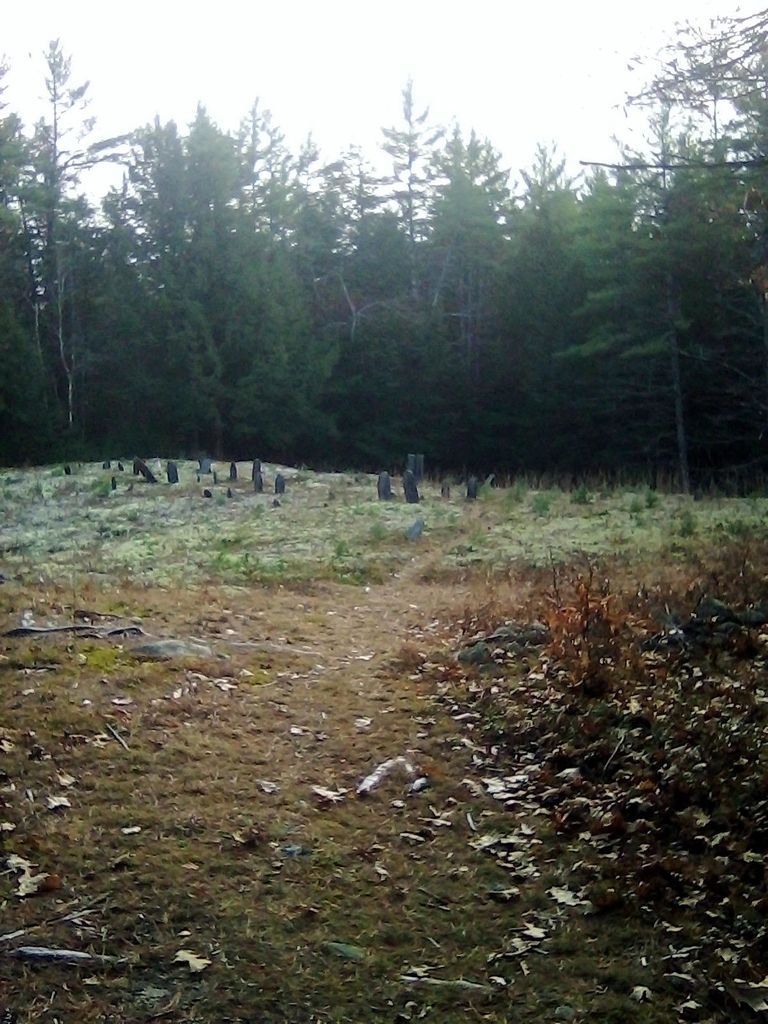
| Memorials | : | 0 |
| Location | : | Royalston, Worcester County, USA |
| Coordinate | : | 42.6848300, -72.2142500 |
| Description | : | This burial place was established in 1764. The earliest engraved stone belongs to Stephen Grant, who died in 1764. The Massachusetts Historical Commission does not refer to this cemetery in MACRIS. This burial place is referenced to in the book "History of the town of Royalston, Massachusetts" on page 457. It reads, in part, "Another of the very early grave yards is the old burying ground located where the first Baptist meeting house was erected; it is sometimes called "the grave yard under the hill." It is nearly two miles from the centre village close by the road... Read More |
frequently asked questions (FAQ):
-
Where is Under the Hill Cemetery?
Under the Hill Cemetery is located at Warwick Road (Route 68) Royalston, Worcester County ,Massachusetts ,USA.
-
Under the Hill Cemetery cemetery's updated grave count on graveviews.com?
0 memorials
-
Where are the coordinates of the Under the Hill Cemetery?
Latitude: 42.6848300
Longitude: -72.2142500
Nearby Cemetories:
1. Bliss Cemetery
Royalston, Worcester County, USA
Coordinate: 42.6945190, -72.2405472
2. Old Centre Cemetery
Royalston, Worcester County, USA
Coordinate: 42.6713982, -72.1889038
3. Hillside Cemetery
Royalston, Worcester County, USA
Coordinate: 42.6726200, -72.1803900
4. Butterworth Cemetery
Royalston, Worcester County, USA
Coordinate: 42.6819300, -72.2539500
5. Maple Cemetery
Royalston, Worcester County, USA
Coordinate: 42.6545520, -72.2235460
6. Boyce Cemetery
Richmond, Cheshire County, USA
Coordinate: 42.7201590, -72.2140600
7. Lawrence Brook Cemetery
Royalston, Worcester County, USA
Coordinate: 42.6693993, -72.1707993
8. Jonas Alliene Cemetery
Royalston, Worcester County, USA
Coordinate: 42.6748790, -72.1656520
9. Gale and Gates Cemetery
Royalston, Worcester County, USA
Coordinate: 42.6920960, -72.2698260
10. Nahum Greene Gravesite
Royalston, Worcester County, USA
Coordinate: 42.6545700, -72.1712900
11. Newton Cemetery
Royalston, Worcester County, USA
Coordinate: 42.7165800, -72.2555600
12. Tully Cemetery
Orange, Franklin County, USA
Coordinate: 42.6398000, -72.2504700
13. Chestnut Hill Cemetery
Athol, Worcester County, USA
Coordinate: 42.6296997, -72.2042007
14. Saint Benedict Center Cemetery
Richmond, Cheshire County, USA
Coordinate: 42.7442040, -72.2214500
15. North Orange Cemetery
Orange, Franklin County, USA
Coordinate: 42.6360230, -72.2690530
16. South Cemetery
Richmond, Cheshire County, USA
Coordinate: 42.7432500, -72.2709600
17. Riverside Cemetery
Royalston, Worcester County, USA
Coordinate: 42.6302986, -72.1453018
18. Pine Grove Cemetery
Fitzwilliam, Cheshire County, USA
Coordinate: 42.7552100, -72.1706500
19. Jones Cemetery
Orange, Franklin County, USA
Coordinate: 42.6148224, -72.2728806
20. Quaker Cemetery
Richmond, Cheshire County, USA
Coordinate: 42.7553500, -72.2722200
21. Silver Lake Cemetery
Athol, Worcester County, USA
Coordinate: 42.6018982, -72.2249985
22. Amadon Toad Hollow Cemetery
Richmond, Cheshire County, USA
Coordinate: 42.7432030, -72.3014670
23. Middletown Cemetery
Richmond, Cheshire County, USA
Coordinate: 42.7619438, -72.2691650
24. Barrus Cemetery
Richmond, Cheshire County, USA
Coordinate: 42.7396000, -72.3133000

