
| Memorials | : | 18 |
| Location | : | Combe Down, Bath and North East Somerset Unitary Authority, England |
| Website | : | www.unionchapelbath.org.uk/wp/about-us/ |
| Coordinate | : | 51.3594751, -2.3443662 |
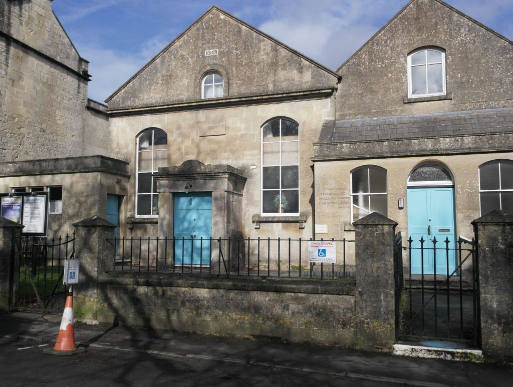
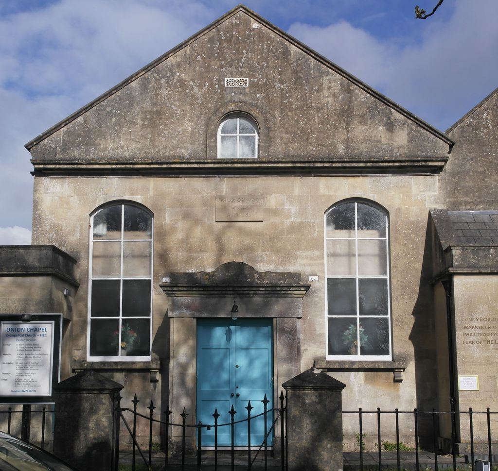
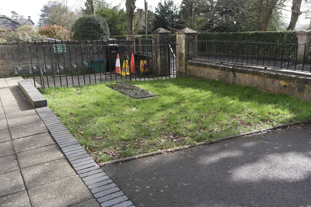
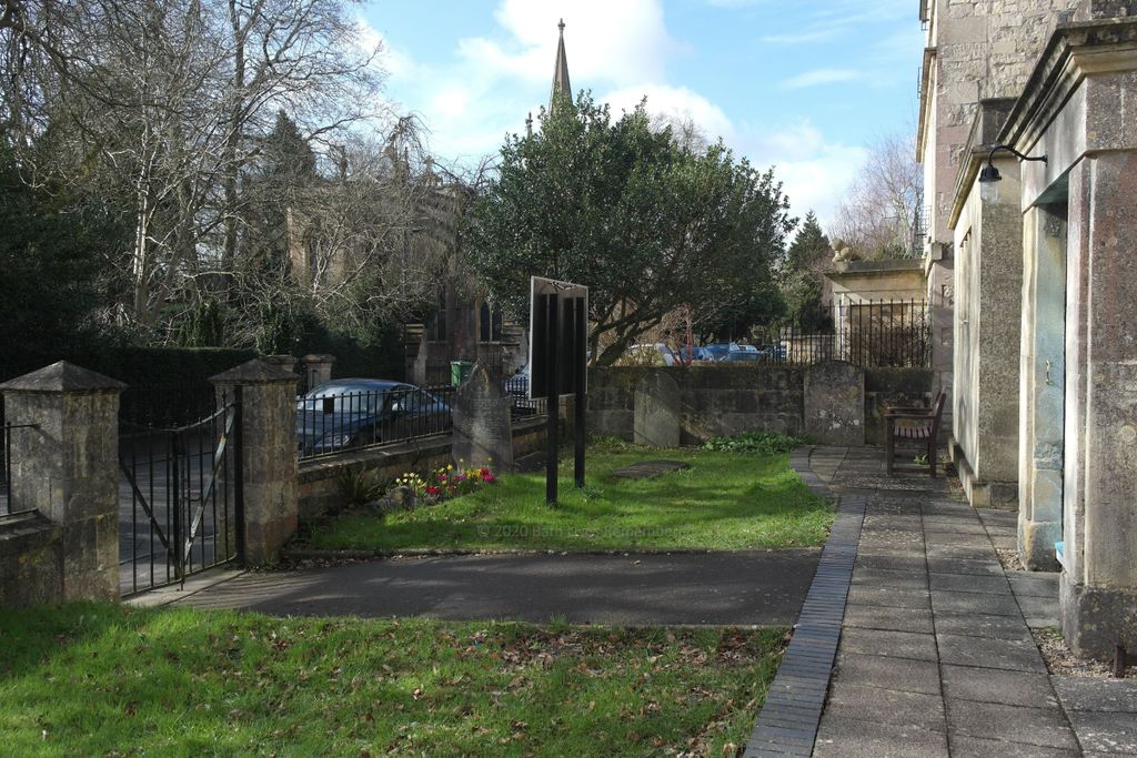
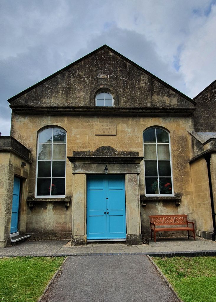
| Description | : | Opened in 1815, Combe Down's Union Chapel remains an active, independent church to the present day. The small burial ground runs in front of and to the side of the original church buildings. A portion is now beneath a church hall (burials protected by building the hall on a platform) and the remainder is grassed over. There were a total of 212 burials in an estimated 124 graves. The earliest burial dates to 1828. The last burial was in 1916. Plot # references are given by Bath Burial Index but it is unclear how these relate to the layout of... Read More |
frequently asked questions (FAQ):
-
Where is Union Chapel?
Union Chapel is located at 101 Church Road, Combe Down, Bath, Somerset Combe Down, Bath and North East Somerset Unitary Authority ,Somerset , BA2 5JJEngland.
-
Union Chapel cemetery's updated grave count on graveviews.com?
18 memorials
-
Where are the coordinates of the Union Chapel?
Latitude: 51.3594751
Longitude: -2.3443662
Nearby Cemetories:
1. Prior Park College
Bath, Bath and North East Somerset Unitary Authority, England
Coordinate: 51.3645990, -2.3442400
2. Jewish Burial Ground
Combe Down, Bath and North East Somerset Unitary Authority, England
Coordinate: 51.3599170, -2.3534670
3. St. Michael's Churchyard
Monkton Combe, Bath and North East Somerset Unitary Authority, England
Coordinate: 51.3559540, -2.3285700
4. St John the Evangelist Cemetery
Bath, Bath and North East Somerset Unitary Authority, England
Coordinate: 51.3696700, -2.3487400
5. Bath Abbey Cemetery
Widcombe, Bath and North East Somerset Unitary Authority, England
Coordinate: 51.3712850, -2.3483060
6. Unitarian Chapel Burial Ground
Widcombe, Bath and North East Somerset Unitary Authority, England
Coordinate: 51.3704650, -2.3539270
7. St Thomas à Becket's Church
Widcombe, Bath and North East Somerset Unitary Authority, England
Coordinate: 51.3734250, -2.3465560
8. Quaker Burial Ground
Widcombe, Bath and North East Somerset Unitary Authority, England
Coordinate: 51.3744350, -2.3498460
9. Smallcombe Vale Cemetery
Bathwick, Bath and North East Somerset Unitary Authority, England
Coordinate: 51.3757400, -2.3429400
10. St. James' Churchyard
South Stoke, Bath and North East Somerset Unitary Authority, England
Coordinate: 51.3497220, -2.3652780
11. St. Mary The Virgin Churchyard
Bathwick, Bath and North East Somerset Unitary Authority, England
Coordinate: 51.3759930, -2.3411930
12. Bath Union Workhouse Graveyard
Bath, Bath and North East Somerset Unitary Authority, England
Coordinate: 51.3584160, -2.3711140
13. Abbey & St James' Graveyard for the Poor
Widcombe, Bath and North East Somerset Unitary Authority, England
Coordinate: 51.3753550, -2.3545640
14. Old Baptist Burial Ground
Walcot, Bath and North East Somerset Unitary Authority, England
Coordinate: 51.3755070, -2.3544360
15. Baptist Burial Ground
Widcombe, Bath and North East Somerset Unitary Authority, England
Coordinate: 51.3764216, -2.3556947
16. Saint Mark's Churchyard
Widcombe, Bath and North East Somerset Unitary Authority, England
Coordinate: 51.3766660, -2.3588010
17. Midford Burial Ground
Bath, Bath and North East Somerset Unitary Authority, England
Coordinate: 51.3394360, -2.3391424
18. Bath Union Workhouse Burial Ground
Bath, Bath and North East Somerset Unitary Authority, England
Coordinate: 51.3570889, -2.3773370
19. St Mary Magdalen Chapel
Widcombe, Bath and North East Somerset Unitary Authority, England
Coordinate: 51.3760486, -2.3643405
20. Old Orchard Street Catholic Burial Vault
Bath, Bath and North East Somerset Unitary Authority, England
Coordinate: 51.3800370, -2.3579910
21. St James Old Burial Ground
Bath, Bath and North East Somerset Unitary Authority, England
Coordinate: 51.3798600, -2.3610100
22. Bath Abbey
Bath, Bath and North East Somerset Unitary Authority, England
Coordinate: 51.3815310, -2.3586640
23. St. Mary de Stall Churchyard (Defunct)
Bath, Bath and North East Somerset Unitary Authority, England
Coordinate: 51.3813350, -2.3600353
24. Quaker Meeting House
Bath, Bath and North East Somerset Unitary Authority, England
Coordinate: 51.3823280, -2.3604380