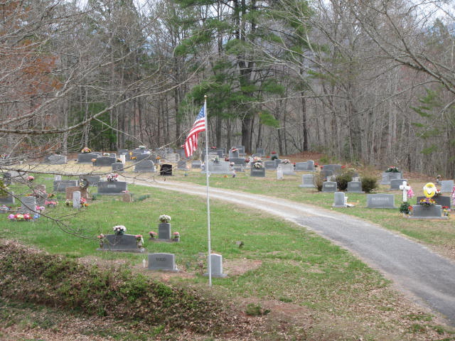
| Memorials | : | 2 |
| Location | : | Fairview, Macon County, USA |
| Coordinate | : | 35.2640200, -83.6481900 |
| Description | : | Directions: From Hardee's in Franklin, North Carolina, take 64E. approximately one mile. Exit right onto the 64W bypass. Stay on this road approximately six to seven miles. Turn right onto Old 64 highway, go past Loafer's Glory gas station, turn left onto Wayah Rd. Follow Wayah Rd. approximately 18 1/2 miles to Nantahala. There will be a gas station (Bateman's) on the left. From Bateman's, go to Windingstairs Rd. Take first road on left, Camp Branch Rd. Follow Camp Branch about two miles to Boga Memory Lane. You will see the Church, when you turn left, take the first gravel... Read More |
frequently asked questions (FAQ):
-
Where is Union Hill Missionary Baptist Church Cemetery?
Union Hill Missionary Baptist Church Cemetery is located at Fairview, Macon County ,North Carolina ,USA.
-
Union Hill Missionary Baptist Church Cemetery cemetery's updated grave count on graveviews.com?
2 memorials
-
Where are the coordinates of the Union Hill Missionary Baptist Church Cemetery?
Latitude: 35.2640200
Longitude: -83.6481900
Nearby Cemetories:
1. Briartown Baptist Church Cemetery
Macon County, USA
Coordinate: 35.2628300, -83.6120600
2. Grant Family Cemetery
Swain County, USA
Coordinate: 35.3055992, -83.6168976
3. Silvermine Missionary Baptist Church Cemetery
Nantahala, Swain County, USA
Coordinate: 35.3144600, -83.6155670
4. Aquone Baptist Church Cemetery
Aquone, Macon County, USA
Coordinate: 35.2094100, -83.6259800
5. Mashburn Cemetery
Nantahala, Swain County, USA
Coordinate: 35.3173050, -83.6073620
6. Red Marble Cemetery
Andrews, Cherokee County, USA
Coordinate: 35.2236300, -83.7304300
7. Wesser Creek Baptist Church Cemetery
Nantahala Township, Swain County, USA
Coordinate: 35.3213997, -83.5727997
8. Phillips-Sherrill Cemetery
Robbinsville, Graham County, USA
Coordinate: 35.2725000, -83.7518000
9. Ledbetter Cemetery
Swain County, USA
Coordinate: 35.3410988, -83.5635986
10. Breedlove Cemetery
Needmore, Swain County, USA
Coordinate: 35.3156013, -83.5366974
11. Euchella Cemetery
Bryson City, Swain County, USA
Coordinate: 35.3452500, -83.5613700
12. Jenkins Cemetery
Stecoah, Graham County, USA
Coordinate: 35.3675003, -83.6860962
13. Grave Gap Cemetery
Bryson City, Swain County, USA
Coordinate: 35.3089440, -83.5248880
14. Wiggins Cemetery
Sweetgum, Graham County, USA
Coordinate: 35.2980995, -83.7774963
15. Cable Cove Cemetery
Fontana Village, Graham County, USA
Coordinate: 35.3750000, -83.6417007
16. Hazie Brown Cemetery
Stecoah, Graham County, USA
Coordinate: 35.3685640, -83.6970100
17. Crisp Family Cemetery
Graham County, USA
Coordinate: 35.3731003, -83.6847000
18. Holloway Cemetery
Graham County, USA
Coordinate: 35.3314018, -83.7596970
19. Edwards Cemetery
Graham County, USA
Coordinate: 35.3755989, -83.6813965
20. Tippet Cemetery
Macon County, USA
Coordinate: 35.2172012, -83.5194016
21. Rice Cemetery
Graham County, USA
Coordinate: 35.3428001, -83.7538986
22. Tellico Cemetery
Franklin, Macon County, USA
Coordinate: 35.2821999, -83.5033035
23. Round Top Cemetery
Almond, Swain County, USA
Coordinate: 35.3764000, -83.5888977
24. Tabor Family Cemetery
Almond, Swain County, USA
Coordinate: 35.3617500, -83.5561080


