
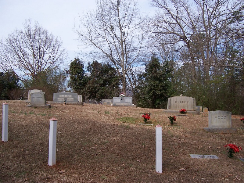
| Memorials | : | 30 |
| Location | : | Union Mills, Rutherford County, USA |
| Coordinate | : | 35.4824350, -81.9440390 |
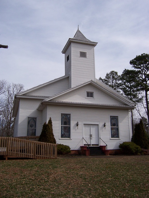
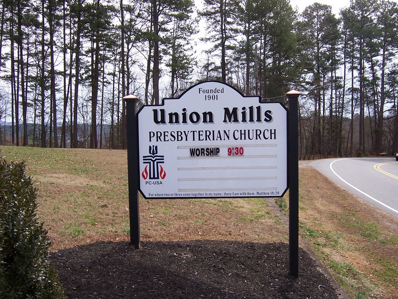
| Description | : | Union Mills Presbyterian Church 2400 Centennial Road Union Mills, NC 28167-9615 |
frequently asked questions (FAQ):
-
Where is Union Mills Presbyterian Church Cemetery?
Union Mills Presbyterian Church Cemetery is located at Union Mills, Rutherford County ,North Carolina ,USA.
-
Union Mills Presbyterian Church Cemetery cemetery's updated grave count on graveviews.com?
30 memorials
-
Where are the coordinates of the Union Mills Presbyterian Church Cemetery?
Latitude: 35.4824350
Longitude: -81.9440390
Nearby Cemetories:
1. Mount Pleasant CME Church Cemetery
Union Mills, Rutherford County, USA
Coordinate: 35.4818800, -81.9592700
2. Union Hill A.M.E. Zion Church Cemetery
Union Mills, Rutherford County, USA
Coordinate: 35.4850770, -81.9671190
3. Pleasant Hill Cemetery
Rutherford County, USA
Coordinate: 35.5022011, -81.9441986
4. Round Hill Baptist Church Cemetery
Union Mills, Rutherford County, USA
Coordinate: 35.4934690, -81.9711200
5. Centennial Cemetery
Rutherford County, USA
Coordinate: 35.4655991, -81.9206009
6. Flack Family Cemetery
Union Mills, Rutherford County, USA
Coordinate: 35.4765400, -81.9784300
7. Grace Tabernacle Cemetery
Union Mills, Rutherford County, USA
Coordinate: 35.4957850, -81.9777540
8. Joseph Baxter Cemetery
Union Mills, Rutherford County, USA
Coordinate: 35.4529650, -81.9594860
9. Liberty Hill Cemetery
Rutherford County, USA
Coordinate: 35.4791985, -81.9847031
10. Piney Ridge C.M.E Cemetery
Rutherfordton, Rutherford County, USA
Coordinate: 35.4467490, -81.9382130
11. Oak Springs Baptist Church Cemetery
Rutherford County, USA
Coordinate: 35.4437990, -81.9396900
12. Old Thermal City Church Cemetery
Thermal City, Rutherford County, USA
Coordinate: 35.5173120, -81.9706250
13. Westminister Baptist Church Cemetery
Rutherfordton, Rutherford County, USA
Coordinate: 35.4647750, -81.8927880
14. Camp Creek Baptist Church Cemetery
Union Mills, Rutherford County, USA
Coordinate: 35.5141983, -81.9039001
15. Little White Country Church Cemetery
Rutherfordton, Rutherford County, USA
Coordinate: 35.4487152, -81.9854279
16. Gilkey United Methodist Church Cemetery
Rutherfordton, Rutherford County, USA
Coordinate: 35.4428110, -81.9773740
17. Gilkey Church of God Cemetery
Rutherfordton, Rutherford County, USA
Coordinate: 35.4424690, -81.9790850
18. Pisgah United Methodist Church Cemetery
Rutherfordton, Rutherford County, USA
Coordinate: 35.4770130, -81.8799750
19. Brittain Cemetery
Rutherfordton, Rutherford County, USA
Coordinate: 35.4530983, -81.8861008
20. Hillsdale Church Cemetery
Rutherfordton, Rutherford County, USA
Coordinate: 35.4849150, -82.0134380
21. Gilboa United Methodist Church Cemetery
Rutherfordton, Rutherford County, USA
Coordinate: 35.4236130, -81.9782150
22. Fork Creek Baptist Church Cemetery
Rutherford County, USA
Coordinate: 35.5249710, -81.8802872
23. Harriett Memorial Freewill Baptist Cemetery
Rutherfordton, Rutherford County, USA
Coordinate: 35.4207573, -81.9770508
24. Fellowship Holiness Cemetery
Rutherfordton, Rutherford County, USA
Coordinate: 35.4140854, -81.9197845