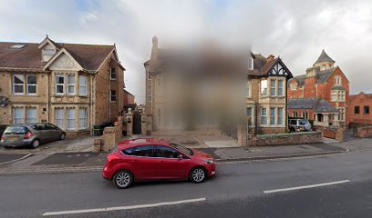
| Memorials | : | 0 |
| Location | : | Taunton, Taunton Deane Borough, England |
| Phone | : | + 44 (0)1823 286776 |
| Website | : | tauntonurc.org.uk/ |
| Coordinate | : | 51.0130240, -3.0997408 |
| Description | : | The United Reformed Church, formerly Paul's Meeting House (SMR 44472), was built in the late 17th century, on the site of a bowling green behind the building which became the County Hotel (Bush, 1977- "The book of Taunton"). It was attacked and badly damaged shortly after opening but reopened in 1689. The burial ground to the rear was in use at least between 1785 and 1860, perhaps earlier. The present building (SMR LB 46128) dates from the late 18th century. (Taken from English Heritage Extensive Urban Survey: An archaeological assessment of Taunton by Clare Gathercole. Published by Somerset County Council,... Read More |
frequently asked questions (FAQ):
-
Where is United Reformed Church?
United Reformed Church is located at 18 Paul St Taunton, Taunton Deane Borough ,Somerset , TA1 3PFEngland.
-
United Reformed Church cemetery's updated grave count on graveviews.com?
0 memorials
-
Where are the coordinates of the United Reformed Church?
Latitude: 51.0130240
Longitude: -3.0997408
Nearby Cemetories:
1. St. George's Roman Catholic Church
Taunton Deane Borough, England
Coordinate: 51.0130135, -3.0986681
2. St. Mary Magdalene Church
Taunton, Taunton Deane Borough, England
Coordinate: 51.0157120, -3.1006450
3. St James Churchyard
Taunton, Taunton Deane Borough, England
Coordinate: 51.0177320, -3.1012480
4. Taunton Prison Cemetery
Taunton, Taunton Deane Borough, England
Coordinate: 51.0119040, -3.1074170
5. Taunton Priory of St Peter and St Paul
Taunton, Taunton Deane Borough, England
Coordinate: 51.0188270, -3.0988810
6. St. George Churchyard
Wilton, Taunton Deane Borough, England
Coordinate: 51.0090900, -3.1069000
7. St James Cemetery
Taunton, Taunton Deane Borough, England
Coordinate: 51.0227000, -3.1136000
8. St Mary's Cemetery
Taunton, Taunton Deane Borough, England
Coordinate: 51.0145110, -3.1208470
9. St. Mary's Old Cemetery
Taunton, Taunton Deane Borough, England
Coordinate: 51.0152400, -3.1212100
10. Taunton Deane Crematorium
Taunton, Taunton Deane Borough, England
Coordinate: 51.0099290, -3.1328370
11. All Saints Churchyard
Trull, Taunton Deane Borough, England
Coordinate: 50.9937770, -3.1180660
12. Ss Peter and Paul Churchyard
Bishops Hull, Taunton Deane Borough, England
Coordinate: 51.0166220, -3.1350170
13. St John the Evangelist Churchyard
Staplegrove, Taunton Deane Borough, England
Coordinate: 51.0318720, -3.1248960
14. St Michael's Churchyard
Orchard Portman, Taunton Deane Borough, England
Coordinate: 50.9893670, -3.0788890
15. Ruishton Church Cemetery
Ruishton, Taunton Deane Borough, England
Coordinate: 51.0204630, -3.0520420
16. St. George Churchyard
Ruishton, Taunton Deane Borough, England
Coordinate: 51.0206300, -3.0511400
17. St Mary Churchyard
Cheddon Fitzpaine, Taunton Deane Borough, England
Coordinate: 51.0426420, -3.0811930
18. All Saints Churchyard
Norton Fitzwarren, Taunton Deane Borough, England
Coordinate: 51.0279030, -3.1468510
19. Stoke St. Mary Churchyard
Stoke St Mary, Taunton Deane Borough, England
Coordinate: 50.9955000, -3.0477000
20. St. Michael's Churchyard
Creech St Michael, Taunton Deane Borough, England
Coordinate: 51.0223660, -3.0355780
21. St. Nicholas's Churchyard
Corfe, Taunton Deane Borough, England
Coordinate: 50.9714590, -3.0947100
22. St Thomas Churchyard
Thurlbear, Taunton Deane Borough, England
Coordinate: 50.9847000, -3.0474100
23. SS Andrew and Mary Churchyard
Pitminster, Taunton Deane Borough, England
Coordinate: 50.9663940, -3.1107440
24. St. Augustine Churchyard
West Monkton, Taunton Deane Borough, England
Coordinate: 51.0507000, -3.0528000

