
| Memorials | : | 0 |
| Location | : | Palmetto, Pickens County, USA |
| Coordinate | : | 33.4791985, -87.9756012 |
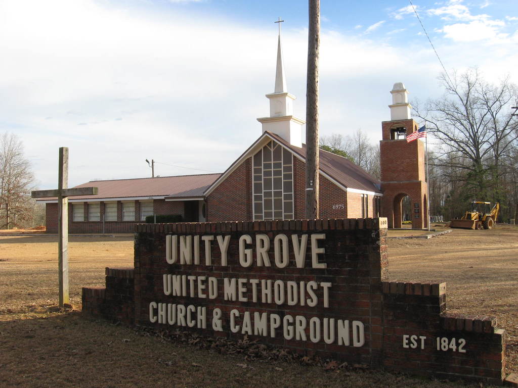
| Description | : | Unity Grove Methodist Church Lower Cemetery is located behind the Unity Grove Methodist Church and east of the Unity Grove Campground. |
frequently asked questions (FAQ):
-
Where is Unity Grove Methodist Church Lower Cemetery?
Unity Grove Methodist Church Lower Cemetery is located at CR 3 (Old Palmetto Road) Palmetto, Pickens County ,Alabama ,USA.
-
Unity Grove Methodist Church Lower Cemetery cemetery's updated grave count on graveviews.com?
0 memorials
-
Where are the coordinates of the Unity Grove Methodist Church Lower Cemetery?
Latitude: 33.4791985
Longitude: -87.9756012
Nearby Cemetories:
1. Unity Grove Methodist Church Upper Cemetery
Palmetto, Pickens County, USA
Coordinate: 33.4813995, -87.9738998
2. Mount Tabor Baptist Church Cemetery
Palmetto, Pickens County, USA
Coordinate: 33.4851600, -87.9787800
3. Old Mount Tabor Cemetery
Palmetto, Pickens County, USA
Coordinate: 33.4920500, -87.9699400
4. Unity Grove CME Church Cemetery
Palmetto, Pickens County, USA
Coordinate: 33.4706000, -87.9948000
5. Old Salem Cemetery
Pickens County, USA
Coordinate: 33.4477997, -87.9794006
6. Hamilton Cemetery
Pickens County, USA
Coordinate: 33.4667015, -88.0180969
7. Dorroh Cemetery
Palmetto, Pickens County, USA
Coordinate: 33.5214005, -87.9882965
8. Bradley Family Cemetery
Pickens County, USA
Coordinate: 33.4761700, -88.0284200
9. Marvin Hill Cemetery
Pickens County, USA
Coordinate: 33.4838982, -87.9180984
10. Wilson Family Cemetery
Bethlehem, Pickens County, USA
Coordinate: 33.4679800, -88.0348100
11. Bridges Cemetery
Pickens County, USA
Coordinate: 33.4979400, -88.0377700
12. McCrary Cemetery
Pickens County, USA
Coordinate: 33.4329000, -88.0116000
13. Wesley Chapel Methodist Church Cemetery
Ashcraft Corner, Fayette County, USA
Coordinate: 33.5292015, -87.9381027
14. Big Hill Cemetery
Pickens County, USA
Coordinate: 33.4738998, -87.9002991
15. Mount Carmel Cemetery
Kennedy, Lamar County, USA
Coordinate: 33.5311012, -88.0218964
16. Thompson Cemetery
Kennedy, Lamar County, USA
Coordinate: 33.5461006, -87.9858017
17. Old Wesley Chapel
Ashcraft Corner, Fayette County, USA
Coordinate: 33.5430984, -87.9460983
18. Phoenix Cemetery
Reform, Pickens County, USA
Coordinate: 33.4768982, -88.0689011
19. Mount Zion Primitive Baptist Church Cemetery
Pickens County, USA
Coordinate: 33.5242004, -87.8992004
20. Bethlehem Church Cemetery
Reform, Pickens County, USA
Coordinate: 33.4756012, -88.0699997
21. Double Branches Cemetery
Pickens County, USA
Coordinate: 33.4277992, -87.9039001
22. Higdon Memorial Cemetery
Kennedy, Lamar County, USA
Coordinate: 33.5572014, -87.9944000
23. Ashcraft Corner Cemetery
Fayette County, USA
Coordinate: 33.5285988, -87.9005966
24. New Hope Methodist Church Cemetery
Reform, Pickens County, USA
Coordinate: 33.4068985, -87.9347000