
| Memorials | : | 2 |
| Location | : | Phelps County, USA |
| Coordinate | : | 38.0511528, -91.8309948 |
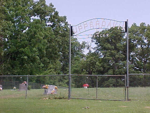
| Description | : | This cemetery is located in Phelps Co, MO, Section 5, Township 38, Range 8. From Rolla, Phelps Co, MO take State Highway E out past the State Highway Patrol Station [on/a 7-8 miles] Turn on Highway A and go abt 1 mile. Turn on Road 8420 and go abt 3/4 to 1 mile. There will be a Mailbox and Double Gate. Drive through Double Gate. There will be a fence around the Cemetery. There will also be a sign on the Fence which says "Davis/Spencer" |
frequently asked questions (FAQ):
-
Where is Upper Davis Cemetery?
Upper Davis Cemetery is located at Phelps County ,Missouri ,USA.
-
Upper Davis Cemetery cemetery's updated grave count on graveviews.com?
2 memorials
-
Where are the coordinates of the Upper Davis Cemetery?
Latitude: 38.0511528
Longitude: -91.8309948
Nearby Cemetories:
1. Miller Cemetery
Phelps County, USA
Coordinate: 38.0461006, -91.8208008
2. Ballance Cemetery
Maries County, USA
Coordinate: 38.0508748, -91.8490509
3. Davis Church Cemetery
Maries County, USA
Coordinate: 38.0668983, -91.8349991
4. Wynn-Maxwell Cemetery
Miller Township, Phelps County, USA
Coordinate: 38.0325012, -91.8308029
5. Maxwell Cemetery
Phelps County, USA
Coordinate: 38.0329530, -91.8536970
6. Hodge Cemetery
Maries County, USA
Coordinate: 38.0863991, -91.8302994
7. Honse Cemetery
Maries County, USA
Coordinate: 38.0661011, -91.8778000
8. Dyer Cemetery
Rolla, Phelps County, USA
Coordinate: 38.0074960, -91.8108300
9. Riley Cemetery
Maries County, USA
Coordinate: 38.0699997, -91.7743988
10. Hazzard Farm Burials
Rolla, Phelps County, USA
Coordinate: 38.0017300, -91.8442980
11. Macedonia Cemetery
Rolla, Phelps County, USA
Coordinate: 38.0320400, -91.7699900
12. Brainard Cemetery
Phelps County, USA
Coordinate: 37.9991989, -91.8227997
13. Davis Cemetery
Maries County, USA
Coordinate: 38.0685997, -91.9021988
14. Prewett Cemetery
Phelps County, USA
Coordinate: 38.0302700, -91.9019300
15. Camp Creek Cemetery
Phelps County, USA
Coordinate: 37.9986000, -91.8685989
16. Ames Cemetery
Rolla, Phelps County, USA
Coordinate: 37.9884100, -91.8382100
17. Goggins Cemetery
Phelps County, USA
Coordinate: 37.9883003, -91.7936020
18. Ray Cemetery
Phelps County, USA
Coordinate: 37.9886400, -91.7917200
19. Tennyson Cemetery
Maries County, USA
Coordinate: 38.1232986, -91.8482971
20. Light Cemetery
Phelps County, USA
Coordinate: 37.9880981, -91.7818985
21. Sharp Family Cemetery
Vichy, Maries County, USA
Coordinate: 38.1261680, -91.8589640
22. Granny Baker Cemetery
Phelps County, USA
Coordinate: 38.0224700, -91.9302500
23. Wentzel Cemetery
Vichy, Maries County, USA
Coordinate: 38.0964012, -91.7407990
24. Wiese Cemetery
Rolla, Phelps County, USA
Coordinate: 37.9674988, -91.8116989