
| Memorials | : | 0 |
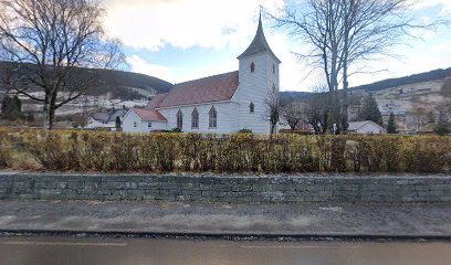
| Location | : | Utvik, Stryn kommune, Norway |
| Coordinate | : | 61.8068200, 6.5201100 |
frequently asked questions (FAQ):
-
Where is Utvik Evangelical Lutheran Church Cemetery?
Utvik Evangelical Lutheran Church Cemetery is located at 210 Rv60 Utvik, Stryn kommune ,Sogn og Fjordane fylke ,Norway.
-
Utvik Evangelical Lutheran Church Cemetery cemetery's updated grave count on graveviews.com?
0 memorials
-
Where are the coordinates of the Utvik Evangelical Lutheran Church Cemetery?
Latitude: 61.8068200
Longitude: 6.5201100
Nearby Cemetories:
1. Innvik Cemetery
Innvik, Stryn kommune, Norway
Coordinate: 61.8538537, 6.6174050
2. Breim
Gloppen kommune, Norway
Coordinate: 61.7336647, 6.4077359
3. Olden Gamle Kyrkje
Stryn, Stryn kommune, Norway
Coordinate: 61.8340000, 6.8046820
4. Olden nye kyrkje
Innvik, Stryn kommune, Norway
Coordinate: 61.8261066, 6.8085692
5. Fredly Cemetery
Sandane, Gloppen kommune, Norway
Coordinate: 61.7664730, 6.1950580
6. Loen kyrkje
Stryn kommune, Norway
Coordinate: 61.8715324, 6.8576627
7. Vereide Kirke Cemetery
Gloppen kommune, Norway
Coordinate: 61.8080150, 6.1416310
8. Gimmestad Cemetery
Gloppen, Gloppen kommune, Norway
Coordinate: 61.7721843, 6.1442135
9. Austefjord Cemetery
Volda kommune, Norway
Coordinate: 62.0616528, 6.3252816
10. Oppstryn Cemetery
Stryn, Stryn kommune, Norway
Coordinate: 61.9098800, 7.0546000
11. Eid
Nordfjordeid, Eid kommune, Norway
Coordinate: 61.9113170, 5.9848230
12. Bjørke
Bjorke, Ørsta kommune, Norway
Coordinate: 62.1070530, 6.5564190
13. Kilsfjord Cemetery
Straumshamn, Volda kommune, Norway
Coordinate: 62.0646805, 6.0658150
14. Stårheim Cemetery
Eid kommune, Norway
Coordinate: 61.9187935, 5.7656247
15. Aalfoten Cemetery
Alfoten, Bremanger kommune, Norway
Coordinate: 61.8383500, 5.6764100
16. Leirshaugen
Volda kommune, Norway
Coordinate: 62.1455498, 6.0669422
17. Hjørundfjord
Orsta, Ørsta kommune, Norway
Coordinate: 62.2096960, 6.4736210
18. Jostedal Cemetery
Gaupne, Luster kommune, Norway
Coordinate: 61.5874930, 7.2828630
19. Ørsta kyrkje cemetery
Orsta, Ørsta kommune, Norway
Coordinate: 62.2003030, 6.1300280
20. Geiranger Church Cemetery
Stranda kommune, Norway
Coordinate: 62.0988477, 7.2071905
21. Syvde Cemetery
Syvdsbotn, Vanylven kommune, Norway
Coordinate: 62.0909174, 5.7445242
22. Davik Kyrkje
Davik, Bremanger kommune, Norway
Coordinate: 61.8922340, 5.5339340
23. Naustdal Cemetery
Naustdal i Sunnfjord, Naustdal kommune, Norway
Coordinate: 61.5089140, 5.7161610
24. Rovde Churchyard
Rovde, Vanylven kommune, Norway
Coordinate: 62.1760650, 5.7398690