| Memorials | : | 0 |
| Location | : | Sharon, Walworth County, USA |
| Coordinate | : | 42.5296570, -88.6728190 |
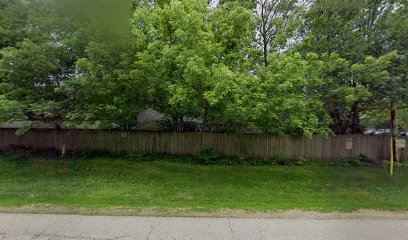
| Description | : | The Valley of the Kings Sanctuary and Retreat has a burial ground for large exotic animals who lived and died there. Human family members will also be memorialized there. |
frequently asked questions (FAQ):
-
Where is Valley of the Kings Sanctuary Burial Ground?
Valley of the Kings Sanctuary Burial Ground is located at W7593 Town Hall Road Sharon, Walworth County ,Wisconsin , 53585USA.
-
Valley of the Kings Sanctuary Burial Ground cemetery's updated grave count on graveviews.com?
0 memorials
-
Where are the coordinates of the Valley of the Kings Sanctuary Burial Ground?
Latitude: 42.5296570
Longitude: -88.6728190
Nearby Cemetories:
1. Brick Church Cemetery
Walworth, Walworth County, USA
Coordinate: 42.5452995, -88.6389008
2. Oakwood Cemetery
Sharon, Walworth County, USA
Coordinate: 42.5233002, -88.7313995
3. North Sharon Cemetery
Sharon, Walworth County, USA
Coordinate: 42.5517006, -88.7268982
4. South Grove Cemetery
Sharon, Walworth County, USA
Coordinate: 42.5331001, -88.7466965
5. Walworth Cemetery
Walworth, Walworth County, USA
Coordinate: 42.5297394, -88.5881577
6. Big Foot Cemetery
Harvard, McHenry County, USA
Coordinate: 42.4920500, -88.5988200
7. Burr Oak Cemetery
Boone County, USA
Coordinate: 42.4660400, -88.7200700
8. Darien Cemetery
Darien, Walworth County, USA
Coordinate: 42.6055000, -88.7173200
9. Cobblestone Cemetery
Walworth, Walworth County, USA
Coordinate: 42.5236015, -88.5597000
10. Saint Catherine Cemetery
Clinton, Rock County, USA
Coordinate: 42.5303001, -88.7866974
11. Mount Philip Cemetery
Clinton, Rock County, USA
Coordinate: 42.5819016, -88.7857971
12. Lawrence Cemetery
Lawrence, McHenry County, USA
Coordinate: 42.4316500, -88.6473500
13. Dullam Cemetery
Capron, Boone County, USA
Coordinate: 42.4361000, -88.7253036
14. Summerville Cemetery
Clinton, Rock County, USA
Coordinate: 42.5713530, -88.8007520
15. United Church Of Christ Columbarium
Delavan, Walworth County, USA
Coordinate: 42.6312300, -88.6476000
16. Blooming Prairie Cemetery
Darien, Walworth County, USA
Coordinate: 42.6321220, -88.7081760
17. Christ Episcopal Church Columbarium
Delavan, Walworth County, USA
Coordinate: 42.6335000, -88.6418000
18. East Delavan Union Cemetery
Delavan, Walworth County, USA
Coordinate: 42.5980300, -88.5606000
19. Old Settlers Cemetery
Delavan, Walworth County, USA
Coordinate: 42.6350000, -88.6448200
20. Stone School Cemetery
Boone County, USA
Coordinate: 42.4782982, -88.8035965
21. Spring Grove Cemetery
Delavan, Walworth County, USA
Coordinate: 42.6375000, -88.6393000
22. Delavan Memorial Arboretum
Delavan, Walworth County, USA
Coordinate: 42.6388000, -88.6476500
23. Chemung Cemetery
Chemung, McHenry County, USA
Coordinate: 42.4188957, -88.6634445
24. Saint Andrews Cemetery
Delavan, Walworth County, USA
Coordinate: 42.6399000, -88.6364400

