
| Memorials | : | 5 |
| Location | : | Andrews, Cherokee County, USA |
| Coordinate | : | 35.1918983, -83.8371964 |
| Description | : | Right off Fairview Road. Pierce Drive turns into Balsam Lane. |
frequently asked questions (FAQ):
-
Where is Valley River Cemetery?
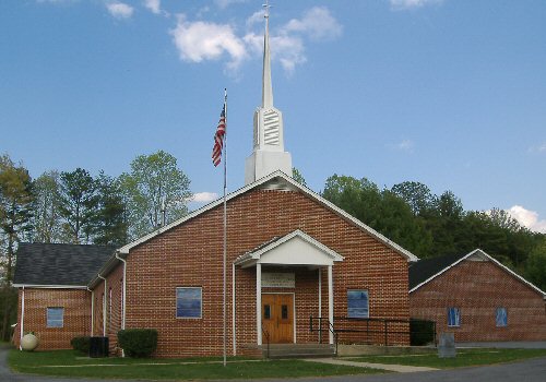
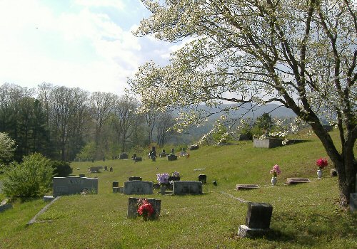
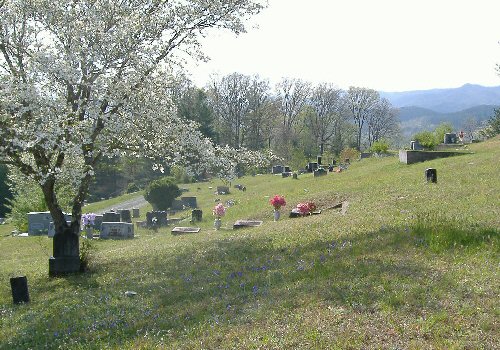
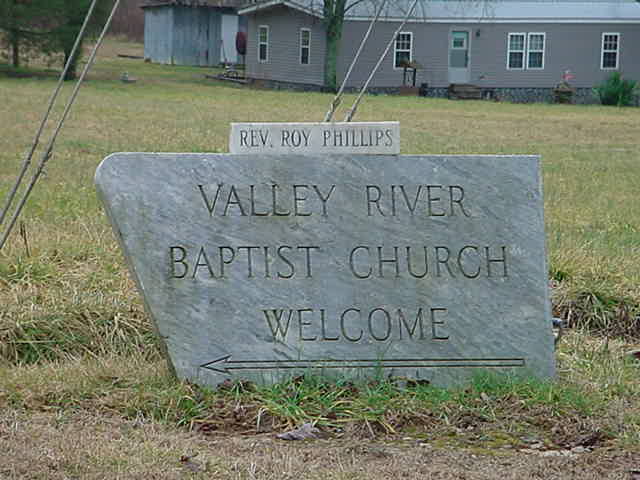
Valley River Cemetery is located at 65 Balsam Lane Andrews, Cherokee County ,North Carolina , 28901USA.
-
Valley River Cemetery cemetery's updated grave count on graveviews.com?
5 memorials
-
Where are the coordinates of the Valley River Cemetery?
Latitude: 35.1918983
Longitude: -83.8371964
Nearby Cemetories:
1. Valleytown Cemetery
Andrews, Cherokee County, USA
Coordinate: 35.1994019, -83.8082962
2. Willis Parker Family Cemetery
Cherokee County, USA
Coordinate: 35.1788457, -83.8971106
3. Parker Family Cemetery
Marble, Cherokee County, USA
Coordinate: 35.1791992, -83.8974991
4. Welch-Blythe Cemetery
Marble, Cherokee County, USA
Coordinate: 35.1818540, -83.9073300
5. Moss Cemetery
Marble, Cherokee County, USA
Coordinate: 35.1819000, -83.9131012
6. Vengeance Creek Memorial Garden
Marble, Cherokee County, USA
Coordinate: 35.1500280, -83.9018450
7. Wiggins Family Cemetery
Marble, Cherokee County, USA
Coordinate: 35.1552800, -83.9135100
8. Mount Zion Baptist Church Cemetery
Marble, Cherokee County, USA
Coordinate: 35.1403820, -83.9260420
9. Little Snowbird Baptist Church Cemetery
Graham County, USA
Coordinate: 35.2761580, -83.8748810
10. Red Marble Cemetery
Andrews, Cherokee County, USA
Coordinate: 35.2236300, -83.7304300
11. Maltby Baptist Church Cemetery
Marble, Cherokee County, USA
Coordinate: 35.1591570, -83.9503130
12. Rowland Hill Missionary Baptist Church Cemetery
Marble, Cherokee County, USA
Coordinate: 35.1336830, -83.9402840
13. Metz Cemetery
Graham County, USA
Coordinate: 35.2976800, -83.8301800
14. Phillips-Sherrill Cemetery
Robbinsville, Graham County, USA
Coordinate: 35.2725000, -83.7518000
15. Zion Hill Church Cemetery
Robbinsville, Graham County, USA
Coordinate: 35.3037000, -83.8741000
16. Atoah
Robbinsville, Graham County, USA
Coordinate: 35.3081434, -83.8271224
17. Wiggins Cemetery
Sweetgum, Graham County, USA
Coordinate: 35.2980995, -83.7774963
18. Fires Creek Cemetery
Hayesville, Clay County, USA
Coordinate: 35.0746994, -83.8739014
19. Moss Memorial Baptist Church Cemetery
Hayesville, Clay County, USA
Coordinate: 35.0824040, -83.7617970
20. Buffalo Baptist Church Cemetery
Robbinsville, Graham County, USA
Coordinate: 35.3176410, -83.8394650
21. Meadow Grove Baptist Cemetery
Hayesville, Clay County, USA
Coordinate: 35.0655760, -83.8150200
22. Peachtree Memorial Baptist Church Cemetery
Murphy, Cherokee County, USA
Coordinate: 35.0935100, -83.9412000
23. Junaluska Memorial Cemetery
Robbinsville, Graham County, USA
Coordinate: 35.3200430, -83.8086040
24. Shiloh Baptist Church Cemetery
Hayesville, Clay County, USA
Coordinate: 35.0664450, -83.7932750