
| Memorials | : | 0 |
| Location | : | Chestnut Mound, Smith County, USA |
| Coordinate | : | 36.1912117, -85.8514404 |
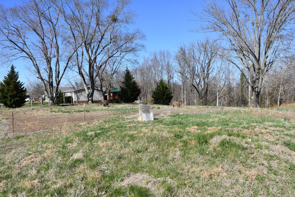
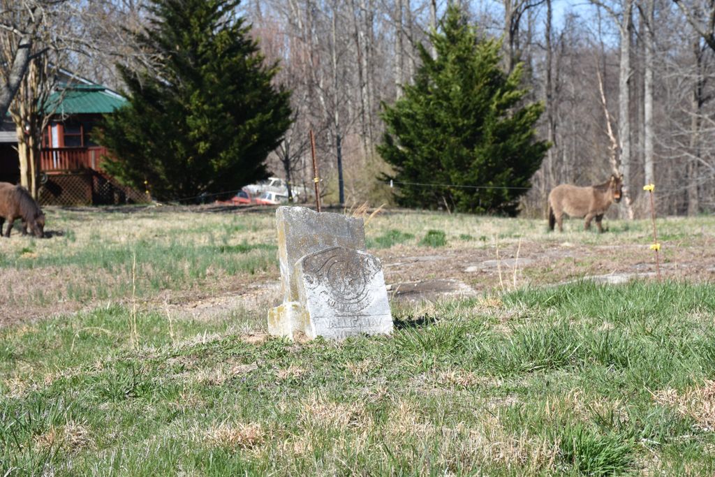
| Description | : | The gravesite of Vallie May Harris sits along Pea Ridge Road between Stonewall and Chestnut Mound. Reported to be other graves that are unmarked here. |
frequently asked questions (FAQ):
-
Where is Vallie May Harris Gravesite?
Vallie May Harris Gravesite is located at Chestnut Mound, Smith County ,Tennessee ,USA.
-
Vallie May Harris Gravesite cemetery's updated grave count on graveviews.com?
0 memorials
-
Where are the coordinates of the Vallie May Harris Gravesite?
Latitude: 36.1912117
Longitude: -85.8514404
Nearby Cemetories:
1. Maxwell Family Cemetery
Chestnut Mound, Smith County, USA
Coordinate: 36.1893140, -85.8460180
2. New Macedonia Missionary Baptist Church Cemetery
Chestnut Mound, Smith County, USA
Coordinate: 36.1886940, -85.8458910
3. Durham Family Cemetery
Chestnut Mound, Smith County, USA
Coordinate: 36.1976800, -85.8534600
4. Wade Family Cemetery
Chestnut Mound, Smith County, USA
Coordinate: 36.1966940, -85.8572580
5. Henderson Petty Cemetery
Chestnut Mound, Smith County, USA
Coordinate: 36.1849960, -85.8414390
6. McKinney Cemetery
Chestnut Mound, Smith County, USA
Coordinate: 36.1971530, -85.8630140
7. Winfrey Cemetery
Chestnut Mound, Smith County, USA
Coordinate: 36.2025800, -85.8360600
8. Gillihan Family Cemetery
Smith County, USA
Coordinate: 36.1778780, -85.8386280
9. Brown Cemetery
Chestnut Mound, Smith County, USA
Coordinate: 36.2025300, -85.8358900
10. Vaden Cemetery
Chestnut Mound, Smith County, USA
Coordinate: 36.2096020, -85.8484130
11. Fitzpatrick Cemetery
Chestnut Mound, Smith County, USA
Coordinate: 36.1855300, -85.8287710
12. High Cemetery
Chestnut Mound, Smith County, USA
Coordinate: 36.2097800, -85.8452900
13. Boze Cemetery
Smith County, USA
Coordinate: 36.2106190, -85.8580630
14. Old Church Cemetery
Chestnut Mound, Smith County, USA
Coordinate: 36.2041660, -85.8314390
15. Dillard Cemetery
Chestnut Mound, Smith County, USA
Coordinate: 36.1710440, -85.8426940
16. Farmer Cemetery
Elmwood, Smith County, USA
Coordinate: 36.2112120, -85.8623600
17. Gross Cemetery
Chestnut Mound, Smith County, USA
Coordinate: 36.2084380, -85.8332100
18. Farmer Cemetery
Chestnut Mound, Smith County, USA
Coordinate: 36.2040620, -85.8745800
19. Wyatt Cemetery
Chestnut Mound, Smith County, USA
Coordinate: 36.2036920, -85.8258930
20. Bellar Cemetery
Club Springs, Smith County, USA
Coordinate: 36.1671690, -85.8630310
21. Fitzpatrick Cemetery
Smith County, USA
Coordinate: 36.1827060, -85.8201630
22. Chestnut Mound United Methodist Church Cemetery
Chestnut Mound, Smith County, USA
Coordinate: 36.2034210, -85.8220200
23. Knight Cemetery
Chestnut Mound, Smith County, USA
Coordinate: 36.2053080, -85.8222990
24. McKinney Cemetery
Chestnut Mound, Smith County, USA
Coordinate: 36.2166800, -85.8378000