| Memorials | : | 0 |
| Location | : | Belvue, Pottawatomie County, USA |
| Coordinate | : | 39.2563690, -96.2507860 |
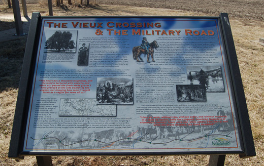
| Description | : | The graves of 7 presumably U.S. Soldiers were placed under a large Elm tree on the west bank of the Red Vermillion Creek (or River). This location was a natural ford on the Fort Leavenworth - Fort Riley Road and Oregon Trail. Later, a bridge and/or a ferry was located here which was operated by Louis Vieux. Modern stone markers have been placed to remember these unknown soldiers. The large Elm tree, estimated to be a sapling in 1716, was declared to be a Kansas Champion in 1978, and the U.S. Champion in 1979. It was subsequently... Read More |
frequently asked questions (FAQ):
-
Where is Vieux Crossing Cemetery?
Vieux Crossing Cemetery is located at 19960 Oregon Trail Road Belvue, Pottawatomie County ,Kansas , 66407USA.
-
Vieux Crossing Cemetery cemetery's updated grave count on graveviews.com?
0 memorials
-
Where are the coordinates of the Vieux Crossing Cemetery?
Latitude: 39.2563690
Longitude: -96.2507860
Nearby Cemetories:
1. Cholera Cemetery
Louisville, Pottawatomie County, USA
Coordinate: 39.2560340, -96.2487960
2. Vieux Cemetery
Louisville, Pottawatomie County, USA
Coordinate: 39.2560997, -96.2466965
3. Polly Creek Cemetery
Pottawatomie County, USA
Coordinate: 39.2742004, -96.2307968
4. Line Cemetery
Louisville, Pottawatomie County, USA
Coordinate: 39.2825012, -96.2544022
5. Louisville Cemetery
Louisville, Pottawatomie County, USA
Coordinate: 39.2602997, -96.3086014
6. Belvue Cemetery
Belvue, Pottawatomie County, USA
Coordinate: 39.2238998, -96.1943970
7. Saint Bernard Cemetery
Wamego, Pottawatomie County, USA
Coordinate: 39.2210999, -96.3069000
8. Pleasant Hill Cemetery
Louisville, Pottawatomie County, USA
Coordinate: 39.3119000, -96.2900000
9. Wamego City Cemetery
Wamego, Pottawatomie County, USA
Coordinate: 39.2058400, -96.3149100
10. Immanuel United Church of Christ Cemetery
Newbury, Wabaunsee County, USA
Coordinate: 39.1746700, -96.2224300
11. Old County Farm Cemetery
Louisville, Pottawatomie County, USA
Coordinate: 39.2957993, -96.3516998
12. Saint John Lutheran Cemetery
Paxico, Wabaunsee County, USA
Coordinate: 39.1595870, -96.2230550
13. Laclede Cemetery
Laclede, Pottawatomie County, USA
Coordinate: 39.3544006, -96.2205963
14. Oak Grove Cemetery
Wheaton, Pottawatomie County, USA
Coordinate: 39.3553100, -96.2965200
15. Greenwood Cemetery
Kaw Township, Wabaunsee County, USA
Coordinate: 39.1819000, -96.1541977
16. Wabaunsee Cemetery
Wabaunsee, Wabaunsee County, USA
Coordinate: 39.1514015, -96.3253021
17. Saint George Cemetery
Saint George, Pottawatomie County, USA
Coordinate: 39.2022018, -96.4152985
18. Valley View Cemetery
Saint Marys, Pottawatomie County, USA
Coordinate: 39.2052994, -96.0721970
19. Saint Joseph Catholic Cemetery
Flush, Pottawatomie County, USA
Coordinate: 39.2947000, -96.4406700
20. Our Lady of Peace Cemetery
Saint Marys, Pottawatomie County, USA
Coordinate: 39.2024600, -96.0634300
21. Holy Cross Cemetery
Emmett, Pottawatomie County, USA
Coordinate: 39.2743988, -96.0466995
22. Saint Mary's College Assumption Chapel Relic Altar
Saint Marys, Pottawatomie County, USA
Coordinate: 39.1919000, -96.0606400
23. Mount Calvary Cemetery
Saint Marys, Pottawatomie County, USA
Coordinate: 39.2019615, -96.0457001
24. Fox Cemetery
Wheaton, Pottawatomie County, USA
Coordinate: 39.4204900, -96.3231800

