
| Memorials | : | 35 |
| Location | : | Oconto, Custer County, USA |
| Coordinate | : | 41.0697980, -99.7036750 |
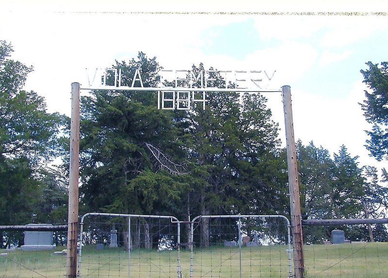
| Description | : | Directions to Viola Cemetery, starting from the intersection of state highway 40 and state highway 21 at Oconto, Custer County, Nebraska. Travel 5.5 miles southeast on highway 40, turn west (right) at the Viola Cemetery sign and travel 0.6 miles, then turn south (left) and travel 0.6 miles to Viola Cemetery. Viola Cemetery is located in SW 1/4 NW 1/4 S26-T13N-R21W |
frequently asked questions (FAQ):
-
Where is Viola Cemetery?
Viola Cemetery is located at Oconto, Custer County ,Nebraska ,USA.
-
Viola Cemetery cemetery's updated grave count on graveviews.com?
34 memorials
-
Where are the coordinates of the Viola Cemetery?
Latitude: 41.0697980
Longitude: -99.7036750
Nearby Cemetories:
1. Saint Mary Cemetery
Oconto, Custer County, USA
Coordinate: 41.1478004, -99.7639008
2. Oconto Cemetery
Oconto, Custer County, USA
Coordinate: 41.1477000, -99.7802000
3. Buffalo First Lutheran Cemetery New
Buffalo, Dawson County, USA
Coordinate: 41.0127000, -99.8150000
4. Buffalo First Lutheran Cemetery Old
Buffalo, Dawson County, USA
Coordinate: 41.0100000, -99.8152000
5. Christ Lutheran Cemetery
Oconto, Custer County, USA
Coordinate: 41.0759000, -99.8560000
6. Saint Patricks Cemetery
Eddyville, Dawson County, USA
Coordinate: 40.9747009, -99.6093979
7. Park Valley Cemetery
Sumner, Dawson County, USA
Coordinate: 41.0317001, -99.5436020
8. Rose Hill Cemetery
Dawson County, USA
Coordinate: 40.9888992, -99.8442001
9. Jewell Cemetery
Sumner, Dawson County, USA
Coordinate: 40.9599991, -99.5646973
10. Box Elder Cemetery
Custer County, USA
Coordinate: 41.1241989, -99.4918976
11. Riverside Cemetery
Custer County, USA
Coordinate: 41.2447014, -99.7581024
12. Lodi Cemetery
Custer County, USA
Coordinate: 41.2196999, -99.8497009
13. Hillside Cemetery
Dawson County, USA
Coordinate: 40.8946991, -99.7869034
14. Sumner Cemetery
Sumner, Dawson County, USA
Coordinate: 40.9608002, -99.5018997
15. Rhinehart Cemetery
Cozad, Dawson County, USA
Coordinate: 40.9599000, -99.9105000
16. Saint Johns Lutheran Cemetery
Lexington, Dawson County, USA
Coordinate: 40.9019012, -99.8458023
17. Cottonwood Cemetery
Dawson County, USA
Coordinate: 40.9322014, -99.9197006
18. Pleasant Valley Cemetery
Oconto, Custer County, USA
Coordinate: 41.0895000, -99.9890000
19. Hewitt Cemetery
Lexington, Dawson County, USA
Coordinate: 40.8588982, -99.7769012
20. Buffalo Grove Presbyterian Church Cemetery
Buffalo, Dawson County, USA
Coordinate: 40.8721000, -99.8270000
21. Walnut Grove Cemetery
Cozad, Dawson County, USA
Coordinate: 40.9763985, -99.9944000
22. Mount Hope Cemetery
Dawson County, USA
Coordinate: 40.8293991, -99.6733017
23. Grace Cemetery
Cozad, Dawson County, USA
Coordinate: 40.8602982, -99.8644028
24. Block Cemetery
Cozad, Dawson County, USA
Coordinate: 40.9753000, -100.0085000