
| Memorials | : | 0 |
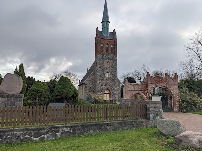
| Location | : | Volschow, Landkreis Mecklenburgische Seenplatte, Germany |
| Coordinate | : | 53.8767764, 13.3379600 |
frequently asked questions (FAQ):
-
Where is Völschow?
Völschow is located at Dr. Georg-Kohnert-Str. 5, Jarmen Volschow, Landkreis Mecklenburgische Seenplatte ,Mecklenburg-Vorpommern , 17126Germany.
-
Völschow cemetery's updated grave count on graveviews.com?
0 memorials
-
Where are the coordinates of the Völschow?
Latitude: 53.8767764
Longitude: 13.3379600
Nearby Cemetories:
1. Friedhof Kagenow
Neetzow, Landkreis Vorpommern-Greifswald, Germany
Coordinate: 53.9006008, 13.4139086
2. Tutow Dorf Friedhof
Tutow, Landkreis Vorpommern-Greifswald, Germany
Coordinate: 53.9131580, 13.2401562
3. Pennewiesen bei Priemen
Landkreis Vorpommern-Greifswald, Germany
Coordinate: 53.9097310, 13.4519000
4. Buchar
Buchar, Landkreis Mecklenburgische Seenplatte, Germany
Coordinate: 53.7252810, 13.2233591
5. Friedhof Grapzow
Grapzow, Landkreis Mecklenburgische Seenplatte, Germany
Coordinate: 53.7109754, 13.2898857
6. Evangelischer Friedhof Demmin
Demmin, Landkreis Mecklenburgische Seenplatte, Germany
Coordinate: 53.9043445, 13.0554326
7. Jüdischer Friedhof Demmin
Demmin, Landkreis Mecklenburgische Seenplatte, Germany
Coordinate: 53.9029179, 13.0502032
8. Friedhof Karlsburg
Karlsburg, Landkreis Vorpommern-Greifswald, Germany
Coordinate: 53.9672769, 13.6156059
9. Friedhof Wrangelsburg
Wrangelsburg, Landkreis Vorpommern-Greifswald, Germany
Coordinate: 54.0158640, 13.5948670
10. Jüdischer Friedhof Anklam
Anklam, Landkreis Vorpommern-Greifswald, Germany
Coordinate: 53.8554800, 13.6881600
11. Saint Joseph Catholic Church (Katholische Kirche)
Greifswald, Landkreis Vorpommern-Greifswald, Germany
Coordinate: 54.0929776, 13.3754894
12. Dom St Nikolai
Greifswald, Landkreis Vorpommern-Greifswald, Germany
Coordinate: 54.0954365, 13.3774535
13. Kloster Eldena
Eldena, Landkreis Vorpommern-Greifswald, Germany
Coordinate: 54.0891600, 13.4522800
14. Gruft zu Wusseken
Wusseken, Landkreis Vorpommern-Greifswald, Germany
Coordinate: 53.7564820, 13.6595990
15. Alter Friedhof
Neuenkirchen, Landkreis Vorpommern-Greifswald, Germany
Coordinate: 54.1186957, 13.3758868
16. Friedhof Friedland
Friedland, Landkreis Mecklenburgische Seenplatte, Germany
Coordinate: 53.6705255, 13.5625755
17. Kirchhof Levin
Levin, Landkreis Mecklenburgische Seenplatte, Germany
Coordinate: 53.8999446, 12.8906057
18. Wusterhusen
Wusterhusen, Landkreis Vorpommern-Greifswald, Germany
Coordinate: 54.1116809, 13.6176269
19. Jüdischer Friedhof Dargun
Dargun, Landkreis Mecklenburgische Seenplatte, Germany
Coordinate: 53.9079985, 12.8264600
20. Friedhof Lubmin
Lubmin, Landkreis Vorpommern-Greifswald, Germany
Coordinate: 54.1353289, 13.6259037
21. Friedhof Stavenhagen
Reuterstadt Stavenhagen, Landkreis Mecklenburgische Seenplatte, Germany
Coordinate: 53.6944255, 12.9036642
22. Jüdischer Friedhof Neukalen
Neukalen, Landkreis Mecklenburgische Seenplatte, Germany
Coordinate: 53.8304200, 12.8093100
23. Neuer Friedhof
Neubrandenburg, Landkreis Mecklenburgische Seenplatte, Germany
Coordinate: 53.5569643, 13.2838280
24. Dorfkirche Jürgenstorf
Jürgenshof, Landkreis Mecklenburgische Seenplatte, Germany
Coordinate: 53.6598460, 12.9049359