
| Memorials | : | 0 |
| Location | : | Kviteseid, Kviteseid kommune, Norway |
| Coordinate | : | 59.3214770, 8.4518020 |
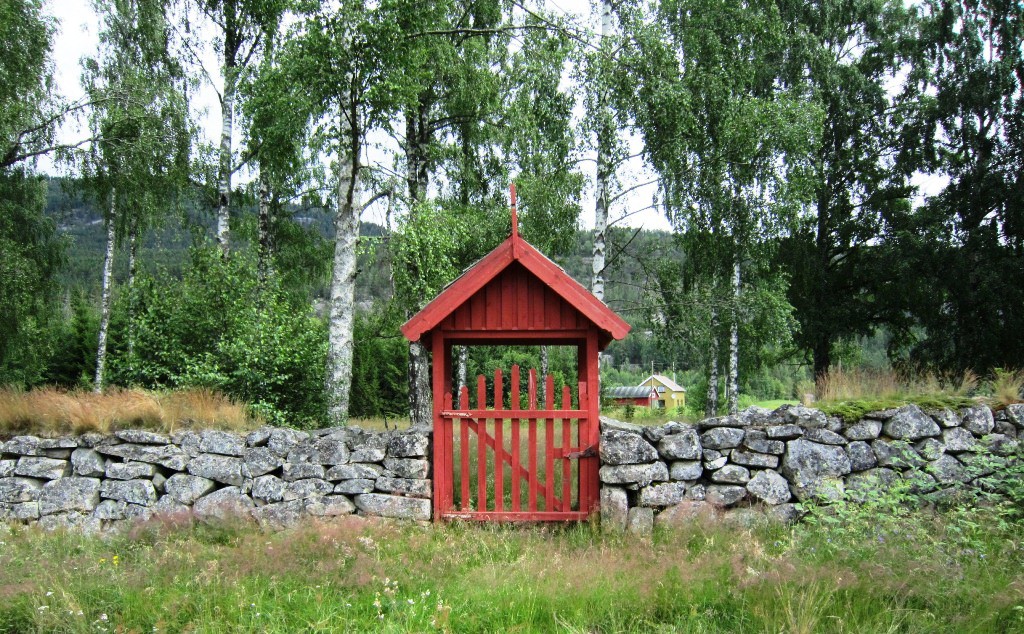
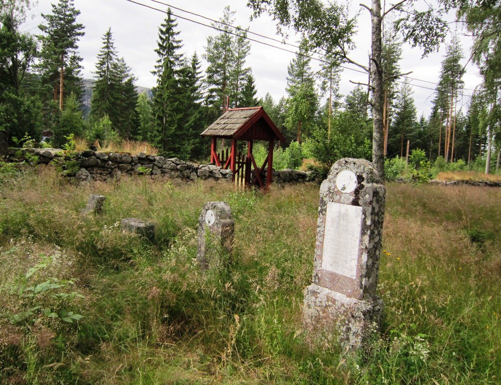
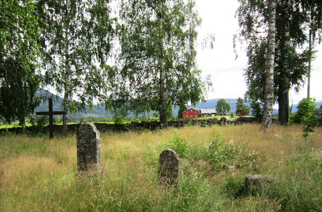
| Description | : | The old Vrådal Church Cemetery (Kviteseid municipality) is located at Sanden, relatively close to the east end of Vråvatn, about half a mile west of the village center Eidstod and a few kilometers from Roholte, where the old stave church was located. The cemetery is still there to see, overgrown in a grove and surrounded by a stone fence. This stave church was replaced in 1685 by a notched, octagonal church on the same site (consecrated 1686). This was reportedly the country's first octagonal church, while the oldest among the remaining church's Hospital in Trondheim. Certain marks in the ground in... Read More |
frequently asked questions (FAQ):
-
Where is Vraadal Old Kirke Cemetery?
Vraadal Old Kirke Cemetery is located at Kviteseid, Kviteseid kommune ,Telemark fylke ,Norway.
-
Vraadal Old Kirke Cemetery cemetery's updated grave count on graveviews.com?
0 memorials
-
Where are the coordinates of the Vraadal Old Kirke Cemetery?
Latitude: 59.3214770
Longitude: 8.4518020
Nearby Cemetories:
1. Vraadal Kirke Cemetery
Kviteseid, Kviteseid kommune, Norway
Coordinate: 59.3278920, 8.4169540
2. Kviteseid Gamle Kyrkje Cemetery
Kviteseid, Kviteseid kommune, Norway
Coordinate: 59.3557050, 8.5255190
3. Brunkeberg Kyrkje Cemetery
Brunkeberg, Kviteseid kommune, Norway
Coordinate: 59.4341430, 8.4818850
4. Nissedal Cemetery
Kyrkjebygdi, Nissedal kommune, Norway
Coordinate: 59.1619840, 8.5051860
5. Lardal Kyrkje
Lardal, Tokke kommune, Norway
Coordinate: 59.4243000, 8.1825000
6. Åmotsdal kirkegård
Seljord kommune, Norway
Coordinate: 59.4826608, 8.6259205
7. Veum Kirke
Veum, Fyresdal kommune, Norway
Coordinate: 59.2852390, 8.0922780
8. Seljord Kirke
Seljord, Seljord kommune, Norway
Coordinate: 59.4898126, 8.6359361
9. Moland Kirke
Moland, Fyresdal kommune, Norway
Coordinate: 59.1820500, 8.0867550
10. Flatdal kirkegård
Flatdal, Seljord kommune, Norway
Coordinate: 59.5607200, 8.5721300
11. Tørdal Church Cemetery
Drangedal kommune, Norway
Coordinate: 59.1550660, 8.8107348
12. Treungen
Treungen, Nissedal kommune, Norway
Coordinate: 59.0075560, 8.5595080
13. Bø Kirkegaard
Bo i Telemark, Bø kommune, Norway
Coordinate: 59.4107600, 9.0547360
14. Mo Cemetery
Mo, Tokke kommune, Norway
Coordinate: 59.4788400, 7.8461700
15. Drangedal Kirke Cemetery
Drangedal, Drangedal kommune, Norway
Coordinate: 59.0995930, 9.0638710
16. Sauland
Sauland, Hjartdal kommune, Norway
Coordinate: 59.6205755, 8.9280959
17. Jysereid
Drangedal, Drangedal kommune, Norway
Coordinate: 59.0304470, 8.9544920
18. Holla Old Cemetery
Ulefoss, Nome kommune, Norway
Coordinate: 59.2808810, 9.2633900
19. Sauherad Kirke Cemetery
Sauherad kommune, Norway
Coordinate: 59.4216140, 9.2814300
20. Nes Kirke Cemetery
Sauherad kommune, Norway
Coordinate: 59.4212980, 9.2824710
21. Felle Cemetery
Felle, Nissedal kommune, Norway
Coordinate: 58.9027290, 8.7495320
22. Heddal Kirkegard
Notodden, Notodden kommune, Norway
Coordinate: 59.5797430, 9.1761410
23. Rauland Cemetery
Rauland, Vinje kommune, Norway
Coordinate: 59.7164150, 7.9990690
24. Tuddal Cemetery
Sauland, Hjartdal kommune, Norway
Coordinate: 59.7555090, 8.7882190