
| Memorials | : | 34 |
| Location | : | Karlstad, Karlstads kommun, Sweden |
| Coordinate | : | 59.3863760, 13.5133020 |
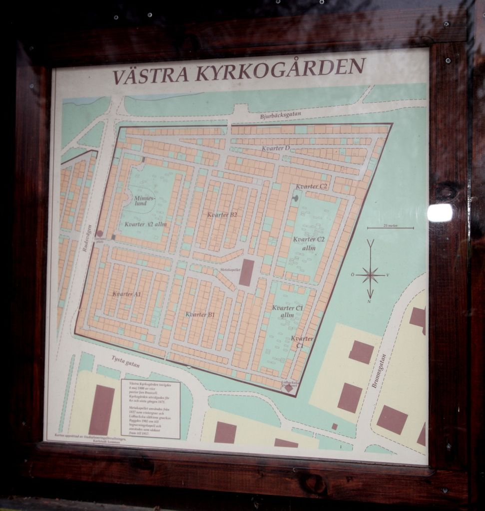
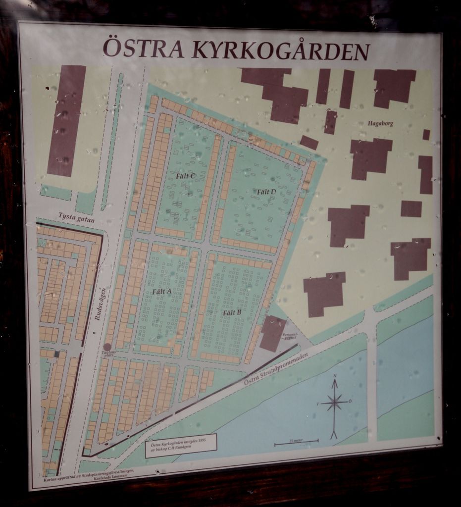
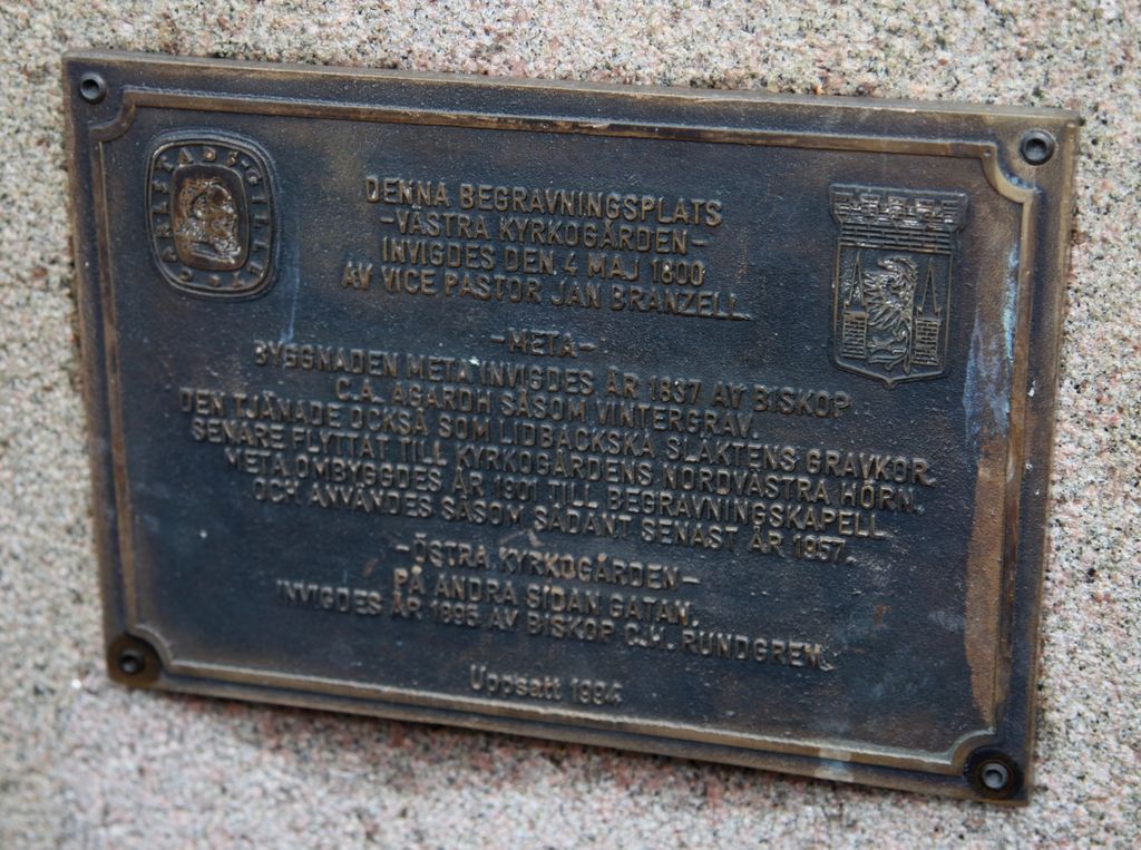
| Description | : | The Old cemetery is located in the Norrstrand section of Karlstad and comprises the Västra (Westside) and Östra (Eastside) cemeteries. Karlstad cemetery administration: Kyrkogårdsförvaltningen Mossgatan 22 654 66 Karlstad More information at https://www.svenskakyrkan.se/default.aspx?id=862997 (in Swedish) |
frequently asked questions (FAQ):
-
Where is Västra kyrkogård?
Västra kyrkogård is located at Karlstad, Karlstads kommun ,Värmlands län ,Sweden.
-
Västra kyrkogård cemetery's updated grave count on graveviews.com?
34 memorials
-
Where are the coordinates of the Västra kyrkogård?
Latitude: 59.3863760
Longitude: 13.5133020
Nearby Cemetories:
1. Östra kyrkogården
Karlstad, Karlstads kommun, Sweden
Coordinate: 59.3863356, 13.5147144
2. Mosaiska begravningsplatsen
Karlstad, Karlstads kommun, Sweden
Coordinate: 59.3973500, 13.5337700
3. Ruds Kyrkogård
Karlstad, Karlstads kommun, Sweden
Coordinate: 59.4031640, 13.5282380
4. Alsters Kyrka
Karlstads kommun, Sweden
Coordinate: 59.4784208, 13.5945353
5. Nors kyrkogård
Valberg, Karlstads kommun, Sweden
Coordinate: 59.4068530, 13.2367010
6. Stora Kils Old Cemetery
Kils kommun, Sweden
Coordinate: 59.5228382, 13.3661000
7. Skallerud Parish Cemetery
Skallerud, Kils kommun, Sweden
Coordinate: 59.5000000, 13.1666670
8. Ölme kyrkogård
Olme, Kristinehamns kommun, Sweden
Coordinate: 59.3647248, 13.9381664
9. Nedre Ulleruds kyrkogård
Deje, Forshaga kommun, Sweden
Coordinate: 59.6052562, 13.4996240
10. Borgvik Lutheran Church Graveyard
Borgvik, Grums kommun, Sweden
Coordinate: 59.3666649, 12.9333334
11. Övre Ulleruds
Övre Ullerud, Forshaga kommun, Sweden
Coordinate: 59.6869339, 13.4672197
12. Nya kyrkogarden
Kristinehamn, Kristinehamns kommun, Sweden
Coordinate: 59.3062670, 14.0847520
13. Gillberga Kyrka
Gillberga, Säffle kommun, Sweden
Coordinate: 59.3214500, 12.7781200
14. Östra Amtervik kyrkogård
Sunne kommun, Sweden
Coordinate: 59.7331050, 13.1978560
15. Ransäters Kyrkogård
Ransater, Munkfors kommun, Sweden
Coordinate: 59.7697612, 13.4497066
16. Kila kyrka
Saterskog, Säffle kommun, Sweden
Coordinate: 59.2043900, 12.8149100
17. By Kyrkogård
Säffle kommun, Sweden
Coordinate: 59.1128100, 12.9379700
18. Brunskog Cemetery
Brunskog, Arvika kommun, Sweden
Coordinate: 59.6539420, 12.8926770
19. Munkfors Kyrkogård
Munkfors, Munkfors kommun, Sweden
Coordinate: 59.8354728, 13.5385466
20. Östra kyrkogården
Filipstad, Filipstads kommun, Sweden
Coordinate: 59.7091290, 14.1780150
21. Sunnemo Kyrkogård
Sunnemo, Hagfors kommun, Sweden
Coordinate: 59.8851009, 13.7200631
22. Åmåls Kyrkogård
Amal, Åmåls kommun, Sweden
Coordinate: 59.0567690, 12.7004220
23. Rockesholms Kyrkogård
Grythyttan, Hällefors kommun, Sweden
Coordinate: 59.5357754, 14.6393867
24. Tösse Kyrkogården
Tosse, Åmåls kommun, Sweden
Coordinate: 58.9753250, 12.6210690