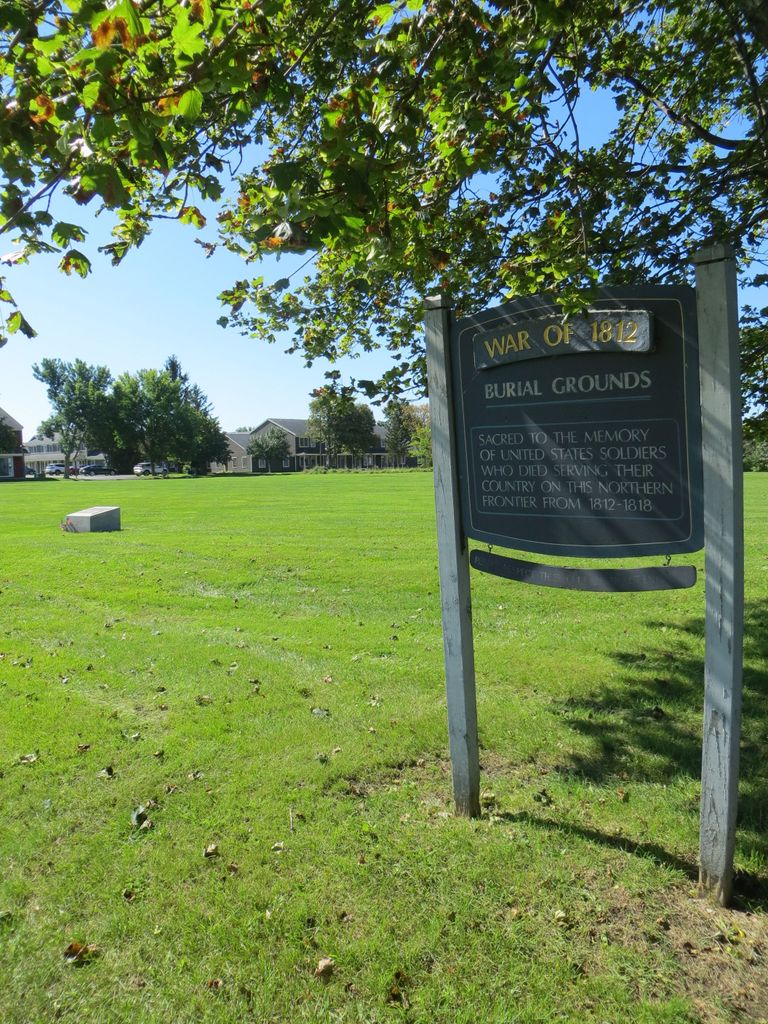
| Memorials | : | 0 |
| Location | : | Sackets Harbor, Jefferson County, USA |
| Coordinate | : | 43.9512440, -76.1124580 |
| Description | : | In 1816, the first phase of Madison Barracks was constructed by the 2nd US Infantry under the command of Colonel Hugh Brady at Sacket's Harbor. Before 1820, the remains of soldiers (officers and some 141 unknown soldiers) who were killed in action in the War of 1812, or who died of sickness on the frontier, were collected and buried within the pickets of Madison Barracks. Among those buried here and later reinterred at the new military cemetery were Brigadier Generals Leonard Wailes Covington and Zebulon Montgomery Pike. Beginning in July 1909, a total of 256 bodies were removed and reinterred... Read More |
frequently asked questions (FAQ):
-
Where is War of 1812 Burial Grounds (Defunct)?
War of 1812 Burial Grounds (Defunct) is located at Backus Road Sackets Harbor, Jefferson County ,New York ,USA.
-
War of 1812 Burial Grounds (Defunct) cemetery's updated grave count on graveviews.com?
0 memorials
-
Where are the coordinates of the War of 1812 Burial Grounds (Defunct)?
Latitude: 43.9512440
Longitude: -76.1124580
Nearby Cemetories:
1. Lakeside Cemetery
Sackets Harbor, Jefferson County, USA
Coordinate: 43.9499900, -76.1066700
2. Military Cemetery
Sackets Harbor, Jefferson County, USA
Coordinate: 43.9482994, -76.1057968
3. Stone Cemetery
Jefferson County, USA
Coordinate: 43.9682999, -76.1306000
4. Ferry Cemetery
Jefferson County, USA
Coordinate: 43.9716988, -76.1252975
5. Membrey Cemetery
Sackets Harbor, Jefferson County, USA
Coordinate: 43.9397180, -76.0808370
6. Carpenter Cemetery
Camps Mills, Jefferson County, USA
Coordinate: 43.9391900, -76.0800600
7. Sherwins Bay Cemetery
Pillar Point, Jefferson County, USA
Coordinate: 43.9766998, -76.1778030
8. Ingerson Cemetery
Jefferson County, USA
Coordinate: 43.9897003, -76.1660995
9. Rices Corners Cemetery
Jefferson County, USA
Coordinate: 43.8947200, -76.0605600
10. Shepard Cemetery
Henderson, Jefferson County, USA
Coordinate: 43.8851830, -76.1574300
11. Muskalonge Cemetery
Jefferson County, USA
Coordinate: 43.9771996, -76.0147018
12. Luther Hill Cemetery
Brownville, Jefferson County, USA
Coordinate: 44.0257988, -76.0997009
13. Smithville Cemetery
Smithville, Jefferson County, USA
Coordinate: 43.8726800, -76.1046700
14. North Adams Cemetery
Jefferson County, USA
Coordinate: 43.8889008, -76.0286026
15. Point Salubrious Cemetery
Jefferson County, USA
Coordinate: 44.0317001, -76.1605988
16. Dexter Cemetery
Dexter, Jefferson County, USA
Coordinate: 44.0130997, -76.0242004
17. Limerick Cemetery
Brownville, Jefferson County, USA
Coordinate: 44.0264300, -76.0467100
18. Grow Cemetery
Jefferson County, USA
Coordinate: 43.8624992, -76.1025009
19. Fields Settlement Cemetery
Fields Settlement, Jefferson County, USA
Coordinate: 43.9504800, -75.9817900
20. Point Peninsula Cemetery
Jefferson County, USA
Coordinate: 44.0130997, -76.2133026
21. Brownville Cemetery
Brownville, Jefferson County, USA
Coordinate: 44.0018700, -75.9914000
22. Green Settlement Cemetery
Green Settlement, Jefferson County, USA
Coordinate: 43.8557014, -76.0378036
23. Cedar Grove Cemetery
Chaumont, Jefferson County, USA
Coordinate: 44.0650100, -76.1345100
24. Bishop Cemetery
Jefferson County, USA
Coordinate: 43.8389015, -76.1547012


