
| Memorials | : | 0 |
| Location | : | Pierrepont, St. Lawrence County, USA |
| Coordinate | : | 44.5652504, -74.9855881 |
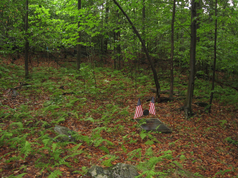
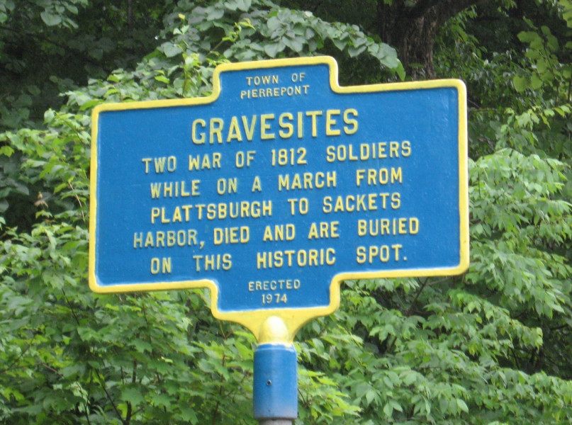
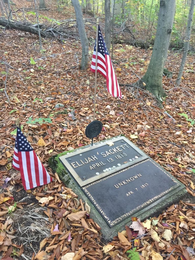
| Description | : | The gravesites for two soldiers of the War of 1812 are located in a wooded area to the east of County Road 24 (Russell Turnpike). Driving north, there is a marker on the right hand side of the road, marking a dirt path through the trees leading to the two markers. |
frequently asked questions (FAQ):
-
Where is War of 1812 Soldiers Gravesites?
War of 1812 Soldiers Gravesites is located at Pierrepont, St. Lawrence County ,New York ,USA.
-
War of 1812 Soldiers Gravesites cemetery's updated grave count on graveviews.com?
0 memorials
-
Where are the coordinates of the War of 1812 Soldiers Gravesites?
Latitude: 44.5652504
Longitude: -74.9855881
Nearby Cemetories:
1. Riverside Cemetery
Hannawa Falls, St. Lawrence County, USA
Coordinate: 44.5950012, -74.9777985
2. River View Cemetery
Willisville, St. Lawrence County, USA
Coordinate: 44.5891991, -74.9524994
3. Pierrepont Hill Cemetery
Pierrepont, St. Lawrence County, USA
Coordinate: 44.5400009, -75.0168991
4. White Church Cemetery
Pierrepont, St. Lawrence County, USA
Coordinate: 44.5738983, -75.0389023
5. Pleasant Mound Cemetery
Colton, St. Lawrence County, USA
Coordinate: 44.5588989, -74.9285965
6. Saint Patrick Cemetery
Colton, St. Lawrence County, USA
Coordinate: 44.5536003, -74.9272003
7. Crary Mills Cemetery
Canton, St. Lawrence County, USA
Coordinate: 44.5761414, -75.0685806
8. Cooks Corners Cemetery
Pierrepont, St. Lawrence County, USA
Coordinate: 44.5043983, -74.9741974
9. Parmeter Cemetery
Potsdam, St. Lawrence County, USA
Coordinate: 44.6316986, -74.9785995
10. Leete Cemetery
Potsdam, St. Lawrence County, USA
Coordinate: 44.6217003, -75.0363998
11. Russell Family Cemetery
South Colton, St. Lawrence County, USA
Coordinate: 44.5071983, -74.9139023
12. Beech Plains Cemetery
West Pierrepont, St. Lawrence County, USA
Coordinate: 44.5120010, -75.0718613
13. Old Saint Mary's Cemetery
Potsdam, St. Lawrence County, USA
Coordinate: 44.6502991, -74.9672012
14. Garfield Cemetery
Potsdam, St. Lawrence County, USA
Coordinate: 44.6511002, -74.9653015
15. Bayside Cemetery
Potsdam, St. Lawrence County, USA
Coordinate: 44.6563988, -74.9897003
16. Saint Mary's Cemetery
Potsdam, St. Lawrence County, USA
Coordinate: 44.6557999, -74.9700012
17. Brick Chapel Cemetery
Canton, St. Lawrence County, USA
Coordinate: 44.5582008, -75.1156998
18. South Colton Cemetery
South Colton, St. Lawrence County, USA
Coordinate: 44.5095100, -74.8786500
19. Grant Cemetery
Potsdam, St. Lawrence County, USA
Coordinate: 44.6357994, -75.0800018
20. Clark Cemetery
Canton, St. Lawrence County, USA
Coordinate: 44.5414009, -75.1327972
21. Chapel Hill Cemetery
Parishville, St. Lawrence County, USA
Coordinate: 44.6282997, -74.8621979
22. King Cemetery
Canton, St. Lawrence County, USA
Coordinate: 44.5306015, -75.1346970
23. Bridge Cemetery
Canton, St. Lawrence County, USA
Coordinate: 44.6032982, -75.1343994
24. North Russell Cemetery
North Russell, St. Lawrence County, USA
Coordinate: 44.5121994, -75.1260986