
| Memorials | : | 0 |
| Location | : | Cullman County, USA |
| Coordinate | : | 34.2505989, -86.4997025 |
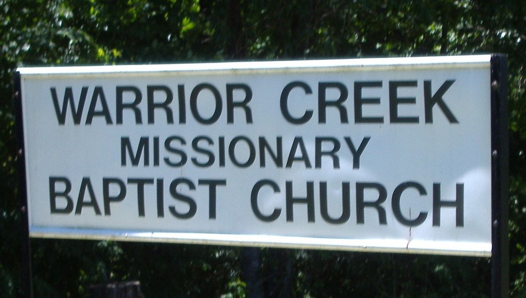
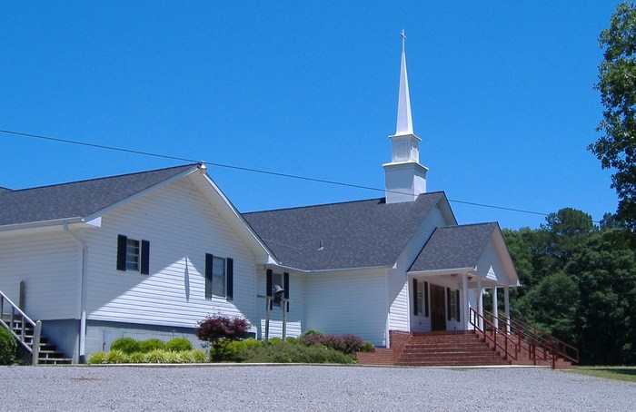
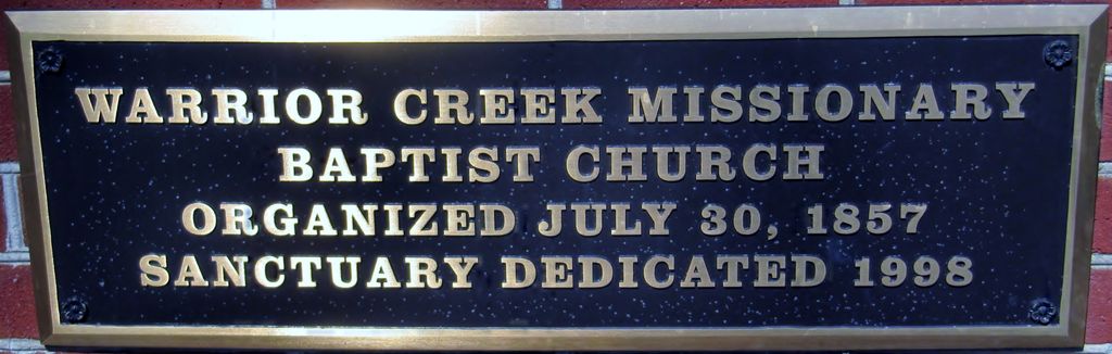
| Description | : | THERE ARE NO OTHER BURIALS IN THIS CEMETERY EXCEPT WHAT IS LISTED. See below. Church and cemetery was founded in 1857. There seems to be a long period of time where no burials occured. Rough guess, it looks like there are 25-50 unmarked graves in the cemetery. They were marked with just a brick. It's a large cemetery, but only has 75-100 burials. From I-65, take Exit 310 (Hwy 157, Cullman) East to AL Hwy 69. Continue North on 69 approximately 25 miles to Arab, Alabama. Turn right (South) on US Hwy 231. Go approximately 5 miles and turn right (West)... Read More |
frequently asked questions (FAQ):
-
Where is Warrior Creek Missionary Baptist Church Cemetery?
Warrior Creek Missionary Baptist Church Cemetery is located at Cullman County ,Alabama ,USA.
-
Warrior Creek Missionary Baptist Church Cemetery cemetery's updated grave count on graveviews.com?
0 memorials
-
Where are the coordinates of the Warrior Creek Missionary Baptist Church Cemetery?
Latitude: 34.2505989
Longitude: -86.4997025
Nearby Cemetories:
1. Shady Grove Cemetery
Blount County, USA
Coordinate: 34.2352982, -86.4843979
2. Bailey-Brown-Wilks Cemetery
Joppa, Cullman County, USA
Coordinate: 34.2731720, -86.4825030
3. New Harmony Baptist Church Cemetery
New Harmony, Cullman County, USA
Coordinate: 34.2458000, -86.5344009
4. Hopewell Missionary Baptist Church Cemetery
Summit, Blount County, USA
Coordinate: 34.2522011, -86.4617004
5. New Canaan Baptist Church Cemetery
Cullman County, USA
Coordinate: 34.2825012, -86.4931030
6. Church of the Living God Cemetery
Arab, Cullman County, USA
Coordinate: 34.2898210, -86.4940660
7. Ebell Cemetery
Blount County, USA
Coordinate: 34.2291985, -86.4561005
8. Summit Cemetery
Summit, Blount County, USA
Coordinate: 34.2038994, -86.4963989
9. New Home Cemetery
Holly Pond, Cullman County, USA
Coordinate: 34.2282982, -86.5516968
10. Old Union Hill Methodist Cemetery
Union Hill, Cullman County, USA
Coordinate: 34.2997150, -86.5117800
11. Roswell Creek Cemetery
Strawberry, Blount County, USA
Coordinate: 34.2083015, -86.5346985
12. Union Hill First Congregational Methodist Cemetery
Union Hill, Cullman County, USA
Coordinate: 34.3012590, -86.5118650
13. Berry-Brookshire Cemetery
Marshall County, USA
Coordinate: 34.2557983, -86.4360962
14. Cox Cemetery
Blount County, USA
Coordinate: 34.2366982, -86.4375000
15. Shiloh Primitive Baptist Church Cemetery
Guntersville, Marshall County, USA
Coordinate: 34.2661018, -86.4353027
16. Gilbreath Cemetery
Marshall County, USA
Coordinate: 34.2391800, -86.4331100
17. Arab Memorial Cemetery
Arab, Marshall County, USA
Coordinate: 34.3088280, -86.4978290
18. New Jerusalem Baptist Church of Joppa Cemetery
Joppa, Cullman County, USA
Coordinate: 34.3027210, -86.5466130
19. Red Hill Cemetery
Marshall County, USA
Coordinate: 34.2602997, -86.4203033
20. Fry Cemetery
Arab, Marshall County, USA
Coordinate: 34.2805040, -86.4277110
21. Union Grove Church Cemetery
Holly Pond, Cullman County, USA
Coordinate: 34.2136002, -86.5674973
22. Methodist Church Cemetery
Arab, Marshall County, USA
Coordinate: 34.3192540, -86.4952090
23. Corinth East Baptist Church Cemetery
Joppa, Cullman County, USA
Coordinate: 34.2939200, -86.5657900
24. Eidson Chapel Cemetery
Cullman County, USA
Coordinate: 34.2393990, -86.5830994