
| Memorials | : | 0 |
| Location | : | Johnson County, USA |
| Coordinate | : | 35.5625000, -93.5792007 |
frequently asked questions (FAQ):
-
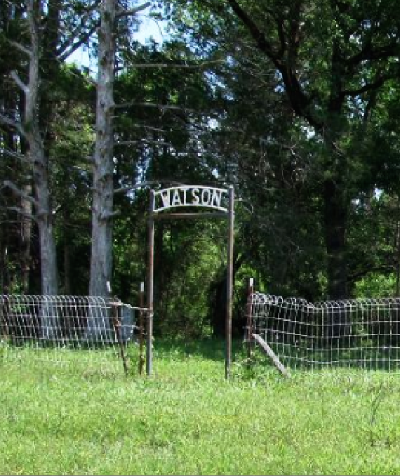
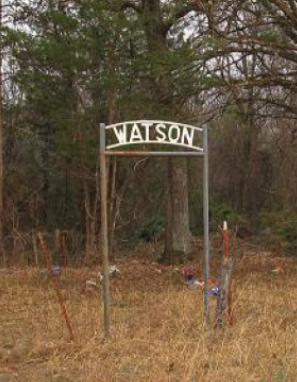
Where is Watson Cemetery?
Watson Cemetery is located at Johnson County ,Arkansas ,USA.
-
Watson Cemetery cemetery's updated grave count on graveviews.com?
0 memorials
-
Where are the coordinates of the Watson Cemetery?
Latitude: 35.5625000
Longitude: -93.5792007
Nearby Cemetories:
1. Edwards Cemetery
Johnson County, USA
Coordinate: 35.5685997, -93.5768967
2. Naylor Cemetery
Johnson County, USA
Coordinate: 35.5527992, -93.5922012
3. Pryor Cemetery
Johnson County, USA
Coordinate: 35.5656013, -93.5552979
4. Ogilvie Cemetery II
Johnson County, USA
Coordinate: 35.5401400, -93.5911800
5. Zachary Cemetery
Johnson County, USA
Coordinate: 35.5438995, -93.5597000
6. Ogilbie Cemetery III
Johnson County, USA
Coordinate: 35.5400009, -93.5911026
7. Hogan Cemetery
Clarksville, Johnson County, USA
Coordinate: 35.5544014, -93.6132965
8. Harmony Cemetery
Harmony, Johnson County, USA
Coordinate: 35.5466995, -93.5438995
9. Porter Cemetery
Hunt, Johnson County, USA
Coordinate: 35.5631000, -93.6198000
10. McDaniel Cemetery
Johnson County, USA
Coordinate: 35.5321999, -93.6110992
11. Bethlehem Cemetery
Hartman, Johnson County, USA
Coordinate: 35.5223920, -93.5945380
12. Ogilbie Cemetery
Johnson County, USA
Coordinate: 35.5266991, -93.6185989
13. Ogilvie Cemetery I
Harmony, Johnson County, USA
Coordinate: 35.5267600, -93.6187700
14. Lone Pine Cemetery
Clarksville, Johnson County, USA
Coordinate: 35.5546180, -93.5102610
15. Sherman Cemetery
Low Gap, Johnson County, USA
Coordinate: 35.6171989, -93.5513992
16. Woodland Memorial Cemetery
Clarksville, Johnson County, USA
Coordinate: 35.5177994, -93.5242004
17. Wood Cemetery
Johnson County, USA
Coordinate: 35.5317001, -93.5074997
18. Kendall Cemetery
Hartman, Johnson County, USA
Coordinate: 35.4956017, -93.6207962
19. Hardgraves Cemetery
Johnson County, USA
Coordinate: 35.5013000, -93.6345000
20. Batson Cemetery
Johnson County, USA
Coordinate: 35.6266420, -93.6304180
21. Gimlin Cemetery
Low Gap, Johnson County, USA
Coordinate: 35.6258500, -93.5244400
22. Liberty Hill Cemetery
Hunt, Johnson County, USA
Coordinate: 35.5339012, -93.6694031
23. Williams Cemetery
Johnson County, USA
Coordinate: 35.5799100, -93.6757800
24. Dowd Cemetery
Johnson County, USA
Coordinate: 35.6225014, -93.6511002