
| Memorials | : | 0 |
| Location | : | Greenville, Darke County, USA |
| Coordinate | : | 40.0977350, -84.6313010 |
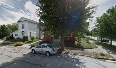
| Description | : | The cemetery was located on the southeast corner of the intersection of Wayne Avenue and Armstrong Street on Lot 806. The cemetery is believed to be the burial ground for those of Wayne’s Army who died at the hospital on the adjoining lot 763. The cemetery was located in Greenville Township, Darke County, Ohio, and is # 2719 (Waynes Army Cemetery) in “Ohio Cemeteries 1803-2003”, compiled by the Ohio Genealogical Society. |
frequently asked questions (FAQ):
-
Where is Waynes Army Cemetery (Defunct)?
Waynes Army Cemetery (Defunct) is located at Wayne Avenue and Armstrong Street Greenville, Darke County ,Ohio , 45331USA.
-
Waynes Army Cemetery (Defunct) cemetery's updated grave count on graveviews.com?
0 memorials
-
Where are the coordinates of the Waynes Army Cemetery (Defunct)?
Latitude: 40.0977350
Longitude: -84.6313010
Nearby Cemetories:
1. West Third Street Cemetery
Greenville, Darke County, USA
Coordinate: 40.0984310, -84.6375340
2. Water Street Cemetery
Greenville, Darke County, USA
Coordinate: 40.1048550, -84.6322340
3. Greenville Union Cemetery
Greenville, Darke County, USA
Coordinate: 40.1082993, -84.6436005
4. Saint Marys Catholic Cemetery
Greenville, Darke County, USA
Coordinate: 40.1242150, -84.6071770
5. Church of God Cemetery
Greenville, Darke County, USA
Coordinate: 40.0677290, -84.6154430
6. Darke County Home Cemetery
Greenville Township, Darke County, USA
Coordinate: 40.0663986, -84.6185989
7. Darke County Childrens Home Cemetery
Greenville, Darke County, USA
Coordinate: 40.1361180, -84.6192930
8. East Zion Cemetery
Greenville, Darke County, USA
Coordinate: 40.1051000, -84.5747600
9. Wakefield Lutheran Cemetery
Wakefield, Darke County, USA
Coordinate: 40.1409910, -84.6132670
10. Saint Johns Lutheran Cemetery
Greenville, Darke County, USA
Coordinate: 40.1344300, -84.5948600
11. Martin Cemetery
Darke County, USA
Coordinate: 40.0891991, -84.5699997
12. Crickbaum Cemetery
Greenville, Darke County, USA
Coordinate: 40.1288850, -84.6937660
13. Dininger Cemetery
Coletown, Darke County, USA
Coordinate: 40.0918999, -84.7069016
14. Hiller Cemetery
Washington Township, Darke County, USA
Coordinate: 40.0995310, -84.7077570
15. Newcomer Cemetery
Pikeville, Darke County, USA
Coordinate: 40.1581001, -84.6374969
16. Emanuel Cemetery
Coletown, Darke County, USA
Coordinate: 40.1293983, -84.7069016
17. Rush Station Cemetery
Greenville, Darke County, USA
Coordinate: 40.1413890, -84.6966670
18. Old Abbottsville Cemetery
Abbottsville, Darke County, USA
Coordinate: 40.0394440, -84.5834656
19. Mount Zion Cemetery
Darke County, USA
Coordinate: 40.0417000, -84.6839000
20. Abbottsville Cemetery
Abbottsville, Darke County, USA
Coordinate: 40.0394440, -84.5774994
21. West Branch Cemetery
New Madison, Darke County, USA
Coordinate: 40.0503006, -84.7039032
22. Pioneer Cemetery
Fort Jefferson, Darke County, USA
Coordinate: 40.0272700, -84.6569000
23. Greenville Township Memorial Gardens
Greenville, Darke County, USA
Coordinate: 40.1708832, -84.6357880
24. Oak Grove Cemetery
Fort Jefferson, Darke County, USA
Coordinate: 40.0233002, -84.6528015