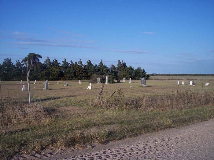
| Memorials | : | 2 |
| Location | : | Lyons, Rice County, USA |
| Coordinate | : | 38.4494200, -98.3308300 |
frequently asked questions (FAQ):
-
Where is Wesley Chapel Cemetery?
Wesley Chapel Cemetery is located at 598 9th Rd Lyons, Rice County ,Kansas ,USA.
-
Wesley Chapel Cemetery cemetery's updated grave count on graveviews.com?
2 memorials
-
Where are the coordinates of the Wesley Chapel Cemetery?
Latitude: 38.4494200
Longitude: -98.3308300
Nearby Cemetories:
1. Salem-Friedhof Cemetery
Bushton, Rice County, USA
Coordinate: 38.4655991, -98.4056015
2. Ebenezer Church Cemetery
Rice County, USA
Coordinate: 38.3908900, -98.2759000
3. Bushton-Farmer Township Cemetery
Bushton, Rice County, USA
Coordinate: 38.5078011, -98.3886032
4. Springdale Cemetery
Chase, Rice County, USA
Coordinate: 38.3630981, -98.3305969
5. Frederick Cemetery
Frederick, Rice County, USA
Coordinate: 38.5077350, -98.2484450
6. Shumway Cemetery
Lyons, Rice County, USA
Coordinate: 38.3911018, -98.2356033
7. Holy Name Catholic Cemetery
Bushton, Rice County, USA
Coordinate: 38.4929400, -98.4432900
8. Lorraine Cemetery
Lorraine, Ellsworth County, USA
Coordinate: 38.5508200, -98.3309800
9. Saint Marys Cemetery
Chase, Rice County, USA
Coordinate: 38.3492012, -98.3507996
10. Baptist Cemetery
Lorraine, Ellsworth County, USA
Coordinate: 38.5657997, -98.3313980
11. Immanuel Cemetery
Rice County, USA
Coordinate: 38.3699989, -98.4421997
12. Emmanuel Lutheran Cemetery
Chase, Rice County, USA
Coordinate: 38.3702350, -98.4433800
13. Cain City Cemetery
Ellsworth County, USA
Coordinate: 38.5337080, -98.4433460
14. Montgomery Cemetery
Barton County, USA
Coordinate: 38.4933014, -98.4805984
15. Rice County Poor Farm Cemetery
Rice County, USA
Coordinate: 38.3449410, -98.2387280
16. Lyons Municipal Cemetery
Lyons, Rice County, USA
Coordinate: 38.3589940, -98.2020190
17. Un-Named Cemetery
Lyons, Rice County, USA
Coordinate: 38.3478140, -98.2110390
18. Saint Peter Lutheran Cemetery
Holyrood, Ellsworth County, USA
Coordinate: 38.5814460, -98.3879430
19. Geneseo Cemetery
Geneseo, Rice County, USA
Coordinate: 38.5069008, -98.1680984
20. Saint Pauls United Church of Christ Cemetery
Holyrood, Ellsworth County, USA
Coordinate: 38.5840180, -98.4063880
21. Old Dunkard Cemetery
Rice County, USA
Coordinate: 38.3549200, -98.1455480
22. Henry Family Cemetery
Ellsworth County, USA
Coordinate: 38.6232270, -98.3389780
23. Hilltop Cemetery
Raymond, Rice County, USA
Coordinate: 38.2886009, -98.4231033
24. Pleasant View Cemetery
Claflin, Barton County, USA
Coordinate: 38.5297012, -98.5372009

