
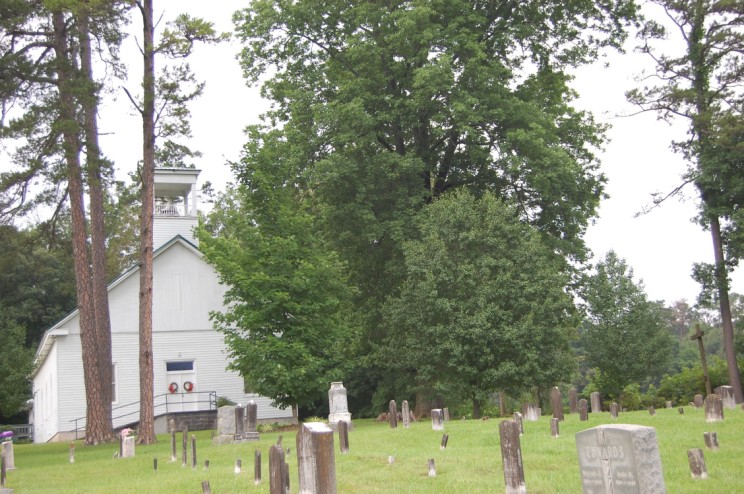
| Memorials | : | 1 |
| Location | : | Piedmont, Jefferson County, USA |
| Coordinate | : | 36.0344009, -83.4978027 |
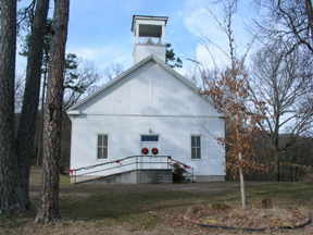
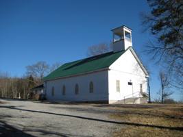
| Description | : | The physical location of the church is actually on Dumplin Valley Road near the intersection of Dumplin Valley Road and Lockett Lane on the North side of the road at the top of a small hillside. Dumplin Vally Road runs East and West roughly parallel North of Interstate 40. The church can easily be found by exiting I40 at Hwy 92 N. From HWY 92 go North until you reach the Jefferson County High School on your left then turn left (West) onto W Dumplin Valley Road. The church will be on your right (North) side... Read More |
frequently asked questions (FAQ):
-
Where is Wesley Chapel United Methodist Church Cemetery?
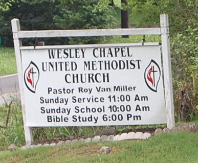
Wesley Chapel United Methodist Church Cemetery is located at 712 Lockett Lane Piedmont, Jefferson County ,Tennessee ,USA.
-
Wesley Chapel United Methodist Church Cemetery cemetery's updated grave count on graveviews.com?
1 memorials
-
Where are the coordinates of the Wesley Chapel United Methodist Church Cemetery?
Latitude: 36.0344009
Longitude: -83.4978027
Nearby Cemetories:
1. Greenhill Cemetery
Dandridge, Jefferson County, USA
Coordinate: 36.0182991, -83.4978027
2. Carter Cemetery
Jefferson County, USA
Coordinate: 36.0484900, -83.5217900
3. French Cemetery
Jefferson County, USA
Coordinate: 36.0102997, -83.5089035
4. Oakland Cemetery
Jefferson County, USA
Coordinate: 36.0517006, -83.4721985
5. Piedmont Cemetery
Piedmont, Jefferson County, USA
Coordinate: 36.0264015, -83.5353012
6. Grahl Cemetery
Jefferson County, USA
Coordinate: 36.0050011, -83.5183029
7. Rocky Valley Cemetery
Rocky Valley, Jefferson County, USA
Coordinate: 36.0602989, -83.5333023
8. Patterson Cemetery
Jefferson County, USA
Coordinate: 35.9981003, -83.4807968
9. Deep Springs Cemetery
Jefferson County, USA
Coordinate: 35.9961014, -83.5130997
10. Flat Gap Cemetery
Flat Gap, Jefferson County, USA
Coordinate: 36.0746900, -83.4958600
11. Mount Zion Cemetery
Dandridge, Jefferson County, USA
Coordinate: 36.0188130, -83.4505080
12. Hillcrest Memorial Gardens Cemetery
Dandridge, Jefferson County, USA
Coordinate: 36.0233002, -83.4486008
13. Holy Trinity Catholic Church Cemetery
Jefferson City, Jefferson County, USA
Coordinate: 36.0727630, -83.4779500
14. Grant's Chapel Cemetery
Grants Chapel, Jefferson County, USA
Coordinate: 36.0400860, -83.4414730
15. Hebron Cemetery
Jefferson County, USA
Coordinate: 36.0572014, -83.4471970
16. Fain Cemetery
Dandridge, Jefferson County, USA
Coordinate: 35.9878006, -83.5307999
17. Shady Grove Cemetery
Dandridge, Jefferson County, USA
Coordinate: 35.9796982, -83.4813995
18. Dumplin Cemetery
New Market, Jefferson County, USA
Coordinate: 36.0017014, -83.5567017
19. Dandridge Cemetery
Dandridge, Jefferson County, USA
Coordinate: 36.0249000, -83.4267900
20. Jefferson County Farm Cemetery
Jefferson County, USA
Coordinate: 36.0285988, -83.4216995
21. Acuff Cemetery
Jefferson County, USA
Coordinate: 35.9906006, -83.5532990
22. Thompson Cemetery
Jefferson County, USA
Coordinate: 35.9844017, -83.5468979
23. McCampbell Chapel Cemetery
Dandridge, Jefferson County, USA
Coordinate: 36.0264015, -83.5792007
24. Cate Cemetery
New Market, Jefferson County, USA
Coordinate: 36.0038986, -83.5736008