
| Memorials | : | 514 |
| Location | : | Kent County, USA |
| Coordinate | : | 38.8868800, -75.7267500 |
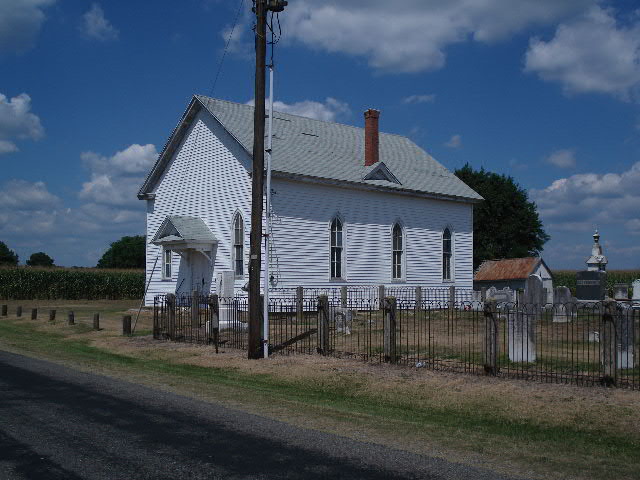
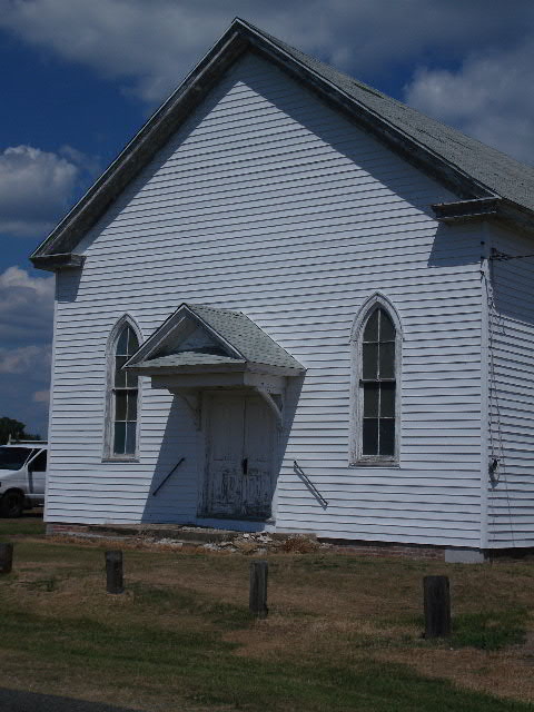
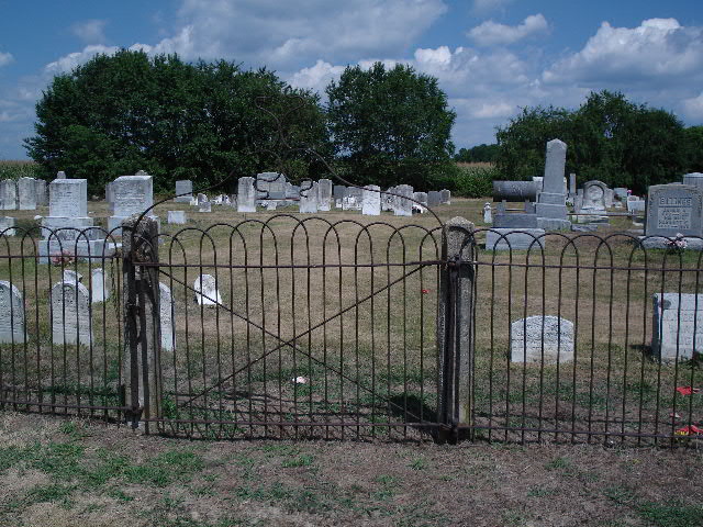
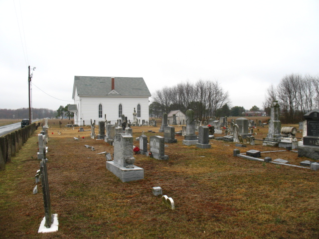
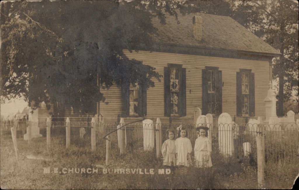
| Description | : | The Church was first erected in 1834, and was built by Thomas Baynard. As late as 1947, the original church building was in use at the farm of Thomas E. Cahall, but it no longer exists. The second building began in November 1872, built by Henry Thawley (who ran the Sunday School at the church) who cut and hauled the timber to build the church. The site was actually on property owned by Henry Thawley. The new building was dedicated in May 1873 by Bishop Levi Scott, and sermon by Rev. Andrew Manship. The church and cemetery property were deeded... Read More |
frequently asked questions (FAQ):
-
Where is Wesley Methodist Episcopal Church Cemetery?
Wesley Methodist Episcopal Church Cemetery is located at Burrsville Road Kent County ,Delaware ,USA.
-
Wesley Methodist Episcopal Church Cemetery cemetery's updated grave count on graveviews.com?
509 memorials
-
Where are the coordinates of the Wesley Methodist Episcopal Church Cemetery?
Latitude: 38.8868800
Longitude: -75.7267500


Nearby Cemetories:
1. Cahall Family Cemetery
Burrsville, Caroline County, USA
Coordinate: 38.8907200, -75.7227100
2. Union Methodist Cemetery
Burrsville, Caroline County, USA
Coordinate: 38.8986015, -75.7296982
3. Fearins Farm Cemetery
Harrington, Kent County, USA
Coordinate: 38.8735780, -75.7193380
4. Melvin Family Cemetery
Burrsville, Caroline County, USA
Coordinate: 38.9034500, -75.7349100
5. Saulsbury Family Cemetery
Kent County, USA
Coordinate: 38.8660900, -75.7046600
6. Baynard Cemetery
Layton Corners, Kent County, USA
Coordinate: 38.9125100, -75.7146400
7. Browns Farm Burial Ground
Brownsville, Kent County, USA
Coordinate: 38.9083000, -75.6797000
8. Collison Family Cemetery
Caroline County, USA
Coordinate: 38.8977430, -75.7841230
9. Anthony Family Cemetery
Caroline County, USA
Coordinate: 38.8808880, -75.7910900
10. Fountain Burial Ground
Hickman, Caroline County, USA
Coordinate: 38.8334000, -75.7332600
11. Ames Cemetery
Caroline County, USA
Coordinate: 38.8622017, -75.7885971
12. Whiteley Family Cemetery
Whiteleysburg, Kent County, USA
Coordinate: 38.9483060, -75.7310200
13. Todds Chapel Cemetery
Farmington, Kent County, USA
Coordinate: 38.8333893, -75.6732330
14. Whites Methodist Church Cemetery
Harrington, Kent County, USA
Coordinate: 38.9320000, -75.6549000
15. Hignutt Family Cemetery
Concord, Caroline County, USA
Coordinate: 38.8237800, -75.7770500
16. Bethel Methodist Church Cemetery
Andrewsville, Kent County, USA
Coordinate: 38.8617300, -75.6368100
17. Spring Grove Cemetery
Denton, Caroline County, USA
Coordinate: 38.8877983, -75.8227997
18. Piney Branch Methodist Protestant Church Cemetery
Denton, Caroline County, USA
Coordinate: 38.9142804, -75.8174338
19. Anderson Family Plot
Harrington, Kent County, USA
Coordinate: 38.9017180, -75.6282340
20. Old Saint Lukes Cemetery
Denton, Caroline County, USA
Coordinate: 38.8849983, -75.8308029
21. Saint Elizabeths Cemetery
Denton, Caroline County, USA
Coordinate: 38.8852997, -75.8352966
22. Taylor Family Plot
Andrewsville, Kent County, USA
Coordinate: 38.8540300, -75.6264880
23. Holy Cross Cemetery
Greensboro, Caroline County, USA
Coordinate: 38.9324989, -75.8193970
24. Benston Family Plot
Harrington, Kent County, USA
Coordinate: 38.9284470, -75.6303590